|
Muffin
didn't seem particularly
interested in the views, and didn't want to get too close to the
edge, so we
soon climbed back up to the Kinsman Ridge Trail and began descending
into the
col between North and South Kinsman.
It
didn't take long to reach South Kinsman, but I could see where it
might be more difficult in the winter with the col deeply filled
with snow and the trail blocked by downed trees. At
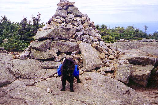
the broad, and more alpine summit of South Kinsman, I took several
pictures, including one of Muffin in front of the huge summit cairn.
The views were superb in all directions, including a southerly vista
of Mt Moosilauke, and the view back along the ridge to North
Kinsman.
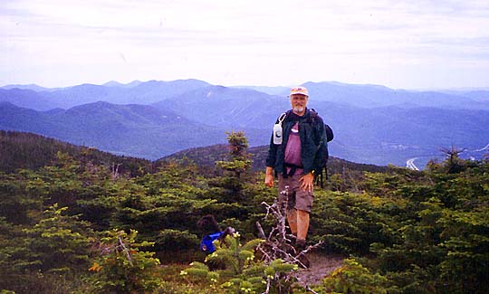
Again,
I was hoping for a nice breeze on this open summit, but I was out of
luck and the blackflies were just as hungry as ever. Before leaving,
I propped the camera on a rock and used its self-timer to take my
own picture.
On
the way back down, I met a father near Kinsman Junction who was
looking for his son. He was planning on checking Kinsman Pond
Campsite, but was thinking that the kid had just found his way back
to Lonesome Lake Hut. I didn't notice anything in the paper the
next day, so I assume that everything turned out
all right.
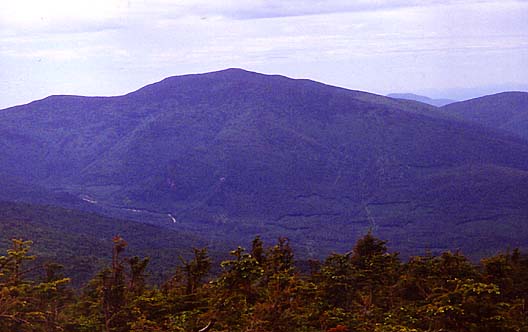
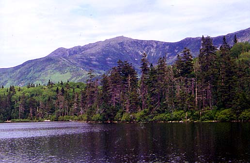
At
Lonesome Lake, I took the picture across the lake to Mt Lafayette
that I couldn't get in the morning because of sun glare, then we
headed back down to the car. On the way down, I answered the usual
questions from generally poorly-prepared hikers about how much
further it was to the hut.
Back
at the car, after resolving never to forget the mosquito repellent
again, we drove home, stopping first in Lincoln for some snacks and
sodas. |
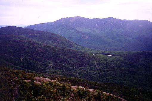
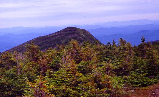
Looking
northeast from North Kinsman. Franconia Ridge dominates the
background, while Cannon Mtn is at the extreme left. The tiny
silver-white patch at right center is Lonesome Lake. |
|