|
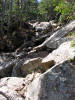
After leaving the campsite, the
Garfield Ridge Trail soon plunged precipitously and made for
extremely slow going. In some places, it was simply easier for
me to just throw down my poles, sit down, and use my hands to
lower myself down a steep boulder or ledge. While climbing up
this section would have been slow, descending was actually more
tedious.
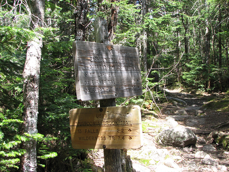
The trail continued to descend,
sometimes more steeply than others, until I reached the junction
with the Franconia Brook Trail, which drops down the ridge to
the 13 Falls Campsite in the Pemigewasset Wilderness.
The trail somewhat leveled out after
that, but still went up and down numerous humps and sags which
made the hiking quite tiring. Usually, I use my altimeter watch
to measure my progress by elevation gain or loss, but that
doesn't work well on ridge trails. If I gained a hundred feet, I
was sure to soon lose it again. Trail junctions, combined with
views ahead to my goal, provided the best estimate of my of
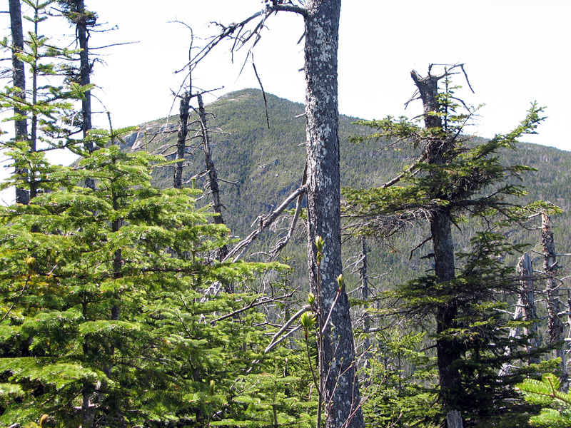
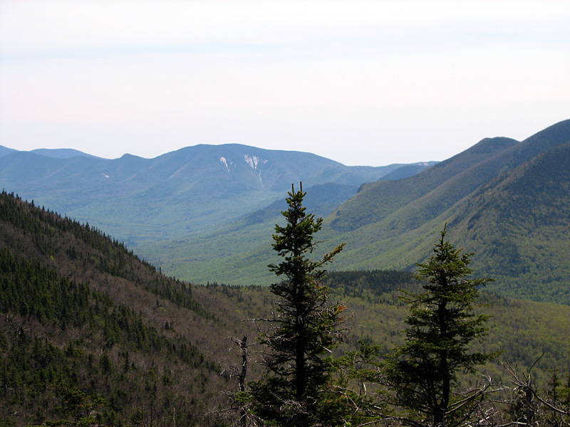
progress. From one high point, I got a good glimpse of Galehead
Mountain through the trees, and then later, another look ahead
to Galehead Hut, which was looking larger and closer. From
another spot, there was a good view straight down into the
Franconia Brook valley.
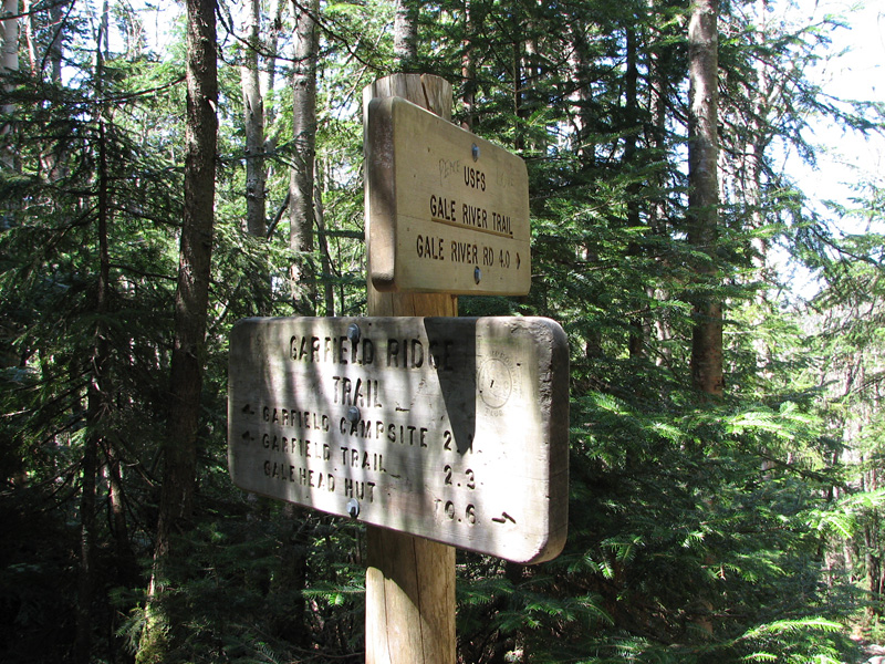
Finally, I reached the junction with
the Gale River Trail, so I knew I was getting close to the hut.
Still, it took longer than I expected to ascend this wooded and
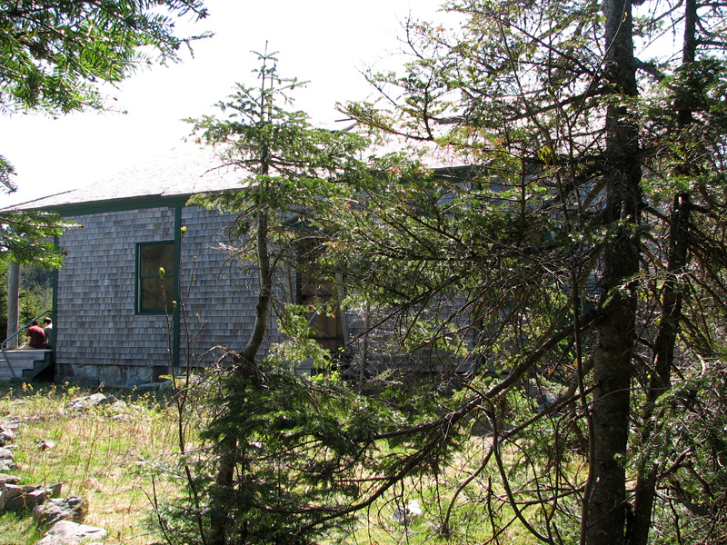
nearly viewless section. I was elated when I reached the hut, as
I was ready for a longer rest. I had hoped to be able to
purchase a new hut t-shirt, but the caretaker wasn't around and
I didn't see any obvious piles of shirts behind the counter.
After refilling my water bottles
inside, I spent some time relaxing out out on the front porch
while talking to a group of 3 hikers who were unfamiliar with
the area and needed some trail advice.
Before leaving, I considered whether
I should climb the short distance up to Galehead Mountain on the
Frost Trail, but decided against it. I'd already been there, the
views were minimal, and I was tired. A bit disappointed over not
getting a t-shirt, I headed back down the Twinway to hike down
the Gale River Trail.
The first half of my trip down was
uneventful. I took a picture of a painted trillium and enjoyed
the spring smells in the air. The trail was moderately steep at
first, which was somewhat tiring after a long day's hike, but I
knew it would soon begin to get less steep to where I didn't
have to pay such close attention to each step.
About halfway down, I made a bad
choice stepping on a slippery root and ended up pitching forward
and then over onto my right side. When I hit the ground, I felt
an excruciatingly sharp pain in the lower right side of my back,
as if I had just torn a muscle. I didn't immediately get up, but
waited for a few minutes, hoping for the initial shock to wear
off and the pain to subside a bit. After turning over onto my
knees and easing myself painfully back up onto my feet, I knew
that I would not be making quick progress, to say the least. I
swallowed a couple of Tylenol and began making way down very
slowly at first, leaning heavily on my left pole to support
myself through each agonizing step. My main concern was that
there might be internal bleeding that would cause me to go into
shock.
Luckily, that never happened, and
after a while, the pain lessened and I was able to walk a little
faster. I was, however, extremely careful going down any
questionable areas. By the time I reached Gale River Loop Road,
I was able to walk almost normally. Oddly enough, my back and
side were much better the next day and I never noticed any
swelling or bruising. |
An extremely
steep section of the Garfield Ridge Trail below the campsite.
The picture does not even come close to do it justice. |
 |