The
summit of Mt Garfield has the concrete remains of an old firetower’s
foundation. Its walls are about three ft high and it’s around five ft
square. If it’s windy or cold, you can climb into the foundation to get
some shelter from the wind, but it was nice out today and, after saying
hello to a couple of people sitting on the surrounding rocks, we picked
our way carefully over the rocks to the south side of the foundation,
where we had great views down into the Pemigewasset Wilderness, to
Franconia Ridge to the west, and to the Twins to the east.
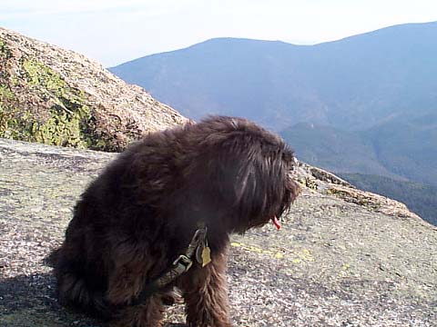
We
sat down against the foundation, admired the views, and had lunch; well,
at least I had lunch. I tried to give Muffin some peanuts, but she
wouldn’t eat them and they just sat there littering the rocks until I
later had to pick them up. In all the fuss, the can of peanuts ended up
getting knocked over, and I had even more mess to clean up.
It
was cooler on the summit so I put on my fleece, but the sun was warm and
the slight breeze felt nice. Although the weather was nice and sunny, a
persistent haze kept us from getting really clear views of the valleys and
peaks around us. Directly in front of us were the Pemigewasset Wilderness
and Owl’s Head Mtn, which we had climbed back in August. I could also
see the narrow dark line of Franconia Brook and followed it downstream
where I could see it join with Twin Brook by the 13 Falls
Tentsite. I
wondered whether I would have been able to see the campsite itself if I
had brought my binoculars.
It
was tempting to just stay up there all day and relax, and maybe even take
a little nap, but “there were miles to go before I sleep”, and Muffin
was ready to go anyway. After cleaning up “our” mess, I put my pack
back on, grabbed my poles, and we started back down the Garfield Ridge
Trail. In a short time, we reached the junction with Garfield Trail again,
but passed it up and kept going toward the Garfield Ridge Campsite, which
was supposed to be about 0.2 miles down the trail. |
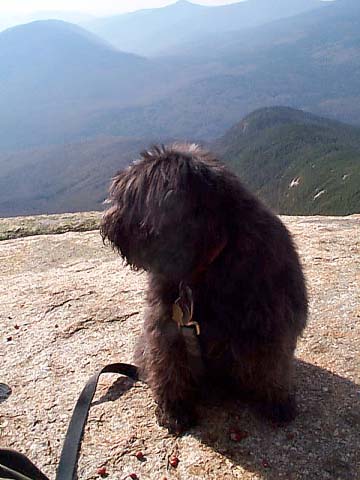
Muffin
at the actual summit of Mt Garfield. In the distance you can see the
rounded summit of Owl’s Head Mtn, and the pointy top of Mt Flume. Just
in front of Muffin are some peanuts that I gave her as a snack, and which
she refused to eat. I later had to pick them all up myself so we
wouldn’t leave a mess. |
 |
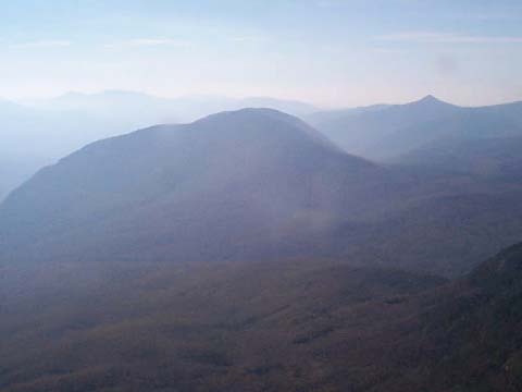
Looking
south from the summit of Mt Garfield. Although the air was hazy, I got
good views of Owl’s Head Mtn, which Muffin and I had climbed in August,
and of Franconia Brook. Just off to the left is the junction of Franconia
and Twin Brooks, where 13 Falls Tentsite is located. |
|