|
I
started up the Dicey’s Mill Trail, which passed through a wet eroded section,
then arrived at a short spur trail to Camp Rich. Camp Rich used to be another
small log shelter like Camp Heermance and Camp Shehadi, but it had recently collapsed,
and was no longer usable. I hope no one was inside when it happened. I think I
would avoid staying at either of the other shelters as well, as I’m sure they
are also on the verge of collapse.
The
trail up Mt Passaconaway was generally fairly easy, but the rock around this area
was crumbly and somewhat unstable. The final section ascended several small ledges,
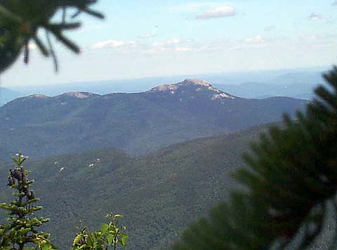
then broke into a level area just below the true summit at an open ledge that
faced northwest with great views of many peaks, including the Tripyramids,
Mt Tecumseh, Mt Osceola, and the Franconia
Range.
A
few yards east of the ledge, a short spur trail climbed another 10-20 feet up
to the true summit, which was wooded and had no views. There was a small cairn
beside the trail.
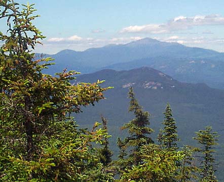
The
east loop of the Dicey’s Mill Trail continues past the summit spur, heading down
to the Walden Trail. I went down the east loop for a short distance to the other
side of the summit area, where a large ledge looked out to the east and north.
From there, I could see Mt Washington,
Hedgehog Mtn, and Mt Chocorua.
I
relaxed on the ledge for about ten minutes, then decided to head back down. I
had made good time, pretty much keeping up with book time. Since book time climbing
up the Dicey’s Mill Trail from Ferncroft Rd to Mt Passaconaway is 3:45, I figured
I could make it down in about 2 hours.
Much
of the Dicey’s Mill Trail, especially below the Rollins Trail junction, is fairly
smooth, so it’s easy to make good time. At about 2000 ft elevation, the trail
crosses the Wonalancet River. There are supposed to be the remnants of the foundation
of the former Dicey’s Mill in the woods nearby, but I didn’t see anything after
a quick look around.
About
a half mile from the parking area, the trail emerged from the woods onto a lane
that ran by a house in a large field. At first, I thought I had missed a turnoff,
but some people on a porch said I was on the right track. The trail/lane crossed
the field, then passed to the right of a closed gate. Soon, I passed Squirrel
Bridge where the Blueberry Ledge Trail veered off to the west. A short time later,
I reached the car, called home, and was on my way. Mt Whiteface and Mt Passaconaway
had been numbers 25 and 26 out of the 48 White Mountain 4000-footers, so I was
now more than halfway finished with the list. |
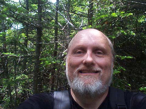
Self-portrait
at the true summit of Mt Passaconaway. As with many wooded peaks, the real views
are from the ledges a short distance below the actual summit. |

|