|
The
next part of the Ammonoosuc Ravine Trail is very steep and rough,
gaining 1000 feet in 2/10 of a mile, and then another 700 feet in the next
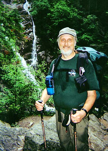
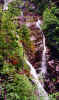
2/10 of a mile. In the middle of this steep section, a short spur path
leads to the gorge. Here, two thin ribbons of water cascade some 600 feet down into
a pool. This is one of my favorite spots on this trail.
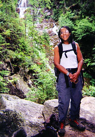
Back
at the spur path junction, the terrain is briefly level, and a number of
hikers had stopped to rest there. Curiously, few were taking the side trip
to the gorge. Fog was now beginning to creep down from the heights, and a
light mist filtered through the air, making the rocks slippery and the
footing tenuous.
Above the steep section, the trail eased up
a bit,
crossing and recrossing the now dwindling river numerous times. Several
slick ledges made for interesting climbing. At
one point, while waiting to ascend one smooth pitch, I lost my balance and
fell backward, but luckily landed safely and gently in a soft bed of
spruce. As we approached treeline, the winds began to pick up, and
we were forced to don our raingear.
Just
above a small level clearing, we arrived abruptly at Lakes of the Clouds
Hut. This proved to be none too soon; shortly after scurrying inside, the
gentle mists gave way to a driving rain.
With
Muffin tied up safely out of the rain under a small overhang outside, Toi
and I found a spot at a table amid the crowds, and sat down to enjoy a
well-deserved lunch, including some nice hot lentil soup that the croo had
prepared. With the chilly damp weather, the soup proved to be quite
popular, drawing many of the hungry diners back for seconds.
Sitting
there, I began to reconsider the fate of our climb. The fog was thick, and
the rain didn't seem to be letting up. I wasn't sure I wanted to continue
if the weather was going to further deteriorate. Visibility was low, but I
knew it could quickly get worse.
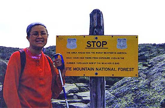
But
shortly thereafter, the rain slacked off, and some hikers returned from
the summit with news that the weather on top of the rock pile was no worse
than it was here at the hut, so I made the decision to carry on. We
bundled up, retrieved Muffin who was ecstatic to be on the trail again,
and headed up the Crawford Path past the warning sign and the two lakes.
Luckily,
the heavy rain did not return, but the mist unceasingly penetrated
our defenses,
and the fog concealed all but the next cairn or two; we felt thoroughly damp. Still, it wasn't particularly cold, so we
were in no real danger of hypothermia. Curiously, the fog also seemed to
alter my sense of time, and before I knew it, we had passed the old stone
corral and the summit buildings were in view. |
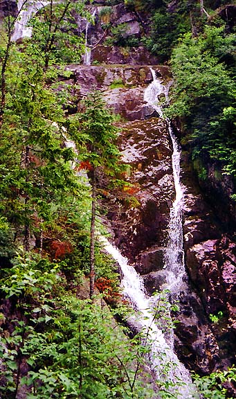
Twin
falls. These cascades, located near the middle of an extremely steep
section of the trail that climbs 1700 feet in 4/10 of a mile, tumble
over 600 feet down the Ammonoosuc Gorge. |
|