|
After
searching for a couple of minutes, we found the Eisenhower Loop and
Edmands Path junction, where we stopped by Red Pond. My water was getting
low and I used the filter to get some from the pond, but it was kind of
murky and unappetizing, so I kept it only for an emergency.
Once again, Erin elected not to climb to the top. Mt Eisenhower looked
like a much more difficult climb than Monroe, but I climbed up easily,
even though I was tired. The rounded summit turned out to be
closer than it looked and I was up and down in about a half-hour. The
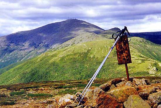
actual summit was a large pile of rocks with a rusted sign stuck in it.
After
picking up Erin at the base of Mt Eisenhower, we started down the Edmands
Path. For about a quarter mile, the trail was carved into the steep side of Mt
Eisenhower, with a sheer drop-off along the right. It continued to follow
the side of a steeply-sloping side of a ridge. Soon, we began entering the
scrub that formed a kind of fence on both sides of the narrow trail,
making it nearly impossible to fall down the steep slope. The trees got
taller and taller, and eventually the trail veered away from its traverse
along the side of the ridge and evened out some. After passing through a
short stone gateway, we walked easily downhill through the trees. Near the
bottom, it started to get a little marshy, and we crossed two bridges
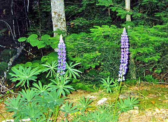
over streams, then finally arrived at the parking lot, where there were
some wild lupines growing.
There
was only one car at the parking lot, and no cars driving along Mt Clinton
Road. Since Erin was particularly tired, she waited while I trudged down the Mt
Clinton and Base Roads to the Ammonoosuc Ravine Trailhead where our car
was. I tried hitchhiking, but neither of the two cars that passed me
stopped. After getting the car, I drove back to pick up Erin, who had decided
to hike to the end of Mt Clinton Road because the bugs were bothering her. Then
we left, stopping to call home at a pay phone and to pick up
supper for Erin from McDonalds. We finally reached home around midnight.
It had a been a long, but rewarding day. |
My
poles on the summit of Mt Eisenhower. In the distance are (from front to
back) Mts Franklin, Little Monroe, Monroe, and Washington. |
|