|
This was pretty much a deja vu hike, as it was
almost a repeat of a hike I made 2 years earlier and for the same
reason. Once again, Toi and Holly were going to be working
in the afternoon at a Girl Scout information booth at a Kid's Fair at
the Mt Wachusett Ski Area, so it seemed like a good time to climb the mountain a couple of times.
Unfortunately, Muffin is mostly retired from climbing mountains, and I
probably would have ended up carrying her back down, so she stayed at
home. We parked at the Ski
Area, so I started up the nearby Balance Rock Trail.
The Balance Rock trail is mostly gentle, and
somewhat rocky, and ends at the appropriately named Balance Rock, a huge
boulder balanced on top of another. From there, I continued up the Old Indian
Trail, which becomes fairly steep after it crosses the auto road, and
then moderates the rest of the way to the top.
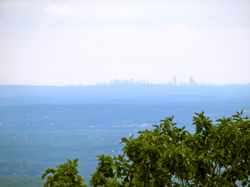
The Mt Wachusett summit area is open and ledgy, with
good views in most directions, particularly east toward Boston, but it was
a bit hazy (as usual on a warm day), and also very crowded because many people
from the Kid's Fair rode up on the ski lift. There were also a number of
birdwatchers who had come to spot hawks, as several different hawk
species visit the mountain, particularly in the early fall.
Since I wanted to accumulate as much vertical
gain as possible in the time I had, I didn't stay long at the summit,
just enough time to quickly eat a small Power Bar. I headed down the southwest
side of the mountain on the steep Harrington Trail all the way
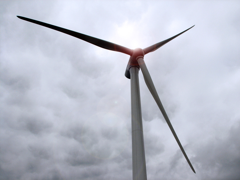
down to the Old Stagecoach Trail, and then hiked over to the Princeton
Municipal Light Department's newly upgraded wind farm. The new turbines
were quite tall, 215 ft for the tower alone and another 125 ft for each
blade. So with the blade at the top pointing straight up, the entire
structure is 340 ft tall. They had built a new road to the wind farm,
and the Old Stagecoach Trail just kind of ended at it. Thinking that I
was at the junction with the Administration Rd, I wasted about ten
minutes looking for the Echo Lake Trail until I realized that the map
had not yet been updated and the new road ran right on top of the former
Old Stagecoach Trail route.
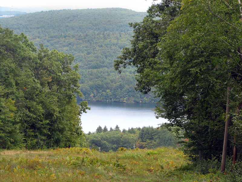
After hiking down the access road, I found the
Echo Lake Trail, which I followed to the High Meadow Trail, and then
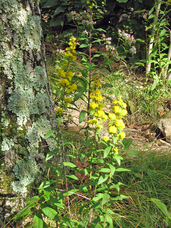
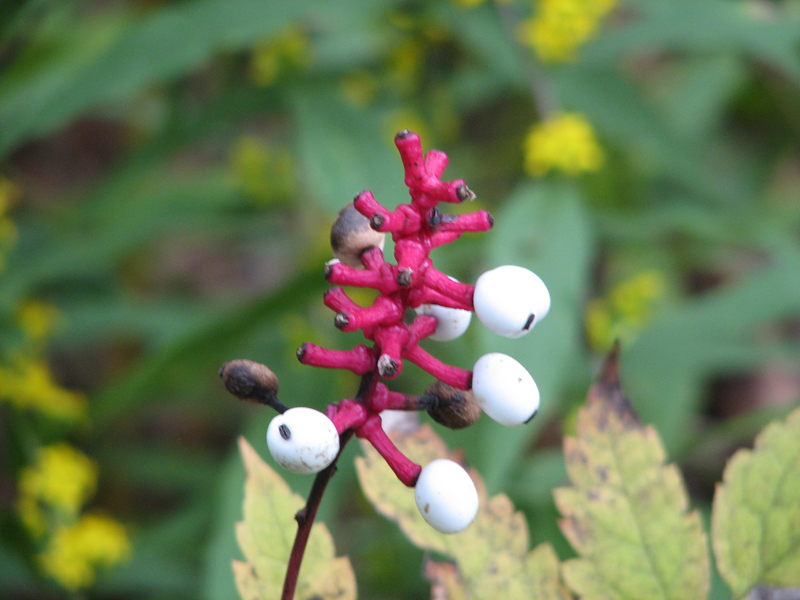
took the Jack Frost and Mountain House Trails back to the summit. Along
the way, I took a couple of pictures of flowers, one of bluestem
goldenrod, and another of white baneberry's old looking fruit.
After reaching the summit a second time and
noticing that I only had a half hour left, I quickly headed down the Old Indian Trail.
Then, about halfway down, I veered off onto the Challenger ski trail,
which quickly (and steeply) got me back down to the lodge area. |