|
We
climbed back up the Guyot Campsite Spur, then headed back up Mt Guyot to
the Twinway. I had planned to go to Mt
Zealand, Galehead Hut, and Galehead Mtn, but Muffin was having a hard time walking because her feet and legs
were sore, so when we reached the Twinway, we decided to skip Zealand and
go directly to Galehead Hut. On the talus slopes of Mt Guyot again, we
saw a weasel hopping in and out of the rocks. It headed straight for us, but
turned away just as was getting close and disappeared among the boulders.
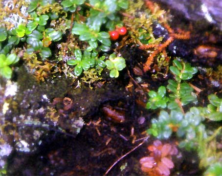
Before we left the alpine zone, we stopped to take a picture of mountain
cranberries.
It
was pretty foggy and Mt Guyot looked dreamlike. Some of the only things
visible were the white-topped cairns almost seeming to light the way along
the path.
The
Twinway was deserted, and there were many large puddles that we had to
walk through or over. We stopped often for Muffin to rest and for me to
adjust my sagging pack. Near South Twin, we saw a turkey-like bird walking
near the trail that seemed very tame. We later found out that it was a
spruce grouse. Because we were tired, it took about two-and-a-half hours to hike from the campsite to the
top of South Twin.
Once
we made South Twin, we started to see more people, most who had hiked up from
Galehead Hut that morning. The hike down from South Twin to Galehead Hut was
brutal, especially since the rocks were wet and slippery, and the trail
was very steep in many spots (this trail drops about 1100 ft in 9/10 mile).
In one talus-strewn area, Muffin got her leg caught between two boulders,
and I had to lift her up and over the rocks.
Although
it’s less than a mile from South Twin to Galehead Hut, it seemed at least
twice that distance. I don’t think I would care to hike down this stretch
again, especially with a heavy wet pack. I had to be very careful not to
slip and fall.
At
Galehead Hut, I had to tie Muffin up outside. I went in, bought a t-shirt
and patch, and talked to one of the staff. Having decided that there was
no way we were going to climb back up the steep Twinway trail to South Twin, I
asked about the AMC shuttle. It was scheduled to stop at the Gale River
Trailhead at 1:25 PM. Since it was now 10:30 AM, and the route down over
the Garfield Ridge Trail and Gale River Trail was long and could take
three hours to complete, I decided that we should leave immediately as it was
about a nine mile walk from the Gale River trailhead back to our car at the North
Twin trailhead.
|
Mountain
cranberries growing amongst the rocks on Mt Guyot. |
|