|
The climb up to Gumdrop Rocks was moderately
steep, but the snow was
beginning to soften in the powerful sun of the ravine, and the traction
was was fairly good. I certainly didn't need to use my crampons. I
settled into a reasonably comfortable niche and took off my pack to get
to my lunch.
I
wasn't alone on the patch of rock; a woman and her dog were also sitting
there watching the action in the gully. Well, actually, the woman
was sitting, but the dog was standing, straining at his leash,
and barking and whining pitifully. Apparently he hated it when his
master, the woman's husband, was away, skiing or otherwise.
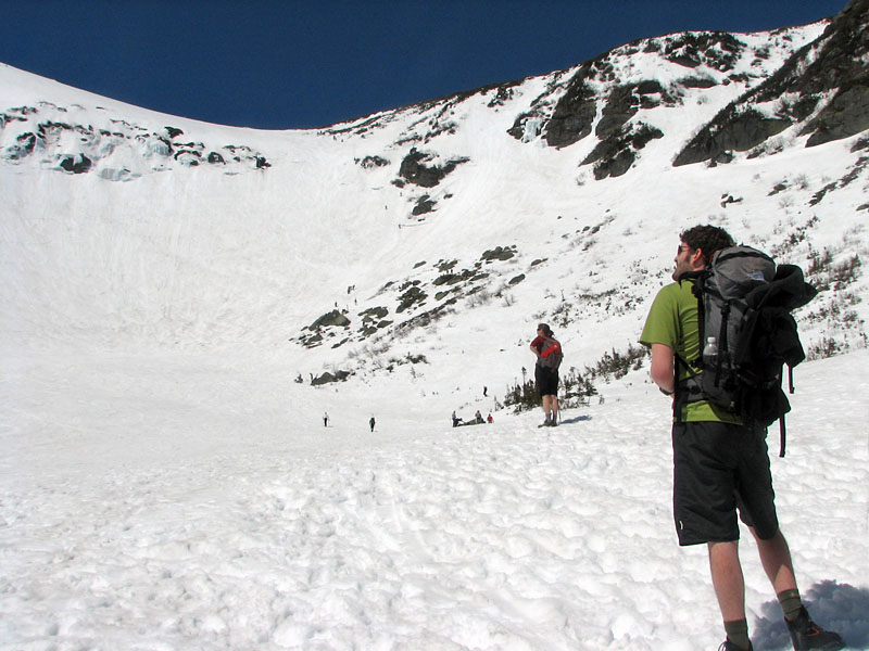
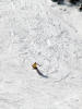
It was a good spot from which to view all
parts of the ravine. One skier, starting at the very top of the
Central Headwall, hurled directly toward the partially snow-covered rock
outcropping a short way down. Then, in a spectacular leap, he launched
off an apparently upturned bank of snow just above the bare rock, sailed
completely over the entire outcropping, and landed with a solid whump on
the snow below. Without losing his balance, he carved his way down the
rest of the steep slope to loud cheers from the crowd.
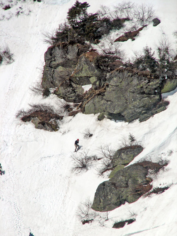
On the other side of the ravine, above Lunch
Rocks, a few brave souls inched their way up the slope and around the
numerous rock formations to try their luck on a run known as the Sluice.
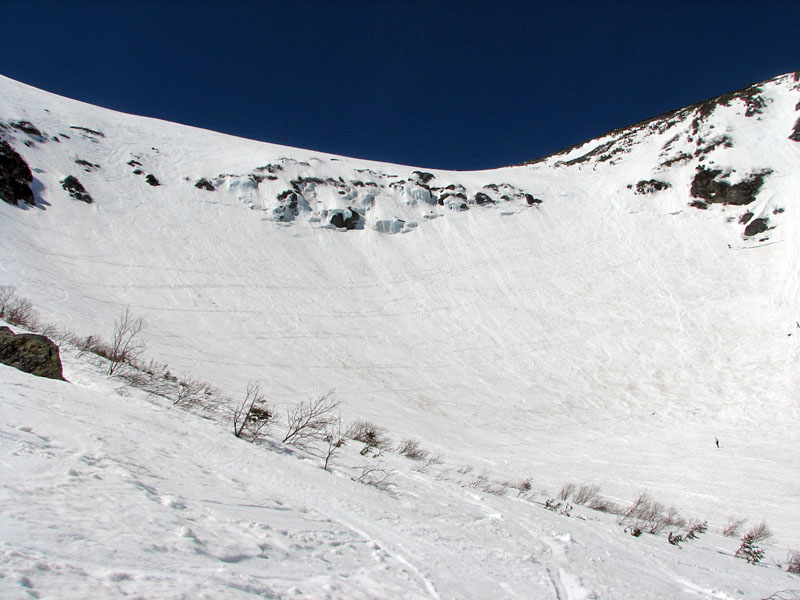
It was so busy in the Ravine that I doubted
the safety of practicing self-arrest on the crowded slopes. The best
spot to practice is on a steep slope with a good runout at the bottom.
That way, if you don't manage to stop your fall with your ice axe,
you'll eventually come to a slow stop in an open flat area instead of
careening over a cliff or hurling into a mass of boulders. However, it
wouldn't be at all pleasant to be run over by a speeding snowboarder.
In the end, I decided that I'd just try a
controlled butt glissade starting right there from Gumdrop Rocks. I
figured that I'd be easier to spot in a sitting position than sliding
face-down on my stomach. Waiting for a lull in the action, I sat down
and scooted my way into a slide, getting ready to control my rate of
descent with my ice axe. Unfortunately, there simply wasn't much of a
descent to control. I could barely get moving in the wet, slightly
slushy snow, and ended up just sliding leisurely down until I completely
lost momentum in the flat area at the bottom.
I was enjoying the atmosphere, and I would
have liked to have stayed longer in the ravine, and perhaps even tried
climbing up the Left Gully, but I needed to get home at a reasonable
hour, and, without sunglasses, my eyes were already taking a beating
from its strong reflected rays.
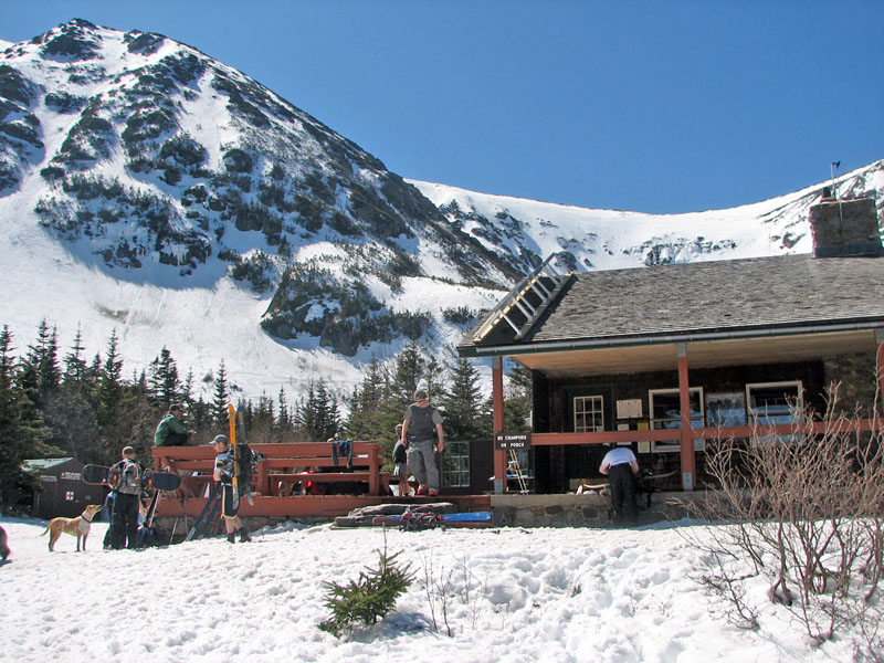
On the way down, I stopped at Hojo's again for
one last look. Most of the crowds were up at the ravine now, and the
deck was comparatively empty.
Most of the way down, I veered off onto a
connecting path over to the adjacent John Sherborne Ski Trail, where I
hoped that the sliding would be better. This was a big mistake. The snow
wasn't packed firmly enough for bare boots and I postholed every few
feet. Even worse, there was far too much ski traffic on the trail for me
to do any sliding. The numerous dips and turns would effectively hide me
from any speeding skiers until it was too late.
Finally, with a sign of relief, I arrived at the bottom onto solid
ground again, and quickly crossed the parking lot to my awaiting car. Another
great day in the mountains had come to a close. |
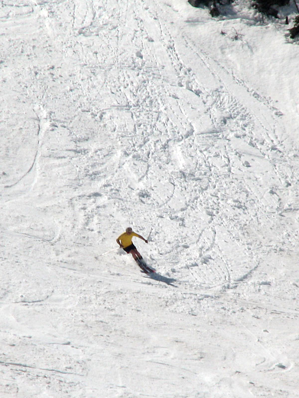
A skier nearing
the end of his run at the bottom of the Central Headwall. |
 |