|
Beyond
this point, my footprints had completely disappeared except in a few
particularly shady areas, or where I had postholed. Other than that, I had
to rely on the sparsely located blazes and an occasional hole from the
tips of my poles. But I thought I remembered the way pretty well, at least
until I starting getting close the steep-walled ravine not far from the
Avalon Trail junction. I had wandered too far downhill toward Crawford
Brook, and ended up retracing my steps quite a distance uphill.
Back
on the right trail again, I finally reached the ravine. It was much
steeper on this bank than on the other, and the trail went straight down,
which made it difficult descending in snowshoes. Even though I took
careful sideways steps, the snowshoes turned into skis, my feet slid out
from under me, and I careened downhill about 20 feet before I could dig in
and stop my slide. It would have been a good place to use my ice axe if it
weren't still strapped to the back of my pack. During the fall, I had
dropped my poles. One of them was right next to me; the other was nowhere
to be seen. I stood up and looked all around, but it had disappeared into
oblivion. I gave up looking and continued carefully downhill on one
snowshoe, using my other foot to dig in and keep me from skidding again.
It worked, but I ended up in a couple of deep postholes because of it.
Crossing
the bottom of the ravine, I noticed that water was flowing not far below
the surface crust. I didn't hang around long to see how strong it was, but
quickly found the angled path up the other side. Soon I was back on the
Avalon Trail, where I figured it would be smooth sailing back to the
notch. Unfortunately it didn't work that way. I missed the first brook
crossing and wandered a bit down the steepening south bank of Crawford
Brook for some distance before I knew that I should be on the other
side. Once again, I retraced my steps, found the crossing, and continued
on my way. Luckily, the rest of the trip back was unremarkable. I took a
side path (the Cascade Loop), but didn't find the cascades to be anything
special. Finally, after crossing the brook one last time, I staggered out
of the snowy woods and across the tracks back to Crawford Hostel.
After
returning the snowshoes and telling the ranger (who had been getting a bit
worried because I had expected to be back by 2:00) about my difficulties
and filling her in on trail conditions, I walked back to the car and
headed home, stopping only once for a couple of sodas and a snack. It had
been a much tougher climb than I had bargained for, but I was glad because
I hadn't given up, but persevered to the top. |
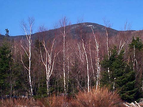
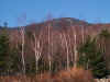
Mt
Tom from Crawford Depot. Although not very impressive from this angle, it
had a definitely been a long hard climb. |
 |