|
The climb up the Twinway to Zeacliff was
much easier and more enjoyable than my last trek over that same
route. In May of 2001, Muffin and I hiked up to Mt Zealand through a
very loose and decaying layer of wet snow and tangle of blowdowns.
Without snowshoes, it was an exhausting trip, at least for me.
Muffin is light enough that she can usually walk on top of all but a
freshly-fallen covering of dry powder. This time, the ground was
nice and dry, and before I knew it, I arrived at the short side
trail to the namesake cliffs that overlook the Zealand valley.
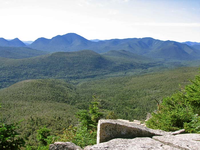
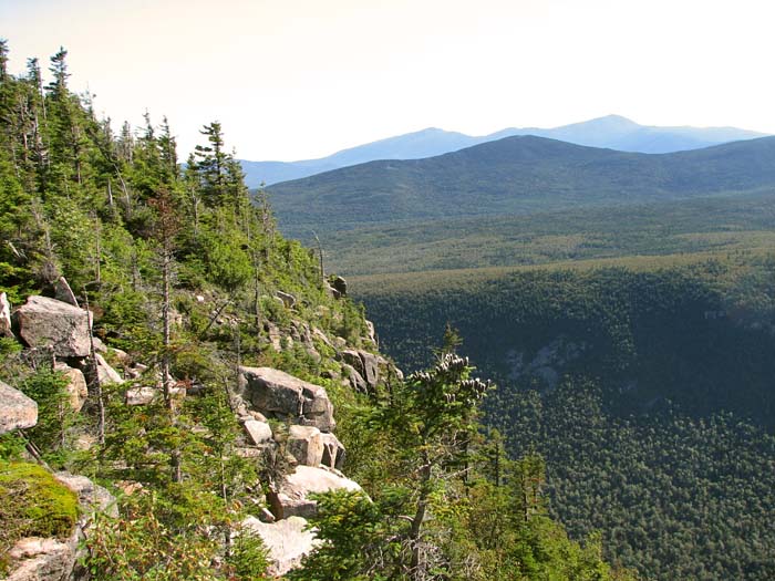
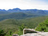
Out in the sun on Zeacliff, the day
had warmed up a bit, but the air was still exceptionally clear and
free of haze, and the views were superb. From Zeacliff's sheer
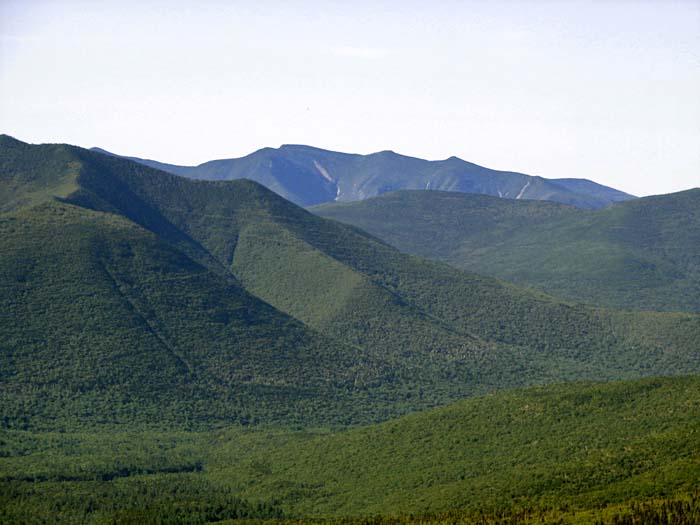
dropoff, I looked out over an impressive array of peaks. I could
see the Hancocks and the Osceolas to the southwest, Mt Carrigain
to the the south, and the northern end of the Willey Range and the
Presidentials to the northeast. Closer by to the east, in Zealand
Notch, the old logging railroad bed that the A-Z Trail follows cut
a thin but distinct line across the lower slopes of Whitehall Mtn.
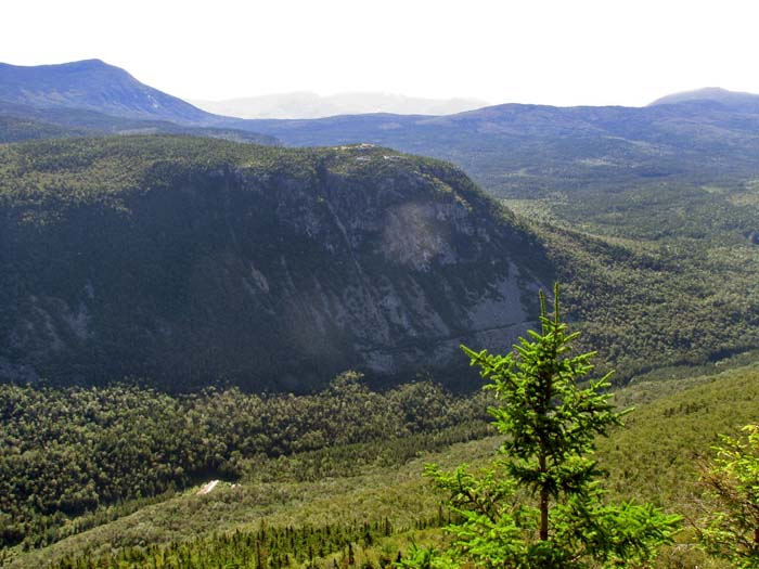
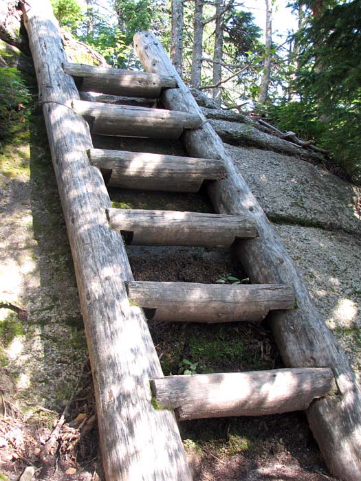
After leaving Zeacliff, the trail
descended slightly to a col where a side path led downhill to the
shores of Zeacliff Pond. Considering the length of my day's hike,
I decided that I didn't want to take the time to go down for a
closer look. At any rate, just beyond, the trail climbed up the
Twinway's only ladder to an outlook over the pond.
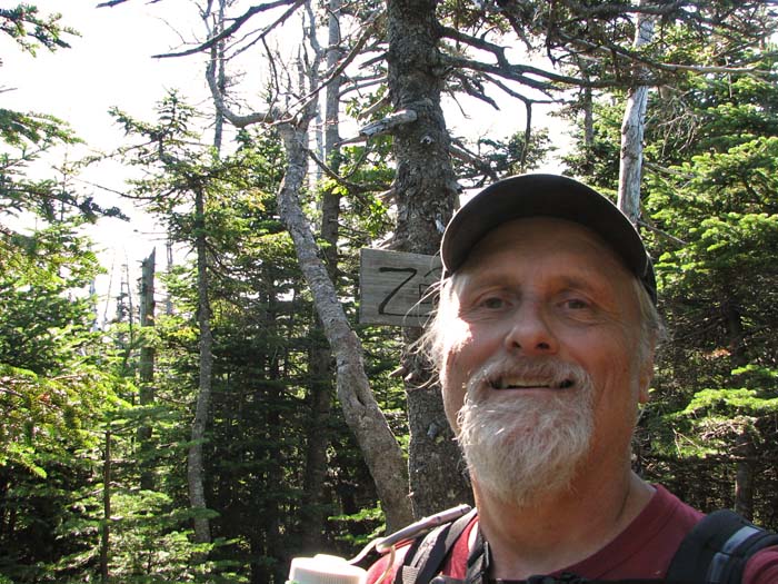
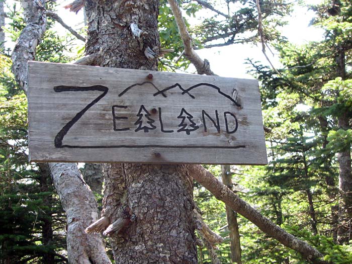
It wasn't too much further to Mt
Zealand as the crows flies, but there were a number of ups and
downs that made it seem like it took forever. I was glad when I
finally reached the sign that marks the spur trail to this wooded
and viewless peak. The spur trail itself was nearly flat; the
actual summit is merely the highest point on a broad rounded knob.
The most impressive thing about Mt Zealand was actually its summit
sign. It seems ironic that this obscure little 4000-footer has one
of the most original and interestingly-carved signs.
After taking a couple of
quick pictures, I headed back down the spur trail to hike the only
portion of the Twinway that I had never been on before - the
section between Mt Zealand and Mt Guyot. |
Mt
Carrigain from Zeacliff. The view from Zeacliff is
impressive, as is the sheer dropoff from its ledgy cliffs. |
 |