|
While inside, after touring the hut’s facilities, I bought a new purple
hut tee-shirt. The tee-shirts this year are kind of plain, without all the
colorful drawings on the back, and the hut names aren’t very prominently
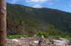
printed. Outside again, I sat with Muffin on the porch for a while, where
the views out over the Pemigewasset Wilderness and to part of the Bond
range were magnificent. The last time we were here, it was foggy and
drizzling, and I had been merely staring out into a void. Galehead
Mountain loomed just to the right, and I could see
Mt Garfield to the far right. Because of the recent construction, some
of the surrounding area was off-limits until the vegetation grew back
again.
I
could have easily stayed on the porch all day. In addition to the good
views, the temperature was perfect and air was fragrant with the scent of
fir trees and freshly-cut pine timbers. But we still had to climb to the
summit, then hike all the way back down the Twin Brook Trail to 13 Falls.
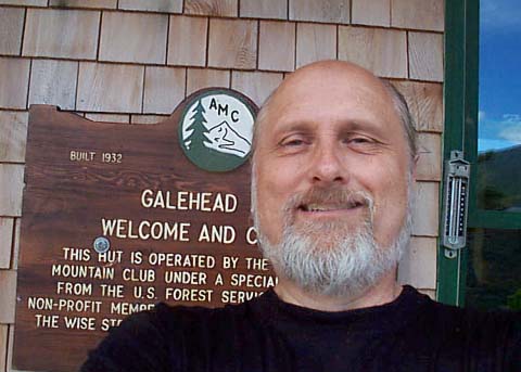
Before leaving, I took another one of my now infamous self-portraits, this
time in front of the hut by the sign.
The
climb up to the summit of Galehead Mountain wasn't difficult, even though we
were tired from the previous day and from today’s hike up from 13 Falls. Most
of the Frost Trail is not exceptionally steep, although there is one spot that
requires a bit of care, mostly on the way back down. Beyond the junction with
the Twin Brook Trail, we left the notorious dog-killing boulders behind, and Muffin
was happy.
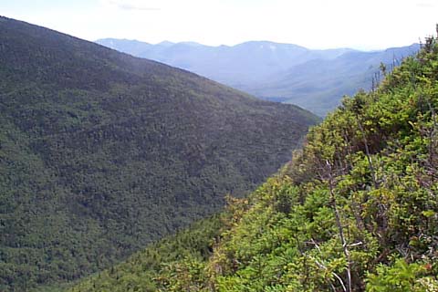
About
three-quarters of the way up, there was a short spur trail to a ledgy southeast overlook. Knowing that the actual summit was heavily treed, we paused
here for awhile, soaking up the views and admiring the abrupt drop-off over the
scrub down into the Twin Brook valley below.
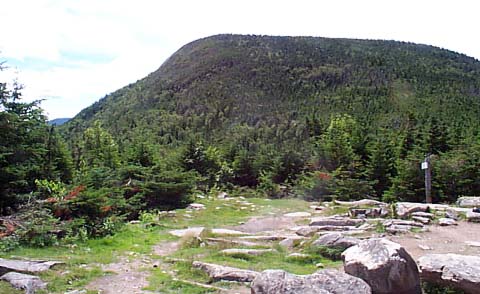
A
short distance beyond the overlook, the trail dead-ends, and we arrived at the
actual summit. A sign on a tree and a cairn adorn the small clearing. As with
Owl’s Head, the top of Galehead is wooded, with almost no views, although if you
stand up tall on the side of the cairn, you can just about see the top of
Mt Garfield in the distance. A group of three hikers caught up to us while
we lingered on the top. They talked about the non-views a bit, then turned around
and headed down. After a brief pause to enjoy the solitude, we too departed. |
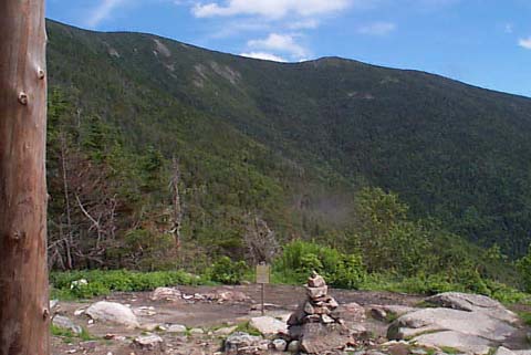
Looking southeast from the front porch of Galehead Hut. Mt Guyot is
at the center, the Bonds are off to the right, and South Twin is out
of sight to the left. The wooden column at the left is one of the
porch roof’s support posts, not a dead tree. |
|