|
The
Owl’s Head Slide is not an officially-maintained trail. Although
there is supposed to be a sign at the base of the slide, it is usually
missing since people steal them as souvenirs. While barely over
4000 feet and not above treeline like Mt Washington, Owl’s Head
is never-the-less considered somewhat of a prize because it is remote
and not well-traveled, the slide itself is a challenging climb,
and it takes some degree of trail-finding know-how and confidence
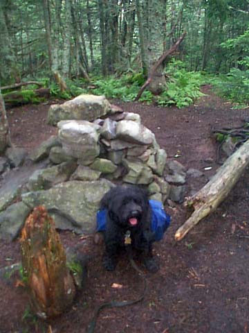
to follow the route up and back. There’s a small cairn on the trail
at the start of the slide, where a narrow stream of scree pushes
through the woods and spills out onto the flat trailbed.
We
stopped in the woods nearby, and I hung my backpack on a branch
in a tree, taking only a bottle of water and the camera. Although
the slide only about two feet wide at the bottom, it soon spread
out to about 40 feet. Parts of it were solid ledges, parts were
loose scree, and rest were somewhere in between. Here and there,
small bushes grew in the cracks among the rocks. I climbed slowly,
often backsliding on the scree as if I were climbing a sand dune.
In many places, I had to stop and help Muffin up a difficult section.
A couple of times, I heard thunder rumble in the distance, and I
considered turning back, but there was no rain and it even looked
like it might clear up, so we continued on. Halfway up the slide,
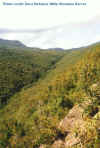
we stopped and sat on a ledge to rest and admire the view. The misty
Lincoln Brook valley was visible curving slowly northward about
600 feet below us, and the lower slopes of the Franconia Range disappeared
into the clouds to the west.
At
the top of the actual slide, a narrow path led steeply up through the
woods. At first, the path was rocky and somewhat unstable, but it soon
moderated and all traces of the slide disappeared. Although reasonably
easy to follow, the path was blocked in numerous places by downed trees
that we either had to climb over, under, or around. About 15 minutes after
entering the woods, we arrived at the top of the ridge. Beaten paths
meandered in several directions, probably made by hikers either searching
for the true summit or for a suitable campsite. I stuck a ski pole in the
middle of the path we came up to mark the way, then continued on in what
seemed the likely direction. A short distance later, after winding through
a mostly flat area, we arrived at the summit, which was located in a
little clearing encircled by lichen-covered trees and ferns. There was a
small cairn but I didn't see a sign.
|
Looking
north up the Lincoln Brook Valley from the Owl’s Head Slide on a
nicer day. Clouds in the distance obscure most of Garfield Ridge. |
 |