Sooner than I expected, we
arrived at the Lincoln Brook Trail junction, where we paused to rest and
have a snack on a conveniently-located log. Here, I needed to make a
decision. The Lincoln Brook Trail heads west to make a long loop around the
isolated and remote Owl’s Head Mountain, then rejoins the Franconia Brook
Trail at the 13 Falls Tentsite, while the Franconia Brook Trail heads
directly north to 13 Falls, about a two hour hike away.
We
could turn onto the Lincoln Brook Trail and head first to Owl’s Head and then
to 13 Falls, or we could continue straight up the Franconia Brook Trail to 13
Falls, set up camp, then double back on the Lincoln Brook Trail to Owl’s Head
and return. Although I figured the second option would add another hour onto the
day’s hike, its advantage was that we could unload most of our pack weight at
the campsite before going to Owl’s Head. I finally decided on the first option
since I figured that I could stash my pack in the woods at the base of the Owl’s
Head Slide before we climbed it. I also calculated that the second option wouldn’t
get us back to our tent until around 7:00 PM, and I didn’t want to risk being
out after dark if there were any unforeseen delays. As it turned out, this decision
proved to be the right one, probably saving the climb and maybe even our lives.
The
Lincoln Brook Trail is much narrower, but still seemed easy enough to follow except
at a couple of brook crossings, where it wasn’t completely obvious where the trail
picked up again on the other side. Both of these crossings were moderately difficult,
especially for Muffin, although I slipped and got one of my new boots soaked while
trying to help her hop from rock to rock. Just after a third, but easier brook
crossing, we heard thunder in the distance and began to feel drops of rain, which
soon turned into a downpour.
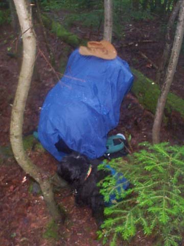
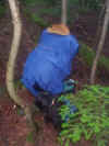
Stopping
under a sheltering fir tree, I put my Goretex jacket on, then took
out the pack’s rain cover and slipped it over my pack. As the pack
itself is not waterproof, I didn’t want to end up with a wet sleeping
bag that night. By the time we reached the Owl’s Head Slide, the
rain and thunder had stopped, and I figured that the "chance of
a thunderstorm" forecast had proven correct, but that it was now
over.
The
Owl’s Head Slide is not an officially-maintained trail. Although
there is supposed to be a sign at the base of the slide, it is usually
missing since people steal them as souvenirs. While barely over
4000 feet and not above treeline like Mt Washington, Owl’s Head
is never-the-less considered somewhat of a prize because it is remote
and not well-traveled, the slide itself is a challenging climb,
and it takes some degree of trail-finding know-how and confidence
to follow the route up and back. There’s a small cairn on the trail
at the start of the slide, where a narrow stream of scree pushes
through the woods and spills out onto the flat trailbed.
|
When
the rain began, I had to put the rain cover on my pack. Unfortunately, there was
no cover for poor Muffin, who had no choice but to get wet. |
 |