|
Continuing
a tradition begun last year, Muffin and I went on a backpacking
trip while Toi and Holly were gone on their daycamp overnight. Our
plan was to stay two nights, first at 13 Falls Tentsite, then at Guyot Campsite. As usual, we left
home at 4:30 AM and made the 2-1/2 hour drive to the Lincoln Woods
parking area on the Kancamagus Highway, where the Wilderness Trail
begins.
After
buying a White Mountain National Forest Service parking sticker at the
information center there, and getting our stuff in order, we crossed
the East Branch of the Pemigewasset River over the suspension footbridge
and headed out on the Wilderness Trail just after 8:00 AM.
The
Wilderness Trail follows the bed of an old logging railroad, so
it looks more like a country lane than a backcountry trail, but
it provides the main link from the south to the rest of the trails
in the Pemigewasset Wilderness. It is flat and easy to walk on,
so we made good time despite my nearly 40-lb load.
We
followed the Wilderness Trail for 2.9 miles, passing the Osseo Trail to
Mt Flume, the Black Pond Trail, and the spur path to Franconia Falls. At this
point, we crossed another footbridge over Franconia Brook and officially entered
the Pemigewasset Wilderness. Here, we turned north onto the Franconia Brook Trail,
which also follows an old railroad bed but isn’t nearly as wide as the Wilderness
Trail. The trail climbed gently through mixed hardwood and spruce/fir forests,
occasionally crossing small streams over rocks. At one point, the trail detoured
around a large swampy area flooded by beavers. Although there were muddy spots,
the trail was relatively dry.
|
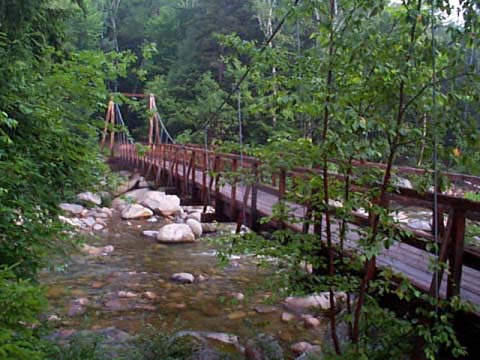
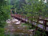
Suspension
footbridge over the East Branch of the Pemigewasset River. This
is the start of the nearly 9-mile long Wilderness Trail, linking
the Lincoln Woods parking area on the Kancamagus Highway with numerous
trails in the Pemigewasset Wilderness. |
|