|
The
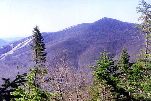
hike was pretty much uneventful until we started to get some views
as we approached the summit. The first view to open up was to the
south, where I could
see Mt Tecumseh and the Waterville Valley ski area not far away. The
lack of leaves on the deciduous trees made the lower slopes look
drab and brown, while the spruce and fir at higher elevations gave
the mountains a dark bluish-green tint.
Soon,
the trail ascended the summit cone and we rounded a bend out onto a
flat area. The weathered concrete foundations of a now defunct
firetower stuck out an unsightly geometric gray from the hard granite.
From
there, two or three paths meandered through the scrub to the nearby
summit ledges. No one was around. For now, we had the broad open summit
area all to ourselves. I sat down leaned against a small boulder to
eat lunch - some peanuts and a power bar - and to admire the views
east and south.
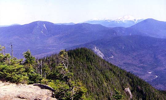
Looking
east, I could see snow-capped Mt Washington and Mt Jefferson on the
horizon, with the closer Mts Hancock and Carrigain framing them.
North Hancock was easily identifiable by the long scar of the Arrow Slide
on its southeast flank. |
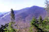
Mt
Tecumseh and the Waterville Valley ski area from the Mt Osceola
Trail. Notice how the lack of leaves on the trees makes the lower
slopes look drab and brown, while the spruce and fir at higher
elevations give the peaks a bluish-green tint. |
 |