|
This was my second hike of the day. In the
morning, after an aborted attempt (due to my inability to drive up the
slippery Zealand Rd) to climb Mt Hale via Zealand Falls Hut and the Lend-a-Hand Trail, I had quickly changed my plans to climb the much
lower Sugarloaf peaks. As this climb was less than I had planned for the
day, I decided to drive on over to Franconia Notch in the afternoon to
climb Mt Pemigewasset (Indian Head), a small peak that I hadn't yet climbed.
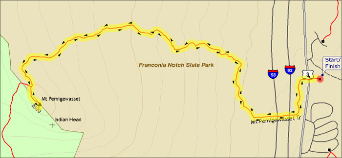
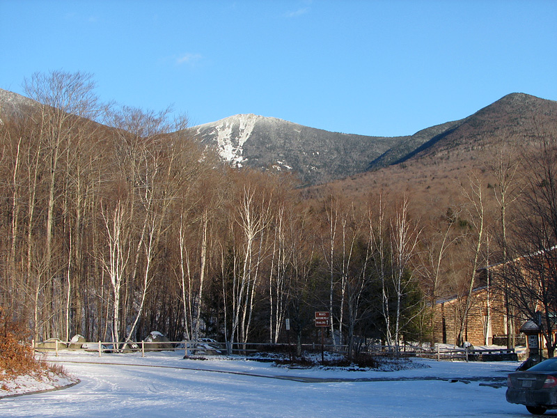
I parked in the Flume Visitor Center parking
lot and took the Mt Pemigewasset Trail, which left from the west end of the
lot and then crossed under the two lanes of I-93 before reaching the
gentle slopes of the mountain. I had recently bought a pair of STABILicers to use when crampons were overkill. Although they gave
decent traction, several of the spikes had broken off while climbing
Sugarloaf, so I wasn't really happy with them and decided not to put
them on just yet.
The trail angled moderately up the mountain,
first heading north and then curving back to the west and southwest.
Right before the summit, it turned left and steepened, soon reaching the
top from the north. It was considerably warmer than it had been in the
morning on Sugarloaf, and after taking a picture of myself, I was ready
to take my hood off.
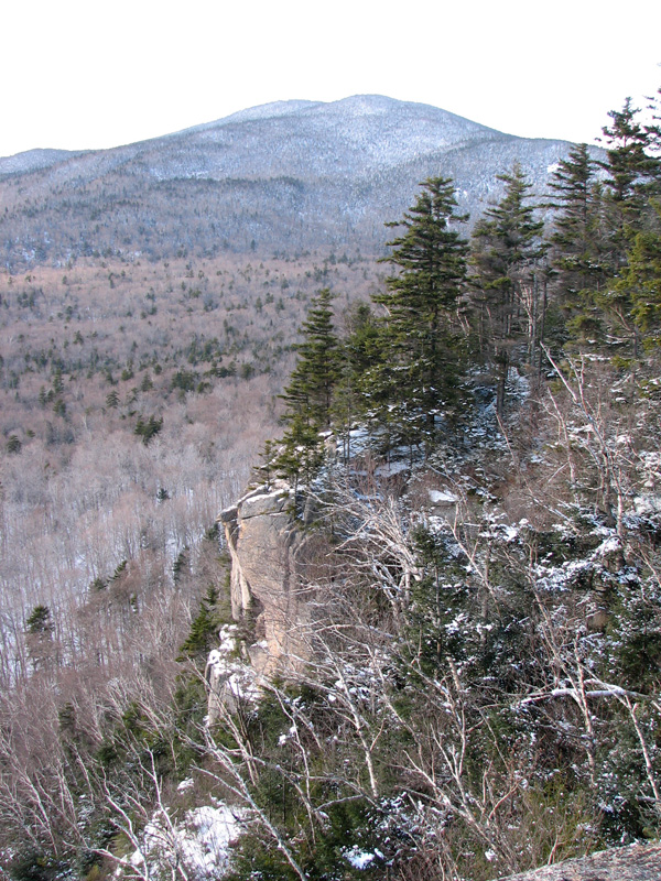
To the west, there was an interesting cliff
with a sheer drop, behind which stood North and South Kinsman. To the
south, the long thin ribbon of I-93 wound though the hills into the
distance.
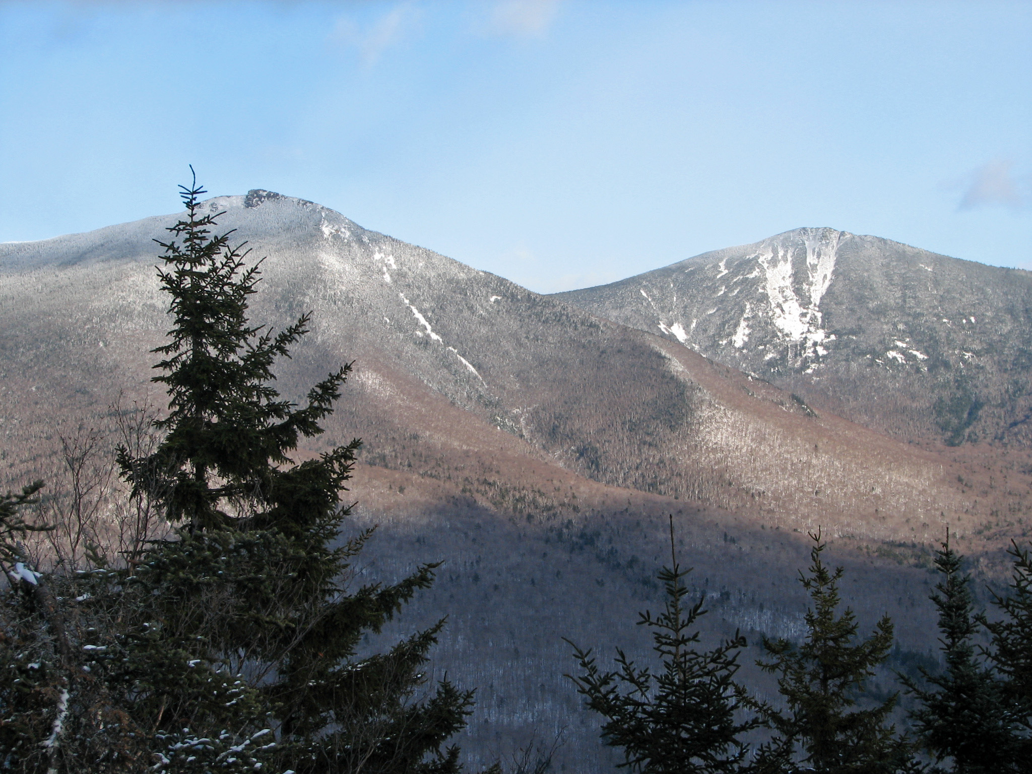
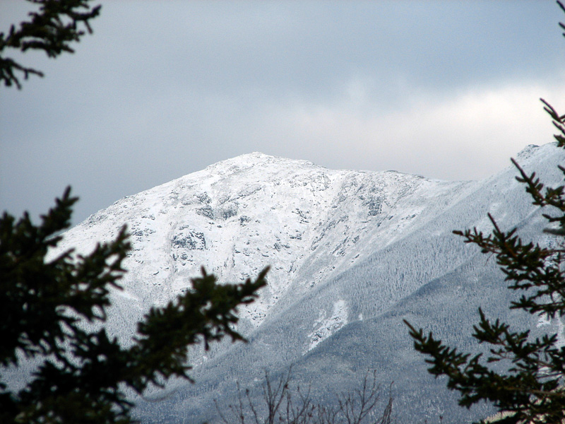
The most interesting views, however, were in
the east where the much higher Franconia Range towered over the notch.
Mts Liberty and Flume each had a slight touch of rime ice, but Mt
Lafayette was draped in a thick coating of rime and snow, looking solemn
in its winter attire.
Before heading down, I decided to put on my
STABILicers since I was much more likely to slip on the icy trails
during my descent than while climbing. Back at the car, I was dismayed
to discover that a few more spikes had broken off. This should not have
happened as I was careful to avoid stepping on rocks. I was also
disappointed in the STABILicers' rear straps, which tended to slip off
my heels. Later, at home, I returned them and bought a pair of Katoola
Microspikes, which have fared far better and are much lighter to boot
(pun intended). |
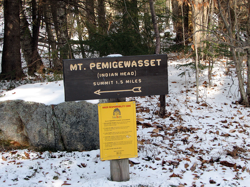
Trailhead. The Mt
Pemigewasset Trail leaves from west side of the Flume Visitor Center's
parking lot, first crossing under I-93. |
 |