|
The
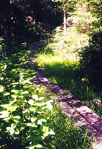
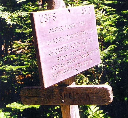
Carter-Moriah and Stony Brook Trails meet at a minor sag in the ridge at
an unusual trail junction - both trails are on bog bridges (timber
puncheons). Of course, considering how dry it had been, the ground wasn't particularly
damp.
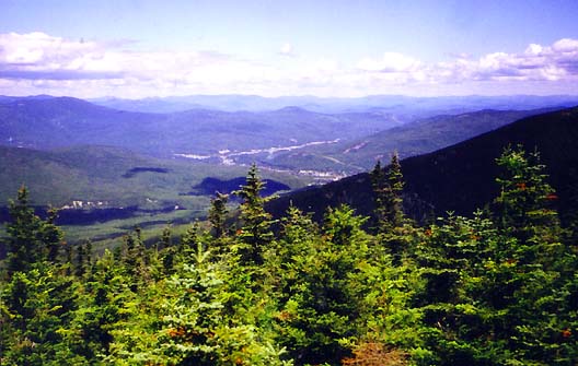
The
trail climbed over some minor humps, then rose steadily to an open ledgy
area with many alpine plants and great views to the north and west. I
could see the town of Gorham in the northwest, with the slender ribbon of
Rt 16 disappearing through a small notch toward Berlin and beyond. To the
north, the tiny rocky summit cone of Mt Moriah peeked out just above the
wooded ridge.
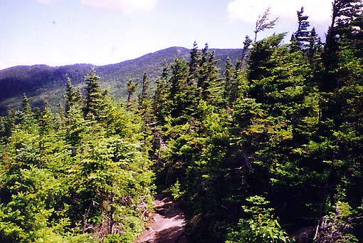
In
the southwest, the jagged and bulky backside of Imp Mtn stood watch on my
section of the ridge and down into the hollow where I guessed the Imp
Campsite and Shelter lay. This mountain is named for the so-called profile
of an imp that is supposed to be visible from the Dolly Copp Campground
just off Rt 16. I've know I've never seen anything notable while driving
by.
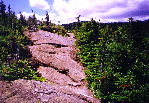
Cairns
marked the way in the ledgy areas, though the trail was pretty easy to
follow. Just about the time I was wondering whether I had somehow passed
the spur trail to the campsite, I rounded a corner, descended a short
steep ledge into the scrub, and there it was!
The
Imp Campsite Spur trail wound steadily downward through the fir and spruce
trees. As with the spur trail down to the Guyot
Campsite, it continued on
a bit longer than I preferred, knowing that I'd also have to climb back up
it three more times over the next couple of days.
|
The
Carter-Moriah Trail at the junction with the Stony Brook Trail. Both
trails meet on bog bridges, although the ground wasn't particularly
damp this time of year. |
 |