|
It
had taken us much longer to ascend King Ravine than I had expected,
and as it was a rather hot day, we had completely run out of water
about halfway up the headwall. From here, we could either head
over to Madison Spring Hut to fill up our water bottles (which
was fairly close, but in the opposite direction that we wanted
to go), or hike southwest on the Gulfside toward the Israel Ridge
Path and the Perch. At this point, climbing Mt Adams was out of
the question; I was too exhausted and too dry, and I'm sure Muffin
was too. And, or course, I had already climbed it and didn't need
it to complete my Four Thousand Footers list.
Of
course, I didn't really want to go downhill to the hut and then
have to climb back up again, so after consulting my map and guidebook,
I decided to make for a spring that was supposed to be somewhere
along the Gulfside Trail between Thunderstorm Junction and the
Israel Ridge Path.
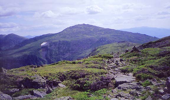
This
part of the Gulfside Trail angled moderately uphill along the
base of the Mt Adams summit cone, but it was nice and smooth,
having been paved with flat stones by the famous trail builder
J Rayner Edmands around the turn of the century.
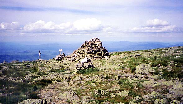
After passing Thunderstorm Junction, a large cairn where the Gulfside
Trail, Lowe's Path, the Spur Trail, and the Great Gully Trail
all come together, the trail starting dropping gently downhill.
On
a clear summer day above treeline, the sun can beat down mercilessly,
and it was doing so now at full strength. I was beginning to regret
not stopping to get water at the hut. It seemed to be taking forever
to reach the spring, and I was beginning to worry that either
the spring had dried up, or I had passed it somehow without noticing
it.
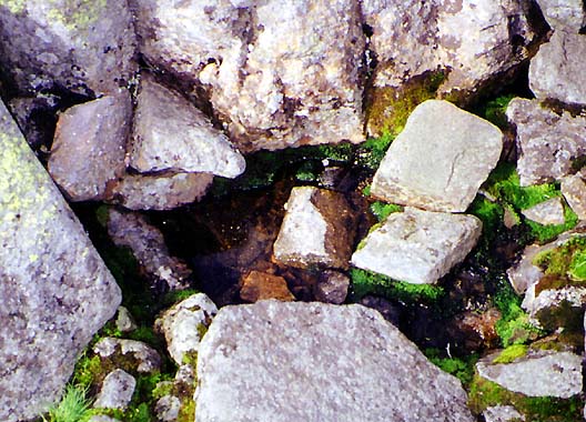
Then,
when I had just about given up hope of finding it, there it was,
right in the middle of the trail. Although no more than a tiny
trickle among some rocks, it was an oasis in the desert as far
as I was concerned. The water was icy cold and clear. I filtered
enough for a couple of bottles, and drank another while we rested.
Muffin lapped up her water directly from the spring.
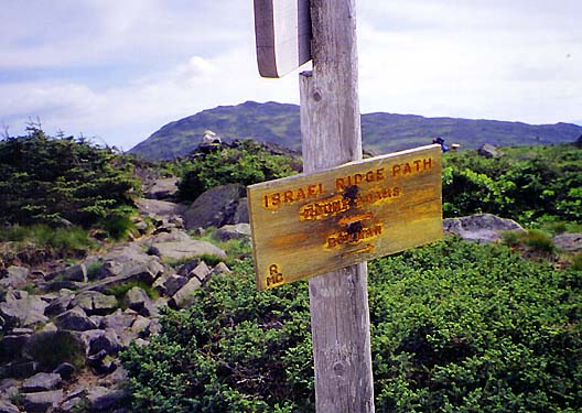
Feeling
refreshed, we continued our trek toward the Perch. It didn't take
long to reach the junction with the Israel Ridge Trail.
I was sure that we'd soon be setting up the tent and lying down
to rest. But Muffin's feet were a bit sore and the path was rocky,
so it took us somewhat longer than I had calculated to reach the
Perch Path.
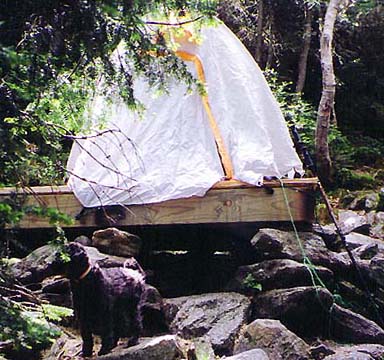
Finally,
the tent platforms at the Perch loomed in sight; I dropped my
pack on the nearest one, which was perfect as far as I was concerned. |
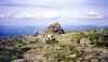
Thunderstorm
Junction. The Gulfside Trail, Lowe's Path, the Spur Trail, and
the Great Gully Trail all come together at this spot. I was glad
to be here instead of still in King Ravine, but I was still thirsty
and tired. |
 |