|
Near
the top, the rocks and alpine plants were covered with rime ice
(frozen fog), which is feathery and forms outward in the direction
of the wind.
The
wind was so strong that instead of standing on the summit like
I usually do, I crouched in a fissure among rocks just below the
summit. Even though I was wearing my Goretex jacket, the wind
chill on the surface on the jacket coupled with my minimal layering,
was making me cold. The wind also seemed to sap the strength out
of me. Huddled among the rocks, I ate a snack and drank some water,
hoping to replenish my strength. This was one time where I simply
couldn’t wait to get back down below treeline again.
After
resting for a short time, I braved the wind and started back down.
The wind was now blowing into my face, and I had to pull my hood
tighter around it. On the way down the summit cone, I took a picture
of Mt Washington, the ridge, and a partial view into the Great
Gulf.
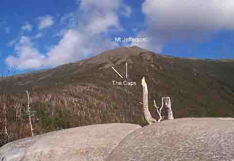
The
trip don’t went slowly. When I finally reached the caps, there
were occasional sheltered spots from the wind, but when I finally
reached the shelter of treeline, I felt a lot warmer again. Soon,
it felt so warm, I had to take off my jacket.
On
the way back down, I stopped at the boulders with the potholes
in them again. This time, the view was much better.
Back
in the parking lot at the trailhead, I got a final look at Mt
Jefferson before I left. |
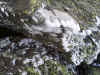
Rime
ice on rocks. Rime is frozen fog. It frequently forms in the mountains,
particulary above treeline when the supercooled droplets of fog
hit a cold surface. Rime ice always forms in the direction of
the wind. |
|