|
By
the time I reached the second Cap, I could clearly see the buildings
on the top of Mt
Washington. I could also see the smoke from one of the
Mt
Washington Cog Railway trains, and hear the blasts from its
mournful whistle.
Finally,
I climbed down off the last Cap and got my first glimpse of
the summit cone of Mt Jefferson jutting up from the ridge. The
wind was roaring here. Based on Mt Washington’s records, which
I later looked up on the Internet, I was probably climbing in
gusts of 60 to 70 mph with a sustained wind force of around 50.
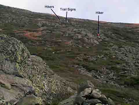
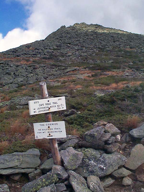
I
began climbing up toward the trail sign that I could see in the
distance. From the map and guidebook, I knew this sign to be pointing
the way for the Cornice Trail, a shortcut to the Gulfside Trail
to Mt Washington. Although it didn’t look that far away, it took
longer and was steeper than expected, and the wind was fierce.
The pictures make it look like a nice mild sunny day, but with
the combination of the high wind and temperatures in the 30’s,
the wind chill was definitely below zero.
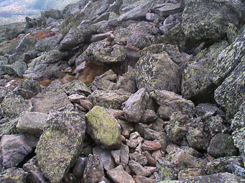
The
ascent up the steep summit cone was the most difficult of all.
The wind was brutal. I had to stop and cling onto rocks or crouch
down low during the stronger gusts to keep from being blown over.
Luckily, it was blowing in an uphill direction, making it unlikely
that I would fall downhill. The trail here was not so much a trail
but a rock hop from cairn to cairn. |
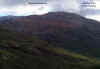
Mt
Washington from the second Cap. Both the summit buildings and
the smoke from one of the cog railway engines was clearly visible.
Not visible in this picture is the ever-present wailing of the
cog's whistle. |
 |