| |
|
|
Mt
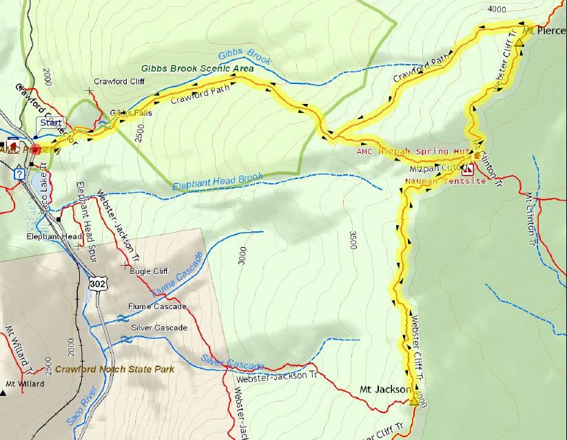
Jackson, Mt Pierce, Mizpah Spring Hut |
|
|
|||||||||||||
On this trip, I was hoping to add three more 4000-footers to Patches' list of completed peaks: Mts Jackson, Pierce, and Eisenhower. I also wanted to pick up my trail maintenance tools at Mizpah Spring Hut to bring them home for the winter. As you can see by the title of this trip report, we never made it to Eisenhower, but I'll get to that later. We parked at the Highland Center, and then headed across Rt 302 to the Crawford Path Trailhead. There were masses of fallen leaves scattered all over the trail, so I had to watch my step in case they made things slippery. Naturally, Patches, with her four sure-footed mountain goat paws, had no trouble whatsoever. It was a little chilly in the early morning, so we started off the day with Patches wearing a little blue jacket. Unfortunately, this wasn't quite enough to keep her clean through all the wet and muddy spots on the trail. By time we got to Mizpah, her legs were covered in splashes of mud, but at least the jacket saved her back from a few splatters. She had to wait outside while I went in and explained to the croo about picking up my tools after our hike to Jackson, but I had brought a plastic tub of ready-to-serve dog food, so she kept herself busy for a little while at any rate. On the way to Mt Jackson, Patches was careful to stay on all of the numerous bog bridges that dot that section of the trail. Muffin had often prefered to walk alongside them, but Patches hugged them like a tightrope. While crossing the quaking bog below Jackson, I was especially thankful for Patches' habit of staying on the boards. At the summit, we rested on some ledges that overlook Crawford Notch. The day was still sunny and calm, and the views were spectacular. Toward the north, the Presidential Range wound its way over Pierce and Eisenhower and up to Mt Washington in the distance; we could even see the tiny dot of Mizpah below Mt Pierce. To the south, there were Mts Webster and Willey. We were enjoying the day and were in no special hurry to leave. But leave we had to if we were going to make all of our hiking goals for the day, so we eventually headed back to Mizpah to pick up my tools and continue on. Since the day was now much warmer, I took off Patches' jacket and stashed it in my backpack. Then, after filling up my water bottles and stowing the tools in my pack, we began our trek up the steep section of the Webster Cliff Trail up to Mt Pierce. It may have been due to the exertion of kneeling and leaning over while trying to stuff my tools securely into my backpack, or from the extra weight of a poorly-packed backback resting uneasily on my shoulders, but as we started our climb, I began to experience heart palpatations, something I get from time to time, usually when I'm straining to lift or move something heavy, especially when I'm bent over or working from an awkward position. They rarely, if ever, occur due to the exertion of climbing a steep trail. Anyway, as is usual, I started to get stressed out about them, which of course only made them all the worse. Consequently, I took a lot of rests on the way up to Mt Pierce and we made very slow time. Finally, at the summit, they seemed to have let up. I took some pictures, but I was now rather tired and stressed out, and on top of that, the day had turned sour and gray, clouds had rolled in over the higher summits, and a chill had come back to the air. It didn't take me long to decide not to push on for Mt Eisenhower. So down the Crawford Path we went, hurrying to get back to the car and head home for a nice long rest. The more I think about, the more I blame the uncomfortable weight of the backpack pressing on my shoulders along with a too-tight sterum strap. I needed to stop fairly often to readjust the pack as it kept slipping down, taking the weight off the belt and putting more of it on my shoulders. It's a good pack, a Gregory Palisade, but it just wasn't fitting that well on that day. Anyway, we finally made it down to the Highland Center, got in the car, and began the long drive home. Bad traffic in Concord and then again along I-495 in Massachusetts made the drive rather stressful, but once home again, my energy level began to return to normal. Patches, of course, never seemed tired at any point in the day. |
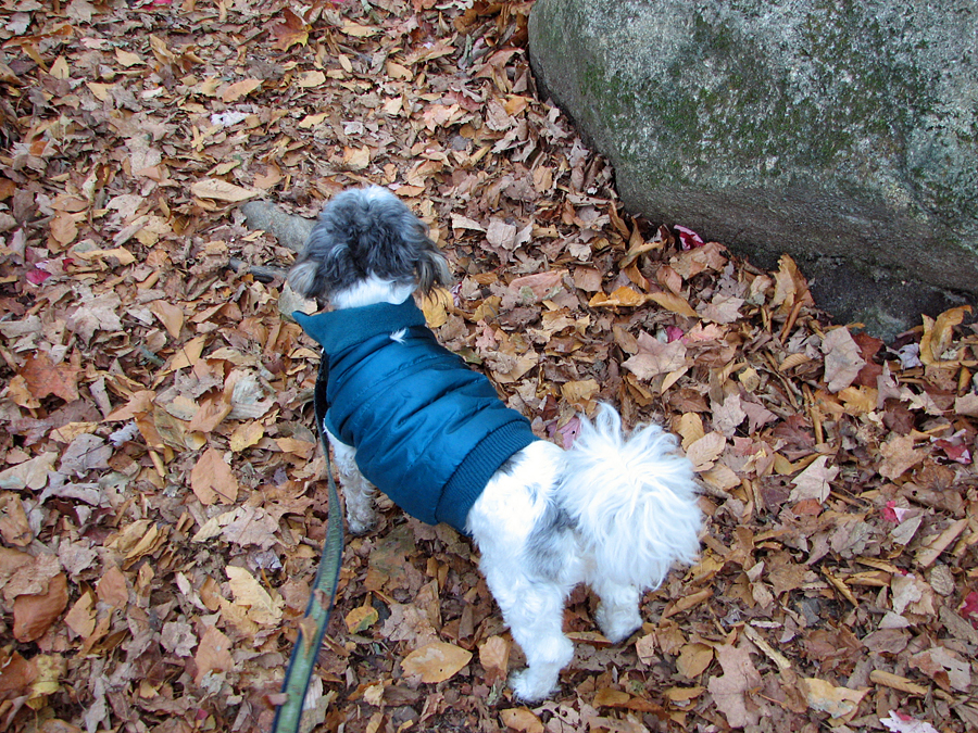
Patches on the lower part of the Crawford Path. The day began a bit chilly so she started off wearing her jacket. |
|
Mt Washington from the quaking bog below Mt Jackson. |
|
|
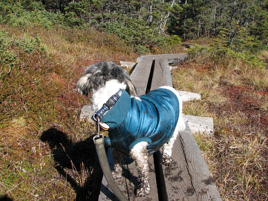
Patches on the bog bridges along the Webster Cliff Trail. This is a perfect example of how she's always looking back to see if anyone's coming. |
|
|
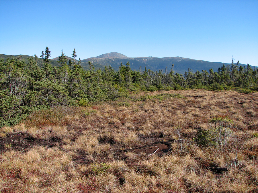
Looking back to Mt Pierce and Mizpah Spring Hut from the steep ascent up the north side of Mt Jackson. |
|
|
Washington, Eisenhower, Pierce, and Mizpah from the summit ledges on Mt Jackson. |
|
|
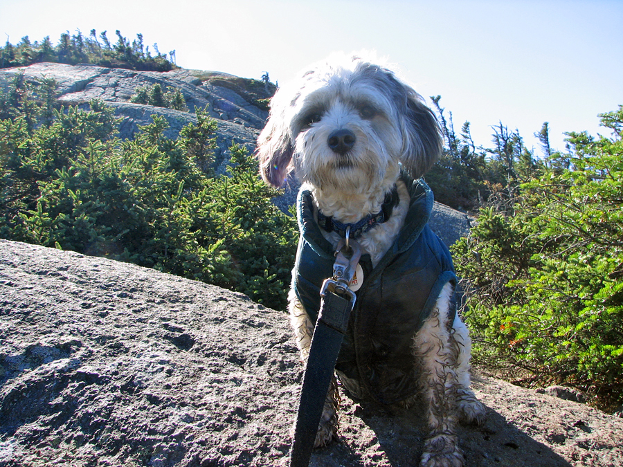
Patches on top of Mt Jackson. We rested on the ledges that overlook Crawford Notch. The true summit is a cairn where the views aren't quite as spectacular. |
|
|
Looking toward the north end of Crawford Notch. The Mt Washington Hotel is visisble just to the right of the road at the center. |
|
|
Nearby Mt Webster with Mt Willey in the background on the other side of the nottch. |
|
|
Self-portrait on Mt Jackson. Holding her is one way to keep her from looking the other way when I take the picture. |
|
|
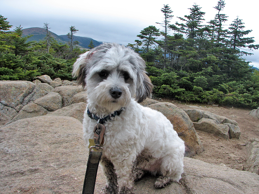
Patches near the front entrace of Mizpah Spring Hut, just before we headed up the Webster Cliff Trail to Mt Pierce. |
|
|
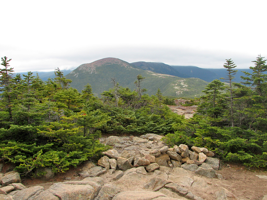
Patches near the summit cairn of Mt Pierce with the top of Mt Eisenhower just visible to the left. |
|
|
Self-portait on Mt Pierce. If I look less than enthusiastic, it's because I was tired and having a problem with palpatations. |
|
|
Mt Eisenhower from the summit of Mt Pierce. Mt Washington is behind and to its right but hidden by the drifting clouds. |
|
|
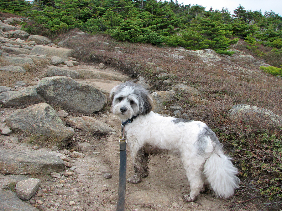
Patches descending the north siide Mt Pierce, and as usual, facing back uphill.. |
|
|
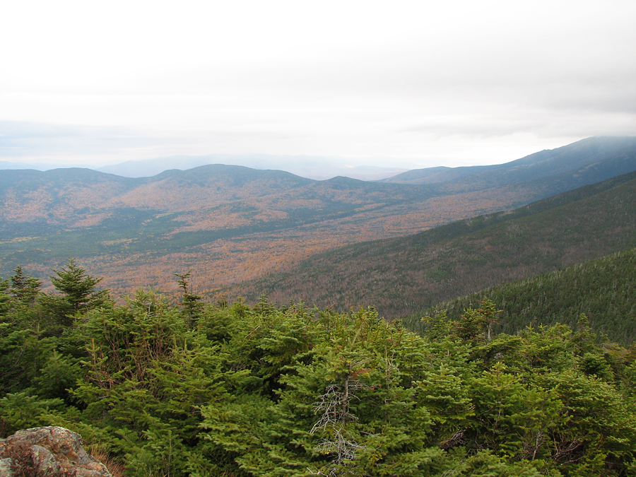
Looking northwest from the junction of the Webster Cliff Trail and the Crawford Path. At the far right, Mt Jefferson is hidden by clouds. |
|
|