|
Before
heading down, I climbed a little bit higher to get a look at the
rocky outcrops from a different angle. I could see the Weatherford
Trail meandering up the other side of the saddle. A couple of hikers
were headed that way on their way down to the south side of the
mountain.
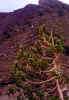
As
in the White Mountains, krummholz grows sparesly above treeline.
The tree most adapted for this in Arizona is the bristlecone pine which
grows in strange twisted shapes similar to that of the spruce trees
in the alpine zone in New Hampshire.
After
taking one last look around, I headed back down the way I came.
It was much faster going down than going up, but I still had to
watch my step as there were a lot of loose volcanic rocks on the
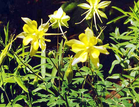
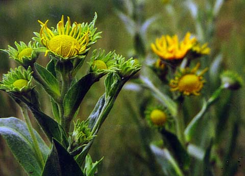
trail. Partway down, I stopped to take a picture of some golden
columbines. In the east, wild columbines are red, so the gold ones
were rather exotic to me. Later, I met a ranger on her way up, who
asked how I was doing. I think she stopped to talk because I was
hiking solo, and she wanted to be sure I had signed in the register
on the way up. I also stopped often to drink more water to minimize
mountain sickness.
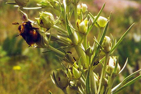
Back
in the relatively thick air of the meadow at 9,300 ft, I stopped
to enjoy the numerous flowers, including blue flag irises that were
a bit past their prime, and many other colorful ones that I couldn't
identify. There were lots of butterflies, more than I've ever seen
back east, and a huge bumblebee that I decided not to get too close
too. What I did not see, but what I had been worried about
before coming out west, were rattlesnakes and scorpions.
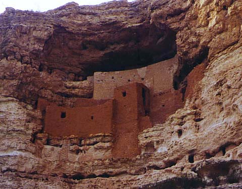
On
the way back to the Phoenix area, I stopped in Flagstaff at a couple
of stores, then later at Montezuma's Castle National Monument in
Camp Verde. This is an ancient cliff dwelling built and inhabited
by the Sinagua Indians from about 1100 to 1400 A.D. It had nothing
to do with the Aztec ruler Montezuma, but for some reason, early
visitors to the area thought it did and gave it that name.
All
in all, it had been a pretty good trip even though I didn't go all
the way to the summit. I had climbed almost 2600 ft to an altitude
of 11,870 ft, higher than I'd ever been before, and in a reasonable
amount of time with only minor symptoms of mountain sickness that
I'm sure would have been no problem if I had been able to take time
to acclimate in Flagstaff before climbing higher. |
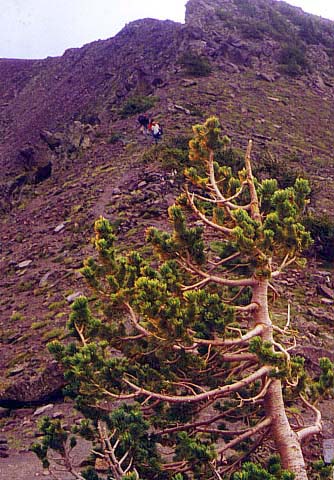
Hikers
on the Weatherford Trail. This trail winds up a small knob then
descends gradually to the south side of the mountain. The tree in
the foreground, which is actually only a couple of feet high, is
a bristlecone pine, which grows as krummholz in the alpine zone. |
|