|
The
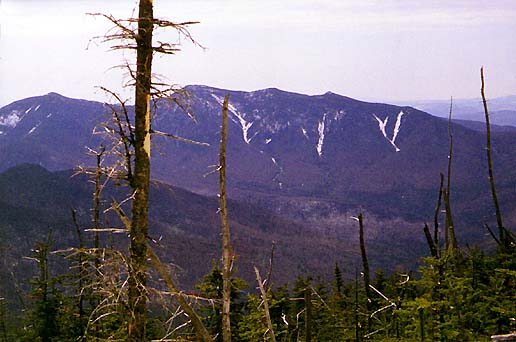
view from the outlook was pretty good to the south and the west. The
Osceolas were clearly visible, as was South Hancock, which looked
particularly steep from this perspective. I could even pick out the narrow
white snowy line of the trail descending precipitously from its
summit.
Soon, it was time to move on. We had done well so far, but I
didn't know what the trail between the peaks would be like. I feared
it would be less-traveled and hard to follow, and with
softer snow, making postholing inevitable. But I was determined to
try my best to make it to South Hancock. I did not really want to
descend back to the loop and climb South Hancock from the bottom.
My
fears were certainly well-founded. I really had to concentrate and look for signs of the
ridge trail among the semi-open woods
between the peaks. In one blowdown patch near the base of the North
Hancock summit cone, I considered giving up and turning around. But looking back
up the steep trail, I decided to give it another chance. I
frequently postholed, but it was always just one leg and never more
than thigh-deep. I lost the trail temporarily five or six times
along the ridge, but it was never as bad as it had been when I climbed Mt
Tom a year earlier. Never-the-less, it took me over two
hours to make the trek to South Hancock, a journey that would have
taken less than an hour under more ideal conditions.
Just
before reaching the South Hancock summit, we came to a somewhat open
area with views east to Mt
Carrigain. I could see the old
firetower on top.
Finally
atop South Hancock, I was elated, but tired. I contemplated the
well-known climbing adage about how most accidents happen on the way
down. And with that in mind, I decided to skip the summit outlook and
head straight down. |
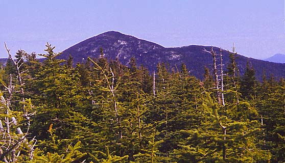
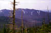
The
Osceolas from North Hancock. East Osceola is the peak to the left of
the dead tree. Mt Osceola is to the right of the tree. |
 |