|
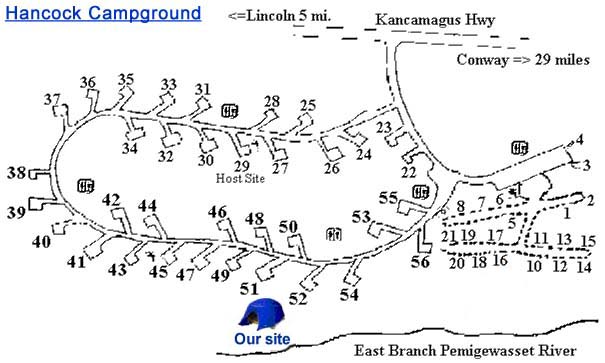
I picked up Erin and Holly after school on Friday, and we drove up to the White
Mountain National Forest (WMNF) Hancock Campground on the Kancamagus Highway
just east of Loon
Mountain Ski Resort. This is one of only a few USFS campgrounds in the
White Mountains that are open in the winter.
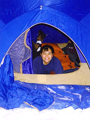
The
Forest Service had cleared out a small drive-in strip in some of the
campground's sites that was just large enough for a car, a tent, and their
picnic table. Unfortunately, the surface of the plowed-out
area of our campsite was icy and as hard as New Hampshire granite, not a
very inviting spot to set up a tent. So we shoveled out our own spot under a
tree and set up the tent there. When the ranger came around to collect the
fee, she said that we weren't supposed to camp off the plowed area,
but I explained how icy it was and she let us stay.
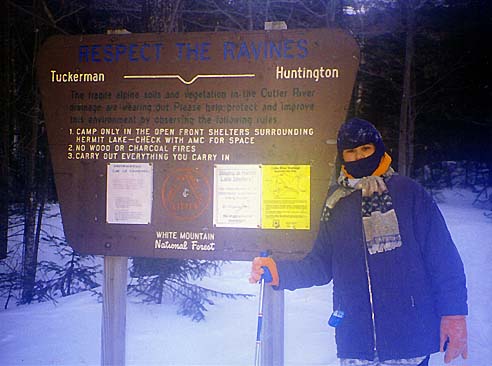
On
Saturday, we ate lunch at the Appalachian Mountain Club (AMC) Pinkham Notch Visitor’s Center, looked around the gift shop for a while,
then started up the Tuckerman Ravine Trail, which was wide and very
well-packed.
A
short distance up the trail, we came to the avalanche warning sign which
had postings for both Tuckerman and Huntington Ravines. The avalanche danger
was low, but since we weren't planning on going up the headwall, it didn't
really matter. |
Holly
trying out the tent at the campground. The surface of the plowed area was
too icy, so we set shoveled out a spot under a tree and set up the tent
there. |
 |