|
Above the hut, the snow began to get deeper.
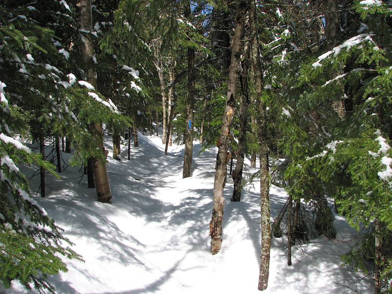
The Twinway had seen recent foot traffic and wasn't bad, but when I
turned right onto the less-traveled Lend-a-Hand Trail, the snow was wet,
sloppy, and slippery. It had obviously seen previous winter use though,
as the center of the trail (often called the "monorail") was fairly
well-packed, while everything to the right or left was like walking
through a sea of soft-serve ice cream.
Since the trail coincided with a running
brook for some distance, I had no choice but to wander to one side or
the other to avoid stepping on its exposed rocks with my snowshoes. And
because the snow was so sticky,
it tended to build up on the bottom of my snowshoes, getting heavier and
heavier until I would finally stop and use my poles to knock it off. I
repeated this monotonous ritual endless times as I gradually made my way
up the trail.
Closer to the summit, the trail grew steeper and the sticky snow
presented a new problem, covering the the bottom of my snowshoes and leaving me with
practically no traction. It wasn't too bad on the way up, but I knew it
would get worse on the way down, and I would have to be careful not to
end up "skiing" down the steeper Hale Brook Trail into a tree or down a
ravine.
Not far below the summit (according to my
altimeter watch), I temporarily lost the trail. In fairly open woods,
soft wet snow can play tricks on your eyes, and every gap between the
trees can look like the right path. I reached a couple of dead ends and
had to backtrack before I hit on the correct route.
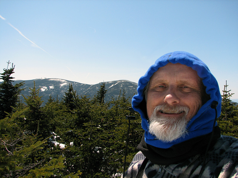
Finally at the top, my first thought was to
find a good dry place to sit for a while. The best place was on the
rocks that made up the summit cairn. My Goretex jacket was soaked on the
inside, and I spread it out on the rocks to dry off a bit while I
guzzled some water and had lunch.
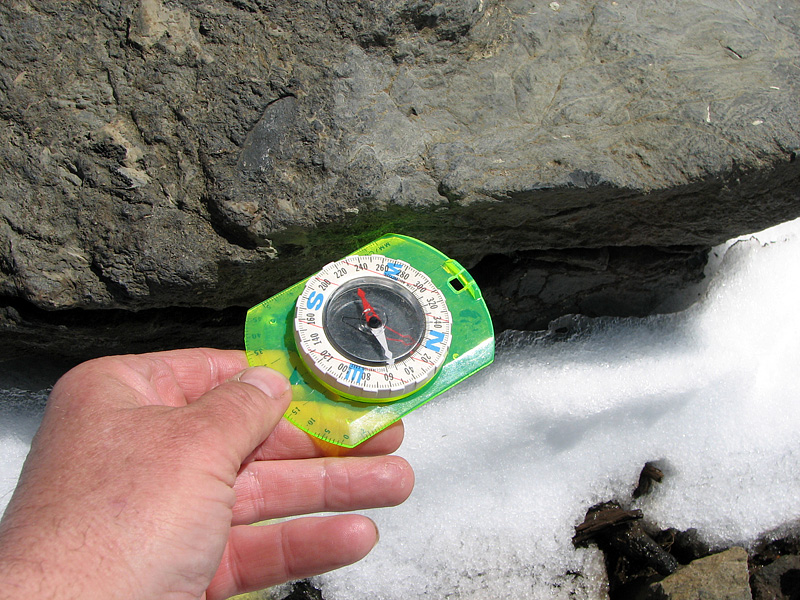
When I felt a bit more rested, I got up to
take some pictures of the landscape, but not before testing the
reputedly magnetic summit rocks for myself. I got out my compass and as
I brought it closer to the rocks by the cairn, the needle swung around
to point directly to it! OK, this was not just an old legend.
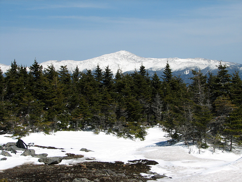
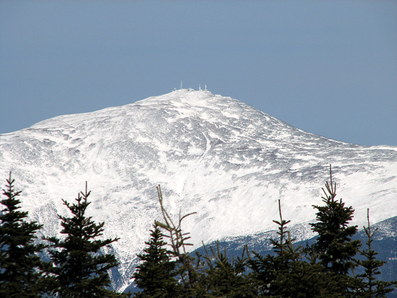
The views of Mt Washington were spectacular.
With my camera zoomed to its maximum of 12x optical, the towers and
summit buildings, as well as the route of the cog railway, were clearly
visible.
All good things must come to an end, and was
time to pick my way carefully down the steep portions of the Hale Brook
Trail, stopping frequently to knock off the buildup of snow on my
snowshoes so I didn't end up careering off into oblivion. The toughest
section was just below the crossing at the top of the ravine, where the
trail tends to lean sideways down toward the ever deepening ravine.
Here, with each step I planted my left foot firmly down into the softer
uphill side of the trail to improve my traction. I had to watch my right
foot though, as the slope threatened to pull it sideways off the trail
and down into the gorge. Thank God for hiking poles!
Lower down, the snow began to peter out and
I was able to remove my snowshoes and walk, with much better footing,
the rest of the way to Zealand Rd. Although it was still a long way back
to the car, the remainder of the hike went smoothly in the warm
afternoon sun, and I was soon on my way home again. |
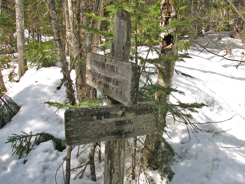
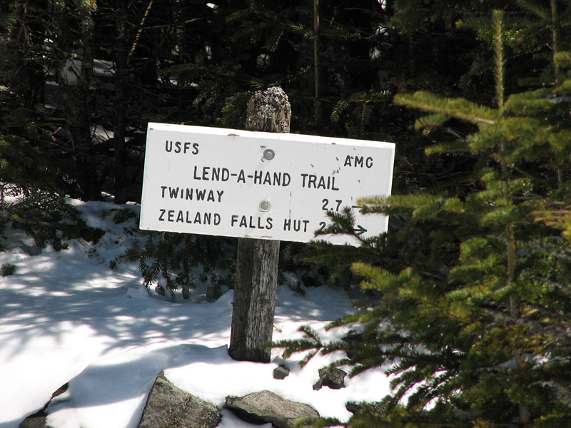
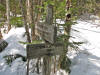
Lend-a-Hand
Trail junction. The Twinway had seen recent foot traffic, but
the snow on the Lend-a-Hand Trail looked wet, sloppy, and not
recently traveled. |
 |