|
The final climb to the top was a bit steeper
and snowier, but I soon burst though the trees into the sunny and
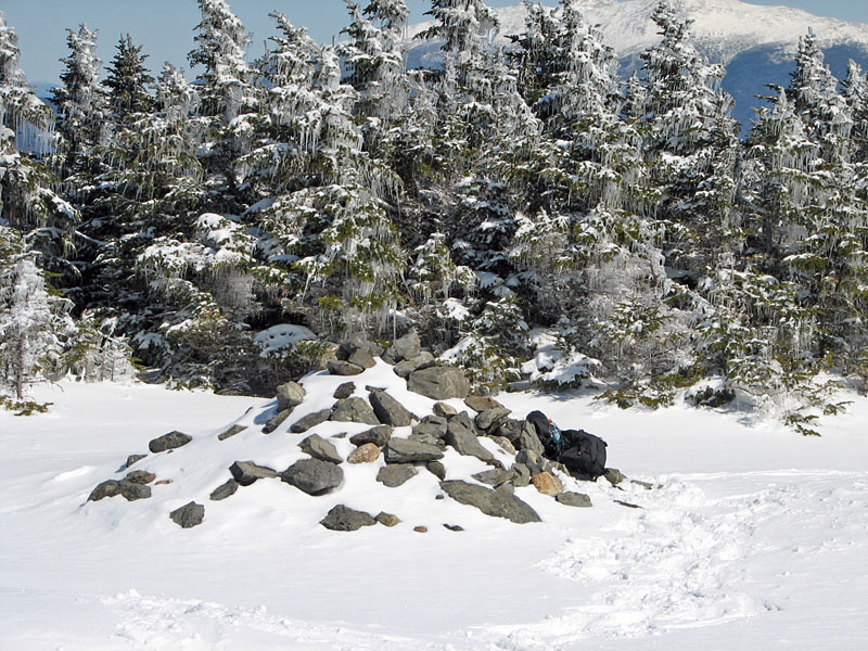
trackless open summit area. My tracks quickly spoiled the pristine
effect, but that's how it goes. The summit cairn, which stands some six
high in the summer, only poked about two-and-a-half feet through the
snowpack.
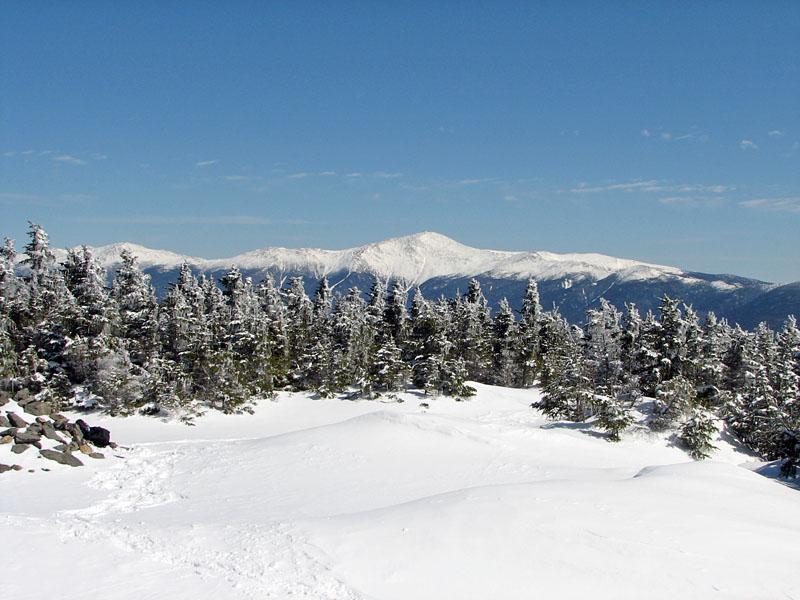
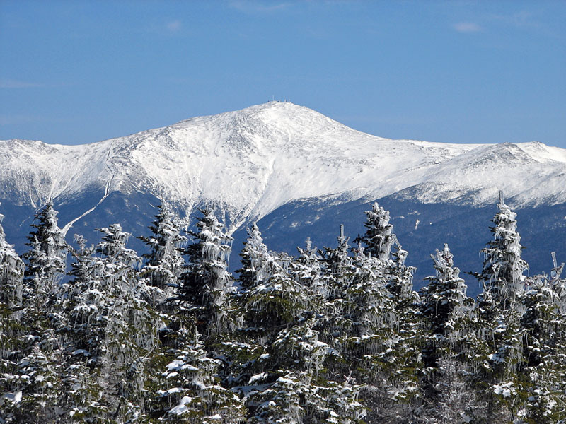
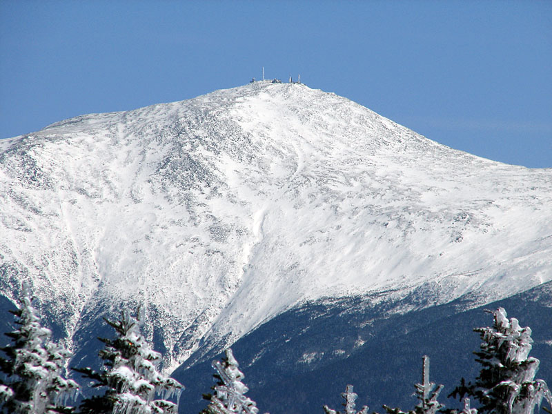
The height of the snow, along with the clear
air, definitely improved the views. To the east, the snow-covered
Presidentials dominated the skyline, with Mt Washington towering above
its nearby neighbors Mt Jefferson and Mt Monroe. Using my camera at a
high zoom level, I could clearly make out the Ammonoosuc Ravine and the
thin line of the Cog Railway.
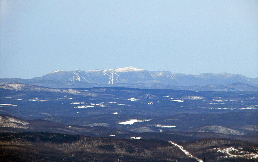
To the west, the views were equally
impressive. I could see all the way off to Mt Mansfield in Vermont's
Green Mountains, about 75 miles away as the crow flies.
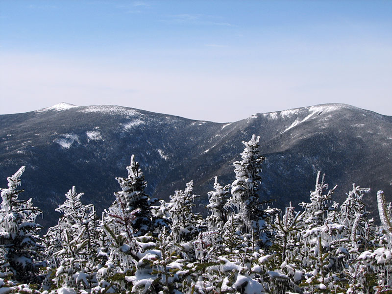
Finally, to the immediate south, I looked
out at the rounded summits of Mt Zealand and Mt Guyot and their
connecting ridge, with the slightly more defined, and bare-topped Mt
Bond visible behind Mt Zealand.
I took a quick look down the Lend-a-Hand
Trail and decided against going down to Zealand Falls Hut. The trail
looked unbroken, I was already tired, and there was always another day.
The weather was beautiful and the
temperature comfortable in the warm sun, so I sat for a while propped up
against the summit cairn eating potato sticks and drinking Gatorade. It
was quiet and restful, and I could have stayed much longer, but I still
had a long way to go to get back down to the car. I hesitated until a
trio of cross-country skiers appeared out of the woods at the west end
of the summit. They had skied up the long abandoned fire warden's road
from Twin Mountain, which they said was easier to follow in the winter
if you knew where to look.
Anyway, I left them to the solitude of the
summit and headed back down the Hale Brook Trail, still fighting snow
buildup on the bottom of my snowshoes all the way back to Zealand Rd,
where I once again removed my snowshoes and completed the trip back to
my car in bare boots. I was tired, but it had been a good trip. It's
always nice to be back in the mountains. |
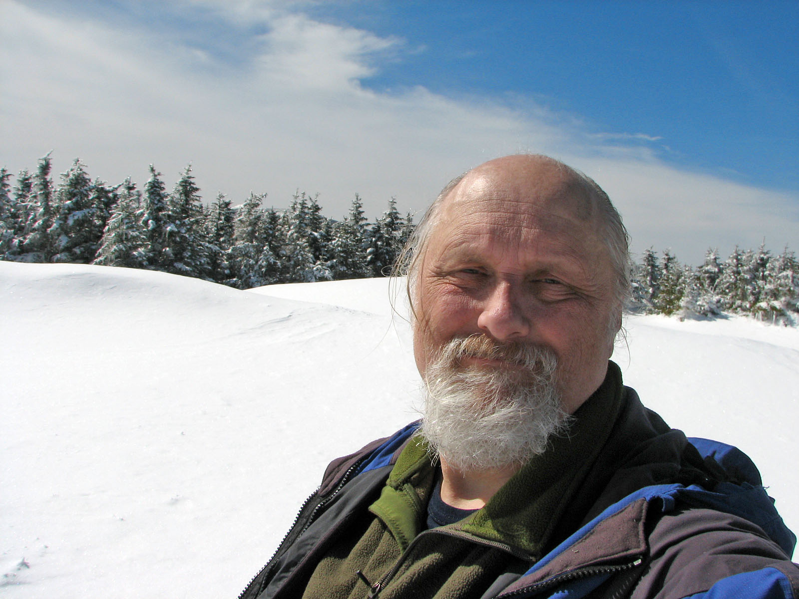
Self-portrait on the summit. I'm sitting on the rocks on the
side of the cairn facing northeast. |
 |