|
Beyond Clam Rock, the trail became narrower,
damper, and quite a bit more rocky and rough. I had to be careful not to
trip or get my foot caught in the gaps between rocks, so I was
definitely moving more slowly. I began to contemplate whether I had the
time to make it up all the way to Mt Washington and back down again and
still drive back to Maine in time to meet my wife for supper. The only
saving grace were the many trail intersections that helped mark my
progress.
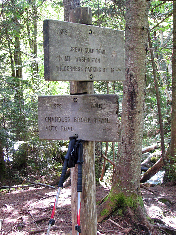
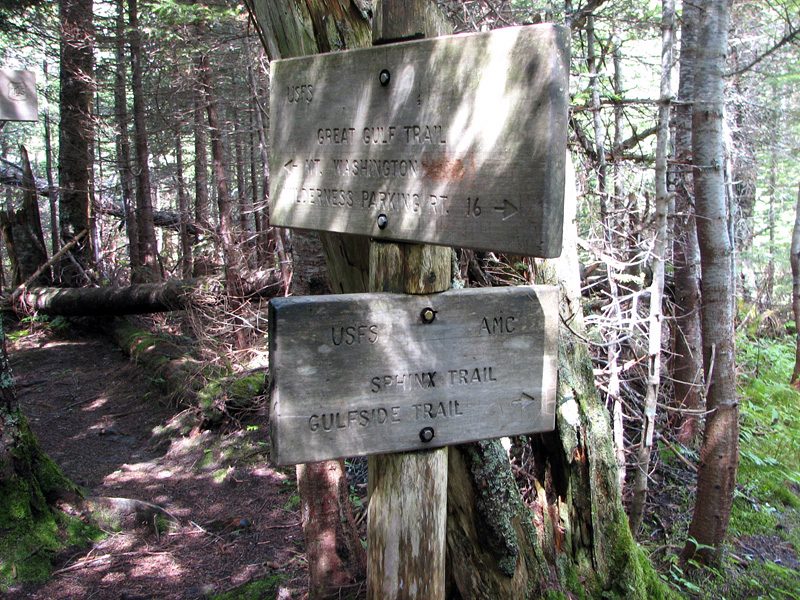
The first of these, the Chandler Brook
Trail, is the shortest route up to the Mt Washington Auto Route from the
Great Gulf. I contemplated taking that path and then continuing on to
the summit via the Nelson Crag Trail. I didn't though, as I really
wanted to see Weetamo Falls and Spaulding Lake, and I still harbored the
hope of making the summit by going up the Great Gulf headwall. From that
point on I was pretty much committed to at least make it to the base of
the headwall; all of the other routes out of the gulf were much steeper,
longer, and mostly headed in the wrong direction.
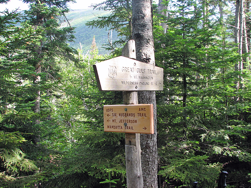
My next milestone was the Six Husband Trail,
named after the six husbands of the Pocasset queen Weetamoo. This is a
notoriously rough trail that ascends Mt Jefferson. In the other
direction, the Wamsutta Trail, named after Weetamoo's first husband,
climbs out of the gulf to the Auto Road and Alpine Garden Trail. By this
time, I was getting tired and the sky was beginning to cloud up. Knowing
that there was a chance of rain and that the headwall was particularly
slippery when wet, I was seriously beginning to consider turning around
at Spaulding Lake, but I wasn't ready to commit myself to either
decision yet.
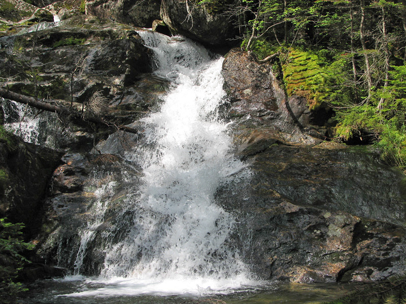
The final trail junction was the Sphinx
Trail, which rises steeply to Sphinx Col, midway between Mts Jefferson
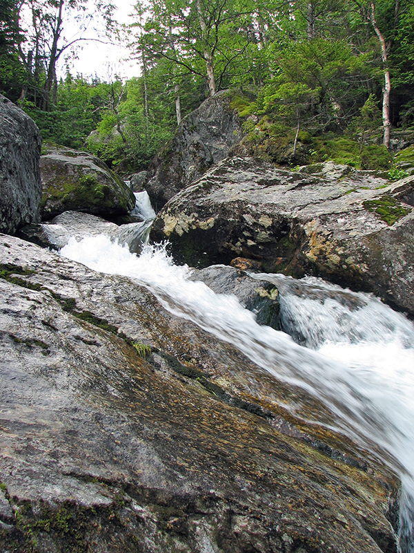
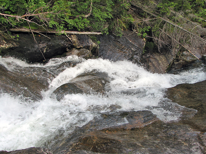
and Clay. I knew that Weetamoo Falls was not far off, and was looking
forward to seeing them. Although nice enough, I guess I had expected
something more spectacular. I may have enjoyed them more if I hadn't
been so tired and so focused on reaching a decision as to whether I'd
continue up to Mt Washington, or turn around.
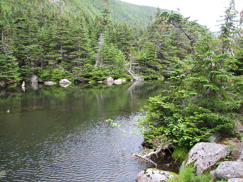
Although still rocky and rough, the trail at
least got a bit flatter as I approached Spaulding Lake. When I finally
arrived, it was almost anticlimactic. The horseshoe-shaped headwall was
most impressive, but the lake wasn't even half the size I had expected,
and the shores were so rocky and tangled with gnarled trees and roots
that it wasn't the idyllic spot for a rest that I had envisioned.
The trail had indeed grown wetter, muddier,
and more slippery, the clouds were gathering up on the ridges, and the
climb looked daunting to me at that moment in time. With at least a
two-hour ascent to the top of the headwall, another 400 or so vertical
feet of climbing to get to the summit, coupled with a long hike back
down to the Pinkham Notch Visitor Center (not to mention a need to hitch
a ride back to my car) and a good chance of rain, I decided to call it
quits. There was always another day.
Even so, my trip was far from over, as it
was another 6-1/2 miles back to the car again over a mostly rough and
often slippery trail. It was probably the right decision at the time,
but of course, I have been second-guessing myself ever since, especially
since the rain didn't really hit until around 9 o'clock. |
Chandler Brook
Trail junction. This trail climbs up to the Auto Road in just under
a mile, with about 1300 feet of elevation gain. |
 |