|
This
was another hike where I didn't have to drive all the way from home.
Instead, my wife and I were at a Society for Creative Anachronism (SCA)
camping event near Hebron, Maine, which is only about an hour's drive
from Gorham. Seeing as I am not really into SCA events and my wife is
not much of a climber, I decided to
take advantage of the relatively short drive to go on a day hike in the
Pinkham Notch area. (It takes me 3-1/2 hours to drive from home to
Pinkham Notch.) I had been wanting to climb Mt Washington via the Great
Gulf Trail for some time. This would be my attempt, although I knew from
the start that recent rains had helped make the trail up the headwall
somewhat slippery and supposedly difficult to follow.
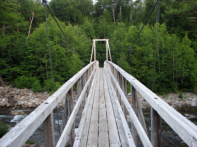
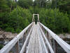
I certainly got a good early start to the day. I was out on the trail by 6:00 AM, and soon crossed the
large suspension
bridge over the Peabody River. The lower part of the Great Gulf Trail is
pleasant hiking; the path is wide, flat, and fairly smooth, and I was
making good time. After passing the
junction with the Osgood Trail, I was in new territory. The only other
time I had hiked into the Great Gulf, I was with Muffin, and we had turned off onto the Osgood
Trail to climb Mt Madison from the south.
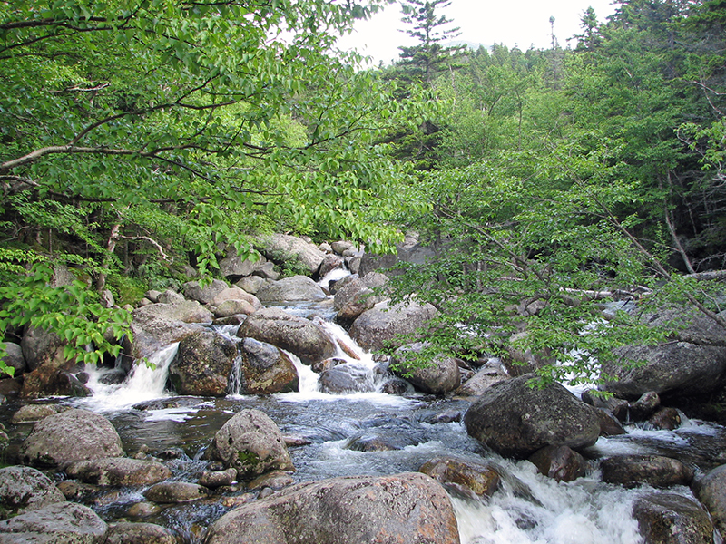
I continued to follow the Great Gulf Trail as
it hugged the
West Branch of the Peabody River, mostly at a gentle grade, until
getting close to the Osgood Cutoff, where it climbed away from the river
and up a high gravelly bank known as the Bluff. From here, there were good
views up to Mt Adams and Mt Madison, and down to Parapet Brook, which
joins the West Branch of the Peabody River a short distance downstream.
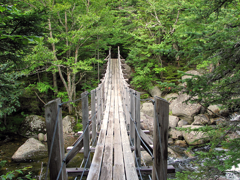
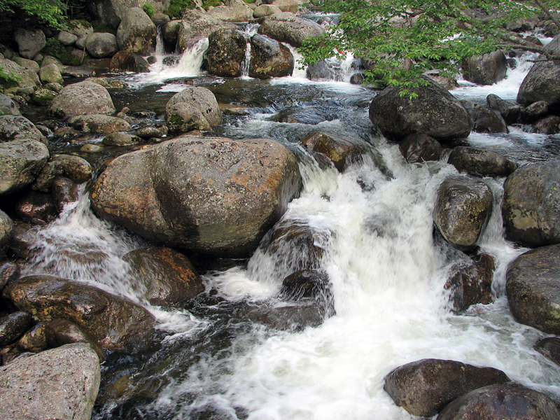
From the Bluff, the trail descended steeply
down a rough bank to Parapet Brook, crossed it over stones, and from there climbed a low ridge that
divided the brook from the West Branch of the Peabody River. Here the
Madison Gulf Trail comes down from Mt Madison to merge with the Great
Gulf Trail for a short distance. After dropping down to the river, the
two trails crossed the river on a narrow aging suspension bridge that
swayed back and forth as I crossed it. It was definitely a one-way
bridge; most hikers would have had a tough time passing each other while
meeting in the middle. At the time, I didn't know it,
but this bridge was due to be replaced in September, just two months
away.
On the other side of the river, the Madison
Gulf Trail turned left to climb up to the Mt Washington Auto Rd, while I
followed the Great Gulf Trail to the right to continue upstream. At this
point, the river is somewhat narrower, but it is still in a ravine and
can dangerous in times of flooding. This is one reason why the suspension bridge
exists here. Without it, heavy rains could strand people in the gulf.
The other reason is that the bridge is part of the Appalachian Trail,
which follows the Madison Gulf Trail at that point.
About a half mile upstream, I arrived at the
huge boulder called Clam Rock. This glacial erratic is supposed to look
like a giant clam, but I had trouble seeing a resemblance. I took a
short rest here and had a snack, and looked around at the tentsites in the large flat area
a little further from the river. |
The first
suspension bridge over the Peabody River. This bridge is only a
short distance down the trail from the parking area. |
 |