|
|
|
|
|
Mt Flume |
|
|
|||||||||||||
|
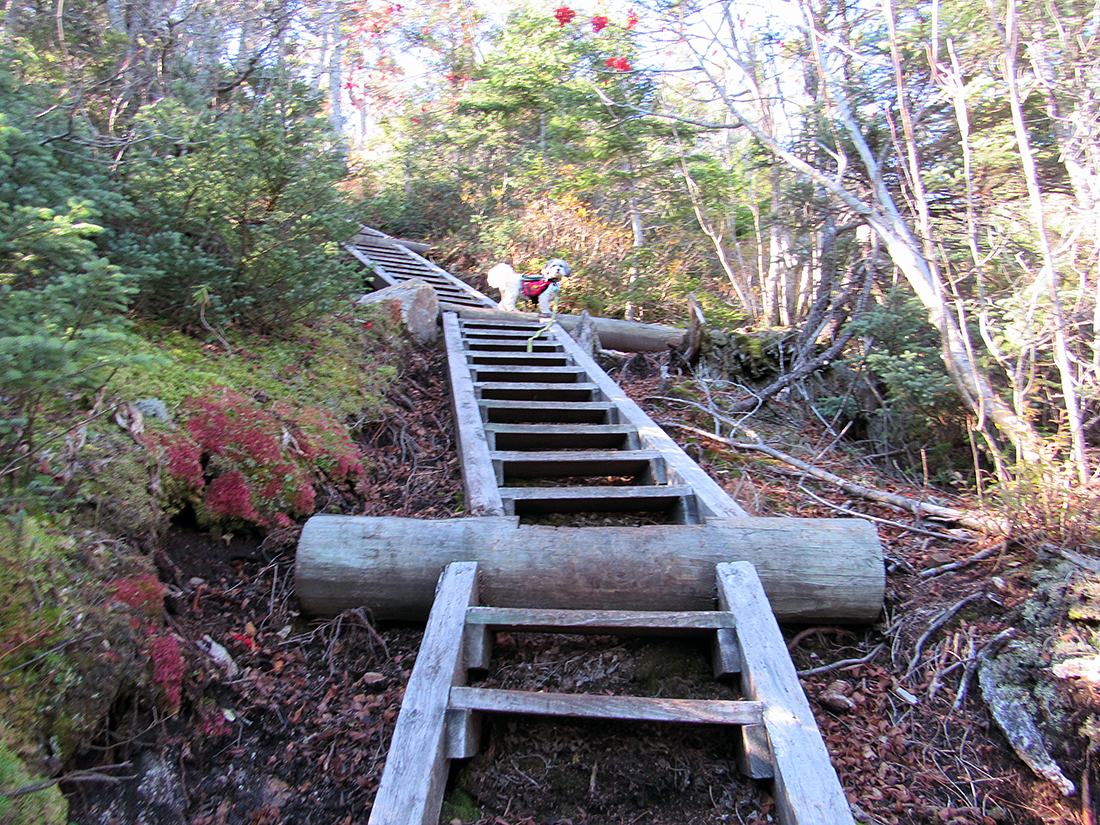
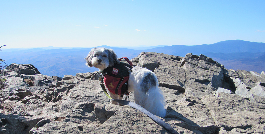
Back in July, Patches and I had climbed Mt Liberty with the hopes of making it to Flume as well, but by the time we had summited Liberty, I had decided that we didn't have enough time and I didn't have enough energy to continue on to Mt Flume (and back) this time. I was still working on recovering my strength after my heart valve surgery in the fall of 2016. The choice of the Osseo Trail to Mt Flume was an easy one to make. I didn't think the slippery, and extremely rough and rocky Flume Slide Trail would be a good route for Patches, not to mention that climbing the Flume Slide was much more strenuous than the gentler and tamer, although much longer, Osseo Trail. After parking at the Lincoln Woods Visitor's Center, we crossed the long suspension bridge over the East Branch of the Pemigewassett River and started up the wide Lincoln Woods Trail, a former logging railroad that still has many visible railroad ties. Years ago, this trail had been known as the Wilderness Trail. Then, sometime around or after the late 1990s, they decided to rename the portion below the second suspension bridge over Franconia Brook as the Lincoln Woods Trail. The Wilderness Trail then started at that bridge and continued all the way northeast to Stillwater Junction below Mt Carrigain. Later, in 2009, they tore down an aging third bridge that crossed over to the Pemi East Side Trail and closed the section of the Lincoln Woods Trail between the former bridge and the Bondcliff Trail. Since then, the only remaining section of trail that bears the name Wilderness Trail begins at the end of the Pemi East Side Trail by the Franconia Brook Tentsite and continues to Stillwater Junction. The trip up the Osseo Trail, which begins about a mile and a half up the Lincoln Woods Trail, was mostly pleasant. The lower portions are not at all strenuous, and the day was slightly chilly but sunny and pleasant. After a long rather straight section just above the brook, the trail became abruptly steeper as it switchbacked up the ridge, and we soon reached a nice lookout to the southeast toward the Tripyramids and the southern part of the Bonds range. It seemed like a good place to take a picture of Patches but she wasn't being very cooperative so I abandoned the idea, The Osseo Trail has one of the longest sections of ladders on any trails in the White Mountains. These ladders begin about a half hour (at my slow pace) above the overlook. They're not particularly steep, just seemingly endless. Patches had no problems scampering up any of the steps, and would often stop and look down at me, wondering why I was taking so long. Eventually, the grade lessened and we came to a flat section where the Flume Slide Trail entered from the south. This seemed to be a good resting spot, at least for a number of other hikers, but we didn't stay long, electing to push on up the last steep pitch (now along the Franconia Ridge Trail) to the summit area. The wind hit us abruptly as we came out of the scrub into the open, so I quickly put on my Goretex jacket over the down jacket I was already wearing. The first open rocky area was not quite the top. That was another short climb/scramble winding along and through the edge of the trees. We finally made it - Patches' 25th 4000-Footer But there was no time to gloat. The gusts of wind coming up from the notch were often brutally strong, nearly pushing me back into the line of trees. But of course this was far better than if the wind had been blowing from behind and forcing us toward the edge of the preciipice. Patches' ears and tail were blowing straight back, but she was at least low to the ground and not as much of a target as I was. I found a somewhat sheltered spot by a large rock, and I sat down to have something to eat. Patches was enjoying the view but hurried over when she heard me open a can of Pringles. Hunkering down, we shared some Pringles, an oatmeal power bar, and a drink of water while I took a few pictures of the views across the notch to nearby Mt Liberty, and up along Franconia Ridge to Mts Lincoln and Lafayette to the north, Before long, it was time to pack up and head down. The wind chill was uncomfortable and the shelter of the trees below began to look more inviting. The descent went much more quickly than the climb, at least at first. Below the switchbacks the hike began to drag on, and by the time we reached the Lincoln Woods Trail, I was quite ready to be back in the car. There were a number of locals strolling along the Lincoln Woods Trail, enjoying a mile or two walk with their dogs and/or friends. I talked to a couple of them as they admired Patches in her backback, and explained where we had been. But we soon hurried on, anxious to reach the journey's end. Everything was going all right until we crossed the suspension bridge and climbed the stairway up to the parking lot, Just beyond the stairs, we approached two guys who were standing right in the middle of the narrow walkway, and one of them was holding on to a bicycle. Patches is deathly afriad of bicycles and tried to pull me back down the path and away from the demon bike. I tried to explain how afraid she was of the bicycle but they basically ignored me, not wanting to yield even an inch while Patches was going berserk trying to get away. In the end, I had to follow her a short distance away, and then pick her up and carry her past these louts while trying to keep my poles from whacking or stabbing them as I walked by. Needless to say, they finally parted and moved on after we were back in the car. |
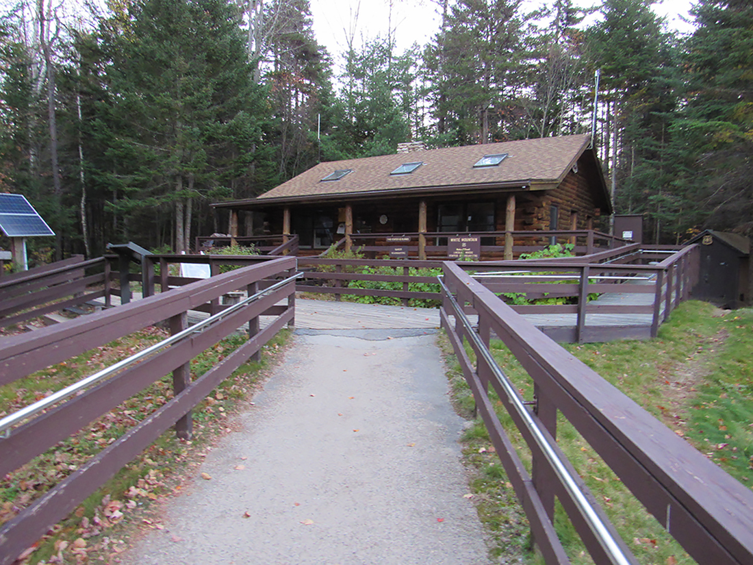
Lincoln Woods Vistor's Center. THis is where both the Lincoln Woods (formerly Wilderness) Trail and the Pemi East Side Trail begin. |
|
|
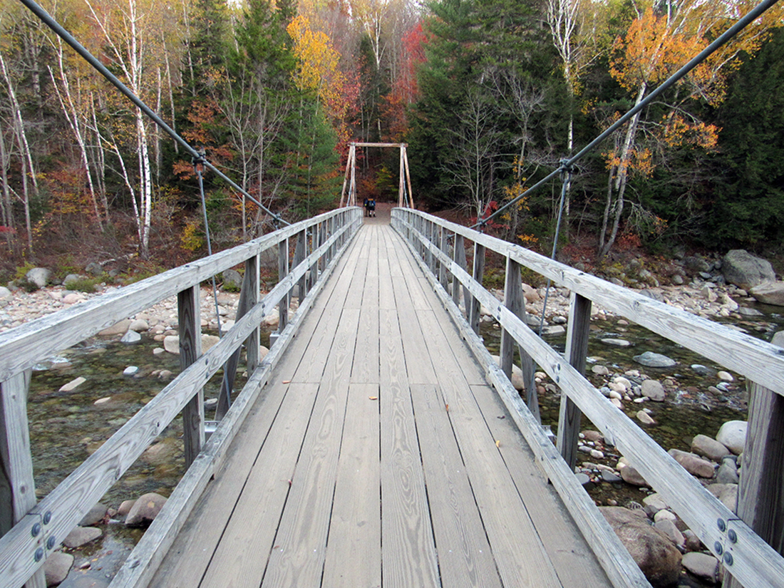
The suspension bridge over the East Branch of the Pemigewassett River. This takes you to the Lincoln Woods Trail on the other side. |
|
|
|
Looking upstream at the East Branch of the Pemigewassett River from the middle of the suspension bridge. |
|
|
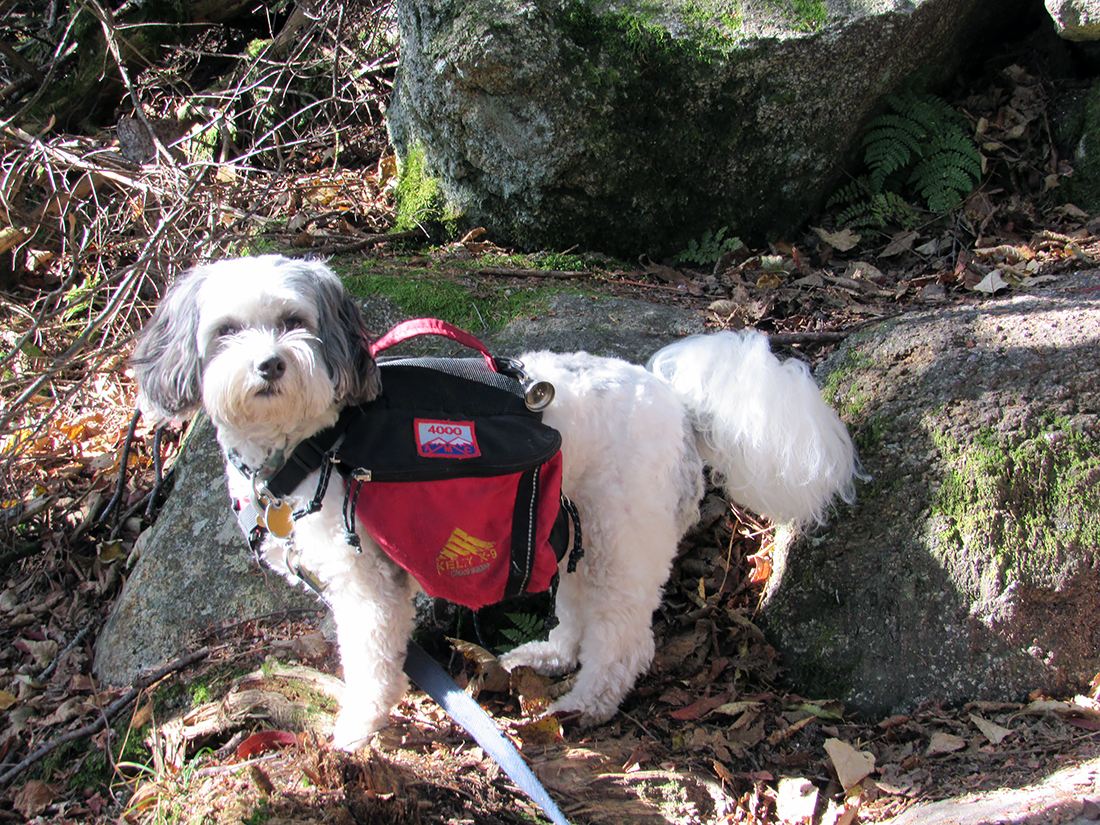
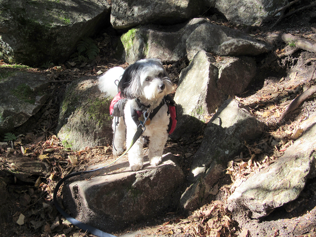
Patches not far from the beginning of the Lincoln Woods Trail. |
|
|
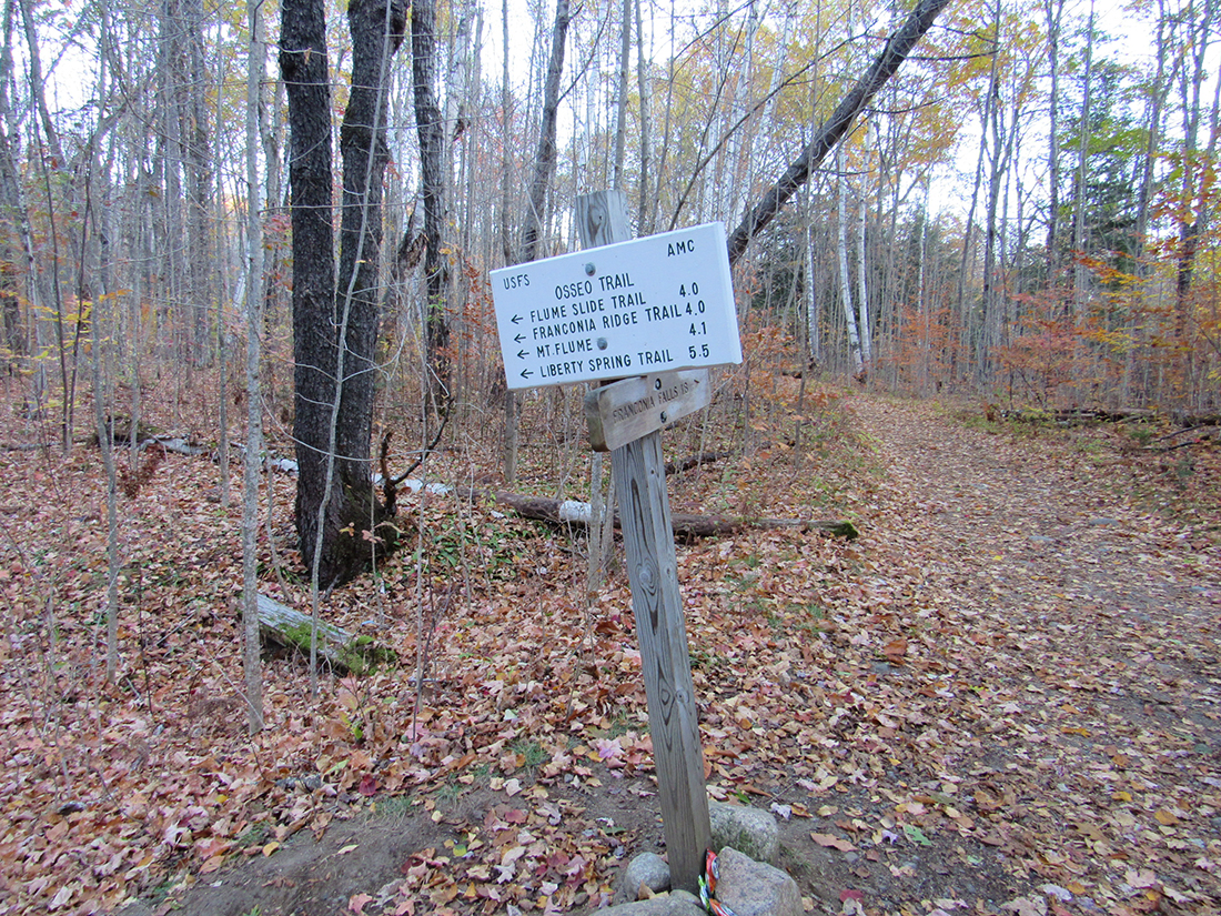
The junction of the Lincoln Woods Trail with the Osseo Trail. |
|
|
Two different pictures of Patches at the same location on the Osseo Trail, not too far below the overlook to the southeast and the long stretch with the ladders. |
|
|
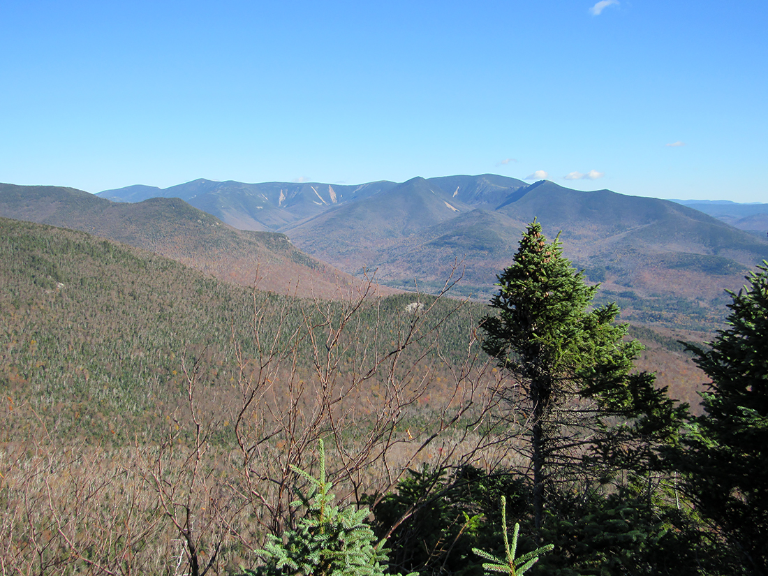
Looking southeast to the Tripyramids (behind the tall balsam fit) and the southern end of the Bonds ridge (at the far left). |
|
|
Patches on one of the longer sections of ladders just above the overlook. |
|
|
Patches on the windy summit of Mt Flume, apparently enjoying the view. |
|
|
Another shot of Patches by the edge of the cliffs on top of Mt Flume, |
|
|
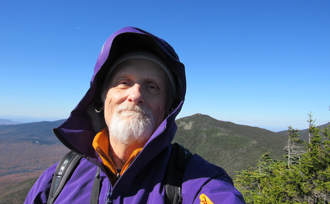
Self-portait on Mt Flume, with Mt Liberty in back of me. |
|
|
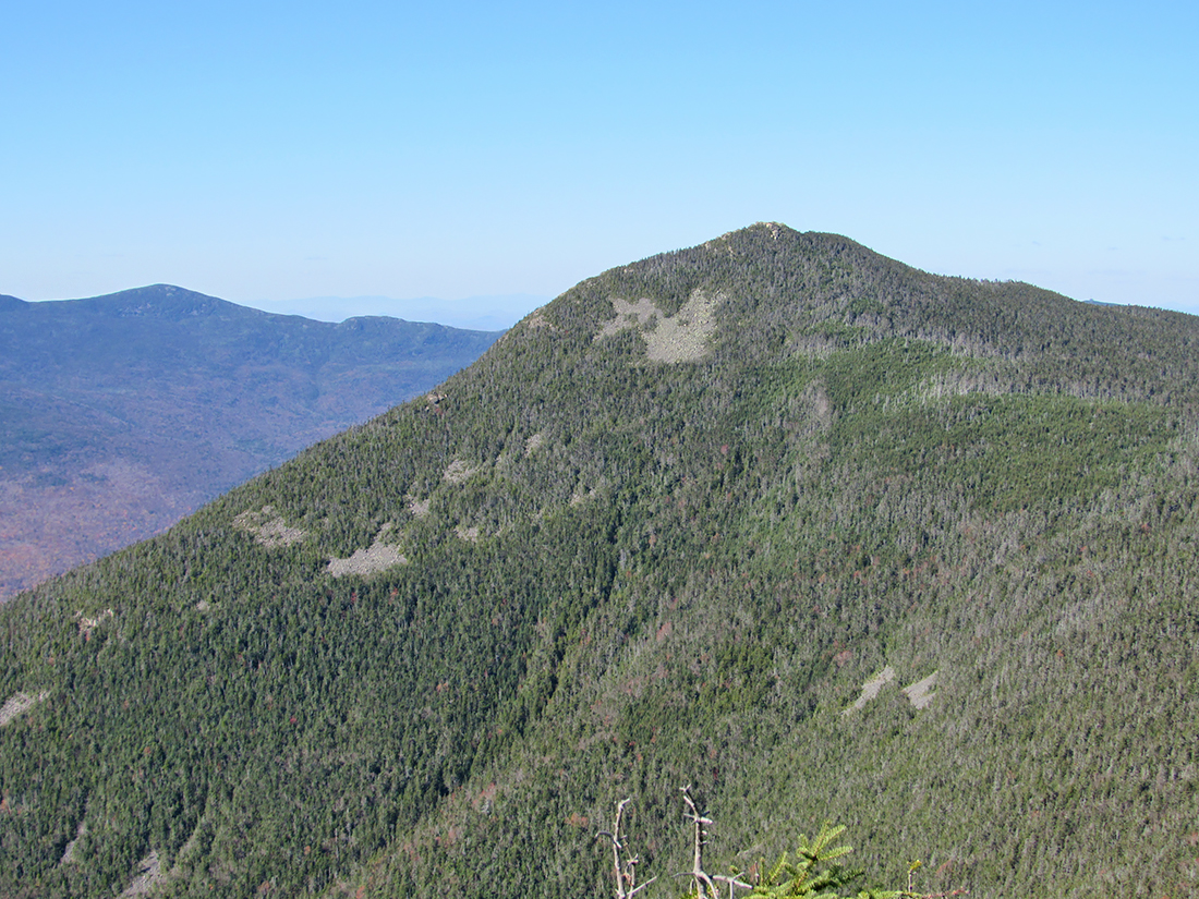
Closeup of Mt Liberty from Mt Flume. The range in the distance is probably the Kinsmans. |
|
|
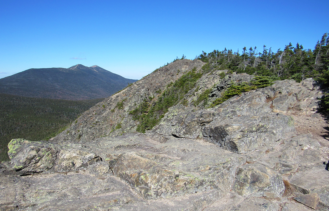
Just below the actual summit of Mt Flume with Mts Lincoln and Lafayette in the northern reaches of Franconia Ridge. |
|
|


