|
Finally,
I got up from our rest and we headed north along the Franconia Ridge
Trail. It was an easy and gentle downhill hike for awhile, followed by a
long fairly level stretch through the col. Eventually, we started to climb
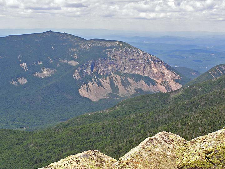
again. Then, about halfway up the Mt Liberty cone, there was a bit of a
view back to Mt Flume through the trees, so I decided to stop and take a
picture.
I
reached for the camera ... but it wasn't there! It wasn't around my
neck or hanging from my backpack straps where I usually keep it. I took
off my backpack and carefully searched every nook and cranny. It wasn't
there either. Then it hit me. I must have left it back in the sun on Mt
Flume after taking the series of summit photos.
Did
I want to spend a half hour hiking back to Mt Flume, and another half hour
slogging back to where I was now? I was already getting tired! Did I want
to sacrifice the camera or hope that someone else would find it and
somehow get it back to me? Did I want to skip climbing Mt Liberty, go
back, get the camera, and then return down the Osseo Trail? None of these
choices were perfect. It was actually a longer hike back down the Osseo
Trail than up and over Mt Liberty and down to the notch. Also, I didn't
really want to lose the camera, or the pictures I had already taken that
day. Reluctantly, I decided to return and get it, then repeat the long
trek back to Mt Liberty.
After
this fiasco, we finally returned (with the wayward camera) to the spot
where we had turned around, and I took my picture of Mt Flume through the
trees (which didn't come out very good). Then we continued the rest of the
way up to Mt Liberty.
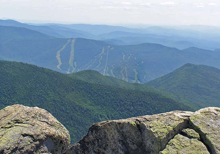
On
the summit, the afternoon views were still excellent. Loon Mountain Ski
Resort was clearly visible to the south and Cannon was as clear as a bell
to the northwest. I was glad to be there, but was feeling a bit more tired
than I had expected to at this point. I no longer had the slightest desire
to continue up Franconia Ridge to the Falling Waters Trail. I was ready to
head back down the mountain. |
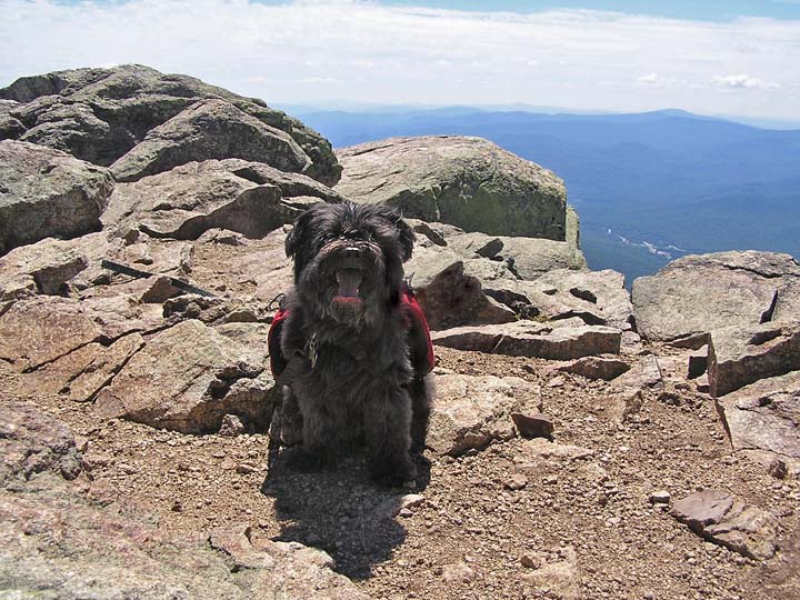
Muffin
on the Franconia Ridge Trail getting close to Mt Liberty. It was
near this spot that I discovered my serious mistake. |
|