|
This
was destined to be a very unusual trip where nothing went as expected.
To begin with, Toi and Holly were leaving for Rocking Horse Ranch
in the Catskills in the afternoon on a Girl Scout weekend. Partly
because of this, and partly because of the weather, I didn’t want
to leave as early as usual. The previous day, we had a minor snow
storm. Naturally, this greatly affected my choice of trails and
I wanted an update in the morning before I left.
I
was considering three options. The first was climbing up Mt Adams
and staying overnight at the
RMC
Gray Knob cabin. I wouldn’t have to carry the winter tent, but
I wasn’t sure how Muffin would do above treeline in possible deep
drifts. The second option was to hike up to the Ethan Pond Shelter
with my tent, and then climb Mt Willey, but I figured the steep
Willey Range Trail might be too deep to climb without snowshoes.
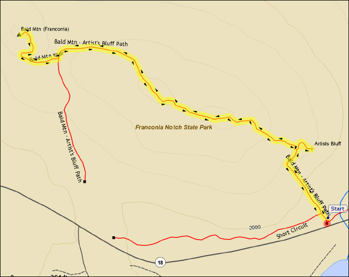
My final decision was to climb up the more heavily-traveled, and
thus more packed, Crawford Path, then take the Mizpah Cutoff up
to the tent platforms by the hut, and climb nearby
Mt Jackson.
I
had planned to leave around 9:00 AM, which would have gotten me
up to Crawford Notch at noon, and to
Mizpah Hut around 3:00 PM, about an hour-and-a-half before
darkness set in. Unfortunately, I didn’t get going until 9:30,
and that was after I discovered that I still needed to stop for
a new pair of shell mitts, a spare fuel canister, and some parachute
cord for tying down the tent and hanging the bear bag. After stopping
in Lincoln to get these items, and to get lunch from McDonald’s,
we drove quickly through Franconia Notch toward Twin Mountain.
I was planning on calling home when we got close to the trailhead
to let Toi know we got there safely. But when I tried calling
on the prepaid cell phone that I had recently purchased $30 worth
of time on, I discovered that the roaming area I was in wouldn’t
allow me to make or receive calls. I left the trailhead parking
lot and went over to the
AMC Crawford Hostel to try their phone, but it wasn’t a coin
phone and you needed a phone card to make calls from it. Since
I didn’t have a phone card, I drove several miles south to a motel
to use their phone. A one-minute call from their Bretton Woods
Phone Company pay phone just to leave a message on our voice mail
cost me $4.70, plus another half-hour’s time driving around.
Finally,
back at the trailhead again, we got ready to leave. The first
thing Muffin did was to run through the deep snow near the parking
lot and lose two of her new dog booties. This was not a good start.
I considered spending the night in the car and leaving early in
the morning on the hike, but I decided to just start out and go
as far as we could. |
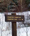
Trailhead.
The Crawford Connector runs from the parking area on Mt Clinton Rd
to the Crawford Path, a short distance above the Rt 302 trailhead. |
 |