|
After
climbing out of Wildcat Col, I finally reached Wildcat C, which
although wooded and unmarked, was obvious because of its east-facing
outlook as described in the guide. I rested here for a few minutes,
then continued on, expecting to go over Wildcat B, and then reach
Wildcat A, which was the last peak before the long downhill trek
to the hut. Almost sooner than I expected, I started climbing
uphill once again. Expecting that I was approaching Wildcat B,
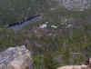
I was surprised to discover that I had actually arrived at Wildcat
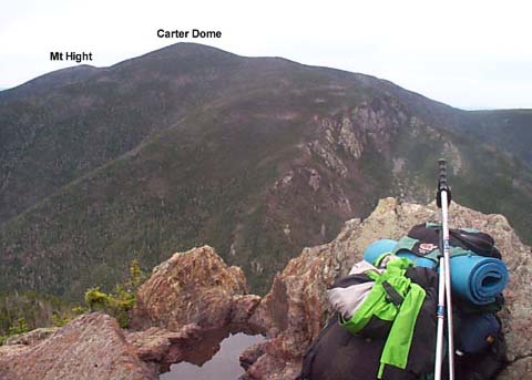
A when I suddenly came to an impressive ledge overlooking Carter
Notch.
After
admiring the views, I began heading down. The trail was steep,
but without the dangerous ledges the Pinkham Notch side had. The
trip down was mostly uneventful, except for an area where a mud
and rock slide had recently obliterated the trail. I carefully
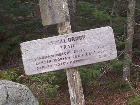
picked my way across this unstable area and continued down, soon
reaching the 19-Mile Brook Trail a short distance from the hut.
After
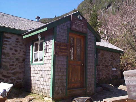
passing by the shores of both Carter Ponds, I arrived at the hut,
a small stone structure consisting of a kitchen, a main room,
and a caretaker’s bunkroom. There are also two bunkhouses, which
look just like the ones at
Lonesome Lake, and a Clivus composting outhouse.
The
hut was not crowded that night. In addition to myself and the
caretaker, there were only two couples. Being that Carter Notch
Hut has several 4-person bunkrooms, I had a room all to myself,
which was nice. The other people were nice also. The caretaker
was a young guy who only had one more week left working there,
after which he was soon going to be going to China to teach.
Since
Carter is a self-service hut year-round, I made my own supper
in their kitchen, a rice and bean mixture I ate on tortillas,
then took a walk around the area before coming in to clean up.
A main feature of this hut is an area called the Rampart, which
is a jumble of huge boulders that fell off the side of Carter
Dome at some point in the distant past. They cover a fairly large
area and create little boulder caves where snow lasts in August.
Later,
after reading in the main room for a short time, I went to bed.
It got down below freezing, so I was glad to have my winter sleeping
bag. For the most part, I slept good, except for waking up in
the middle of the night with a toothache, which I took ibuprofen
for. |
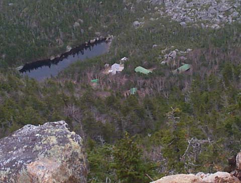
Carter
Notch Hut from the summit of Wildcat A. I always enjoy summits
with steep dropoffs and impressive views. |
|