|
I left
home a little later than usual – about 5:30 AM – because I overslept.
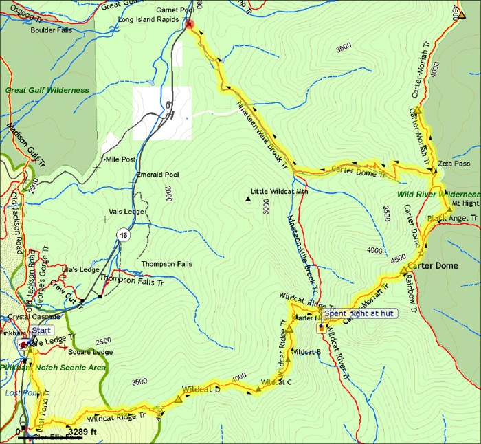
I drove up to Gorham, NH to meet a guy who runs a local shuttle
service. I met him at his office in town and then followed him
in my car to the Carter-Moriah Trailhead in Gorham. After parking
my car there, he drove me to the Pinkham Notch Visitor’s Center,
where I was going to begin my hike. My plans were to stay overnight
Friday at Carter Notch Hut, then Saturday at the Imp Shelter,
then hike down to Gorham and my car on Sunday.
After stopping
briefly at the AMC Pinkham Notch Visitor's Center, I left on the Lost Pond Trail,
which was directly across Rt 16. The weather was mostly sunny,
with temperatures in the 40s.
The Lost
Pond Trail is about a mile long, and connects the Visitor’s Center
with the Wildcat Ridge Trail, allowing you to avoid a difficult
stream crossing. The trail was a little bit wet, and much rockier
than I had expected.
I
got to the Wildcat Ridge Trail in a half hour. After a brief stop,
I started up the trail, which quickly became very steep. Soon,
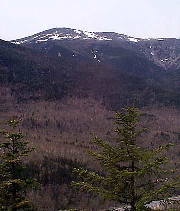
I reached the first of many ledges, where I got a good look Mt
Washington, the Northern Presidentials, and Pinkham Notch.
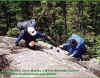
After a
while, the ledges became more numerous and the trail got even
steeper. The guidebook had said that this was a steep trail and
that you had to be careful in wet weather, but it didn’t mention
the one-foot wide ledge with a several hundred foot drop where
you had to hold onto the smooth face of a boulder while wearing
a heavy pack to keep from plunging down the mountain. Nor did
it mention the narrow wooden pinned steps on the side of an almost
vertical ledge, where the only real hold you had was to lean forward
into the rock face and allow gravity to keep you from pitching
over backward.
|
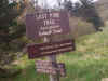
Lost
Pond Trailhead. This short trail starts opposite the Pinkham Notch
lodge, skirts around the pond, and connects with the Wildcat Ridge
Trail not far from its start, avoiding a difficult stream crossing. |
 |