|
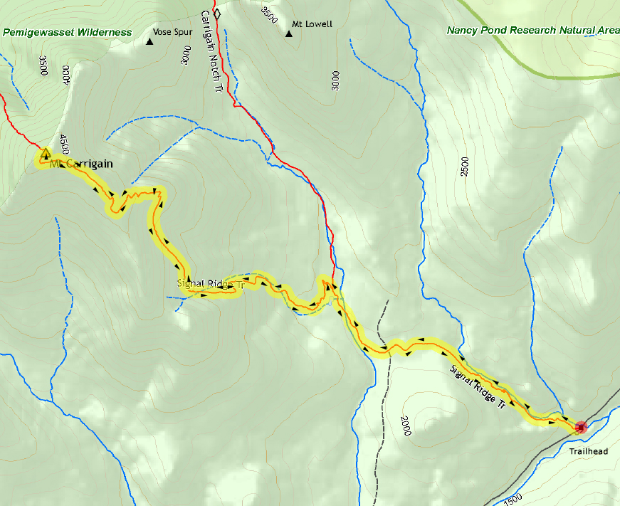
Even though I would have preferred to go on a hike that included two or more mountains (to add more peaks to Patches' 4000-Footer list), I decided that this was a good time to climb Mt Carrigain. This was partly because Sawyer River Rd had just reopened after several months of being repaired, and partly because Bear Notch Rd closes for the winter fairly early in the season. Bear Notch Rd provides a shortcut to Rt 302 from the Kancamagus Highway, and when Sawyer River Rd is closed, you have to walk two miles each way between Rt 302 and the Signal Ridge Trailhead.
It was a nice cool fall morning when we parked at the trailhead to begin our hike. It was a Saturday so the parking lot was already filling up when we got there around 7:30. The first leg of the hike to the Carrigain Notch Trail junction wasn't as pleasant as it could of been thanks to a large unleashed dog that was almost never close to its owners. It kept on running back and forth along the trail and annoying Patches (and me). Most people will leash their dog if it's starting to bother other hikers. This person didn't seem to notice.
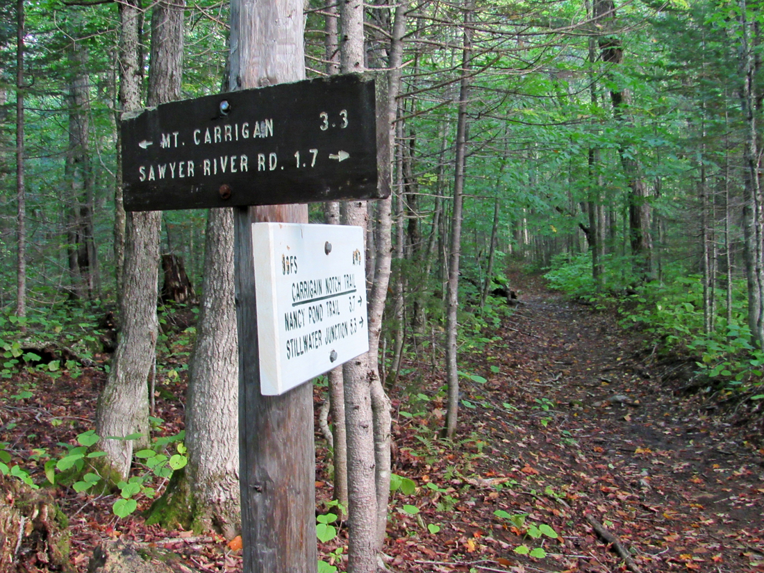
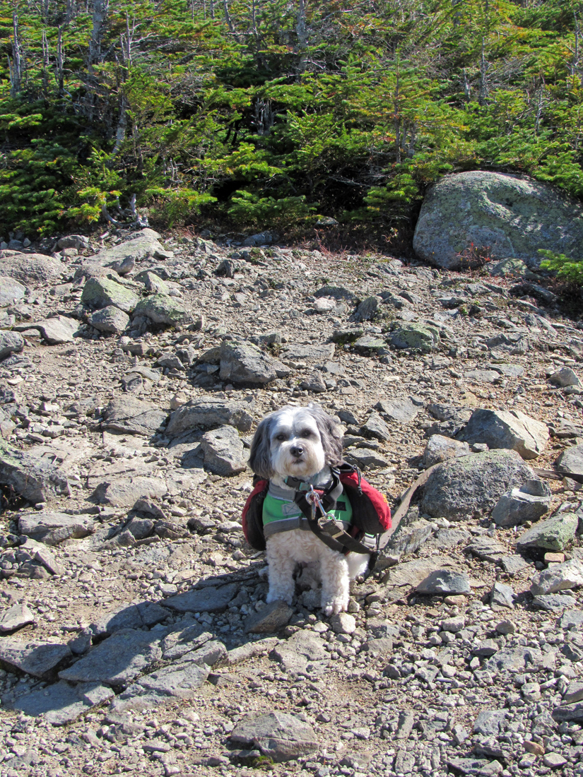
By the time we arrived at the Carrigain Notch Trail junction, 1.7 miles from the trailhead, the annoying dog and its owner had passed in front of us, so thankfully, we didn't see them any more. Not long after this point, the trail ascended a minor ridge, crossed a small brook, and then began to gradually get steeper, slowing our pace.
Since the fall of 2017, when I figured that I was pretty much recovered from my heart valve replacement surgery, I seem to have days when I am able to climb more quickly and with less rest stops, and then days when I'm really dragging. Ascending Mt Monroe in August was definitely a slow laborious climb, but it was probably due, at least in part, to the poor air quality from the California forest fires. By contrast, I felt pretty good on our longer July hike to the Twins and Galehead. Today's trek was somewhere in the middle. I felt pretty good early on, but as the grade steepened, I needed to stop and catch my breath more often. My cardiologist can find no reason for it, but I'm supposed to get a cardiac CT scan sometime soon (which has now moved to 2019). Maybe that will help figure this out.
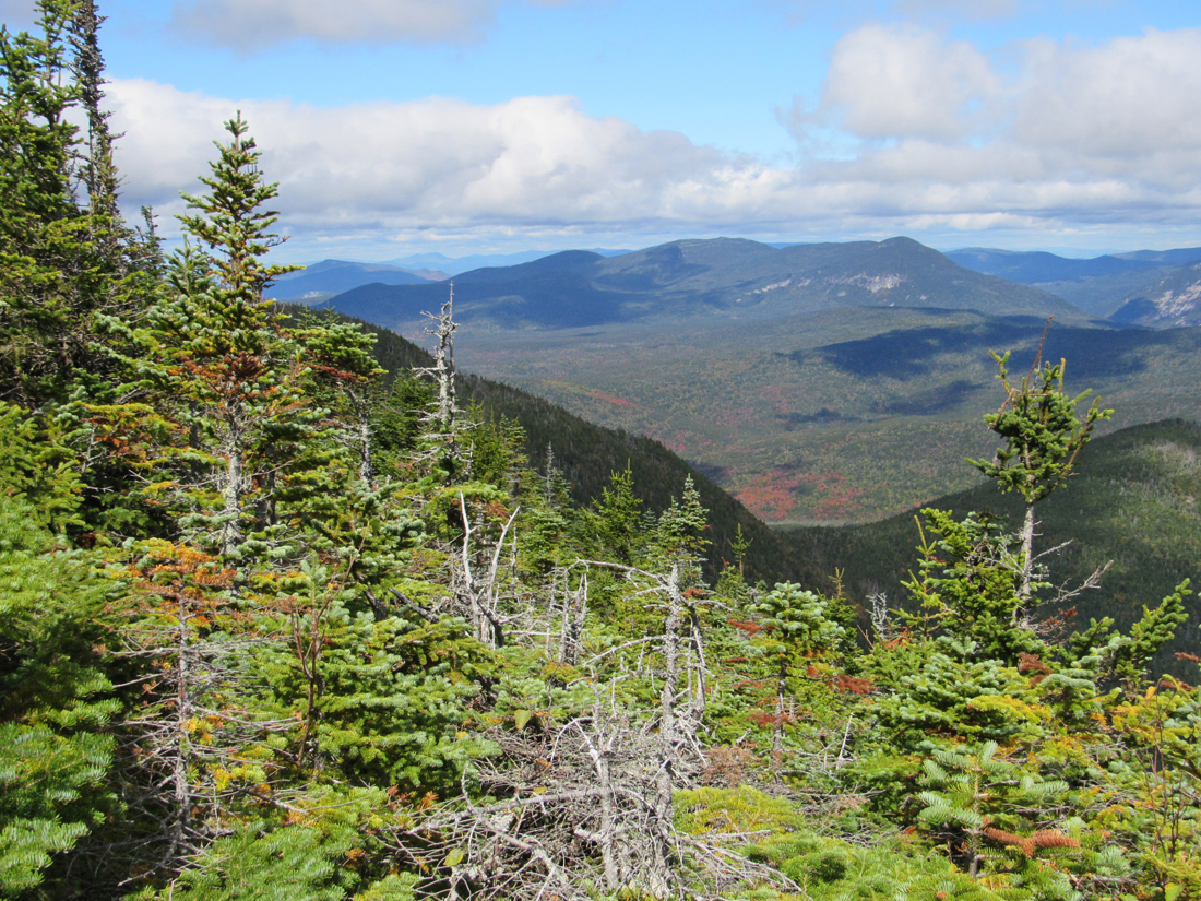
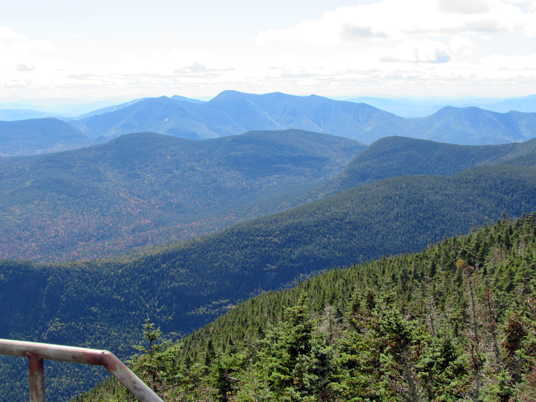
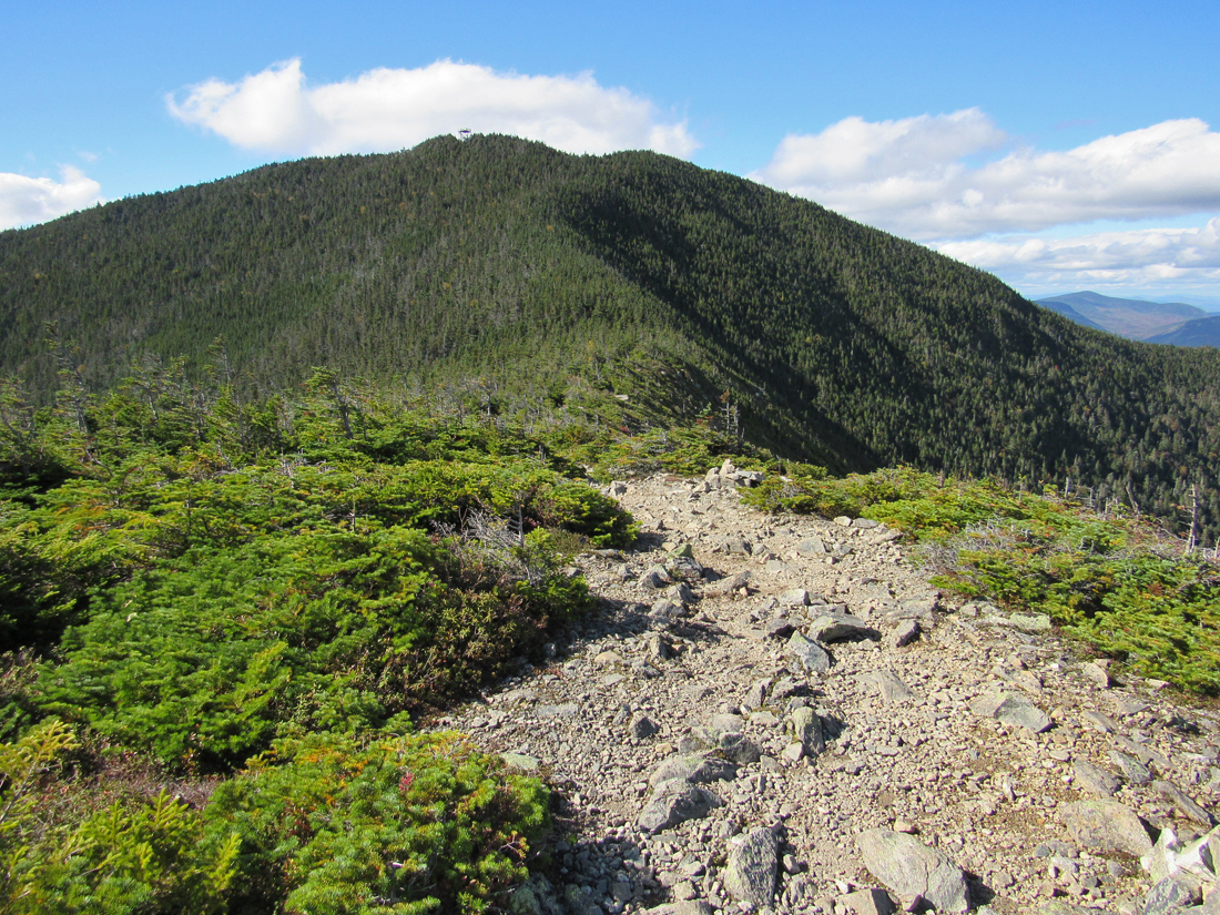
Eventually we reached the open ridge right below the summit cone. The views were excellent and the air clear. Breaking out into the open and being able to see how high you've come and to savor the distant scenery, can really lift your spirits when you're tired and feeling discouraged about how long you've been struggling upward. It can give you another burst of energy.
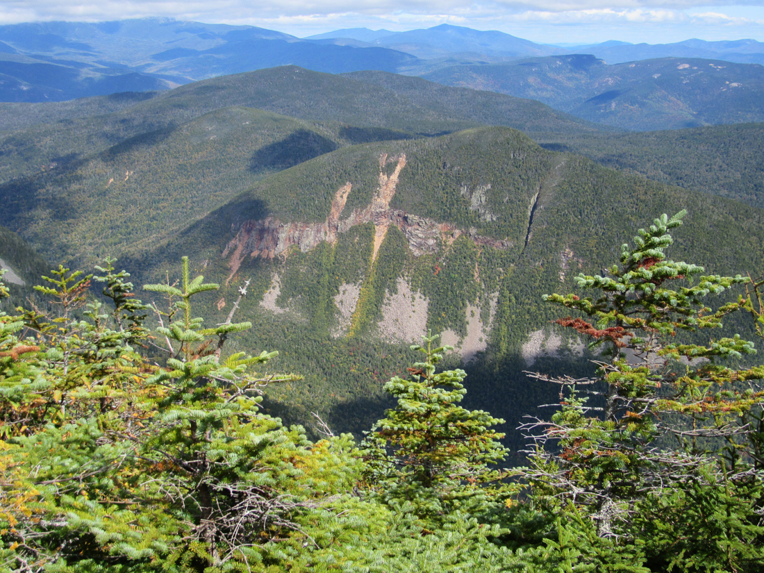
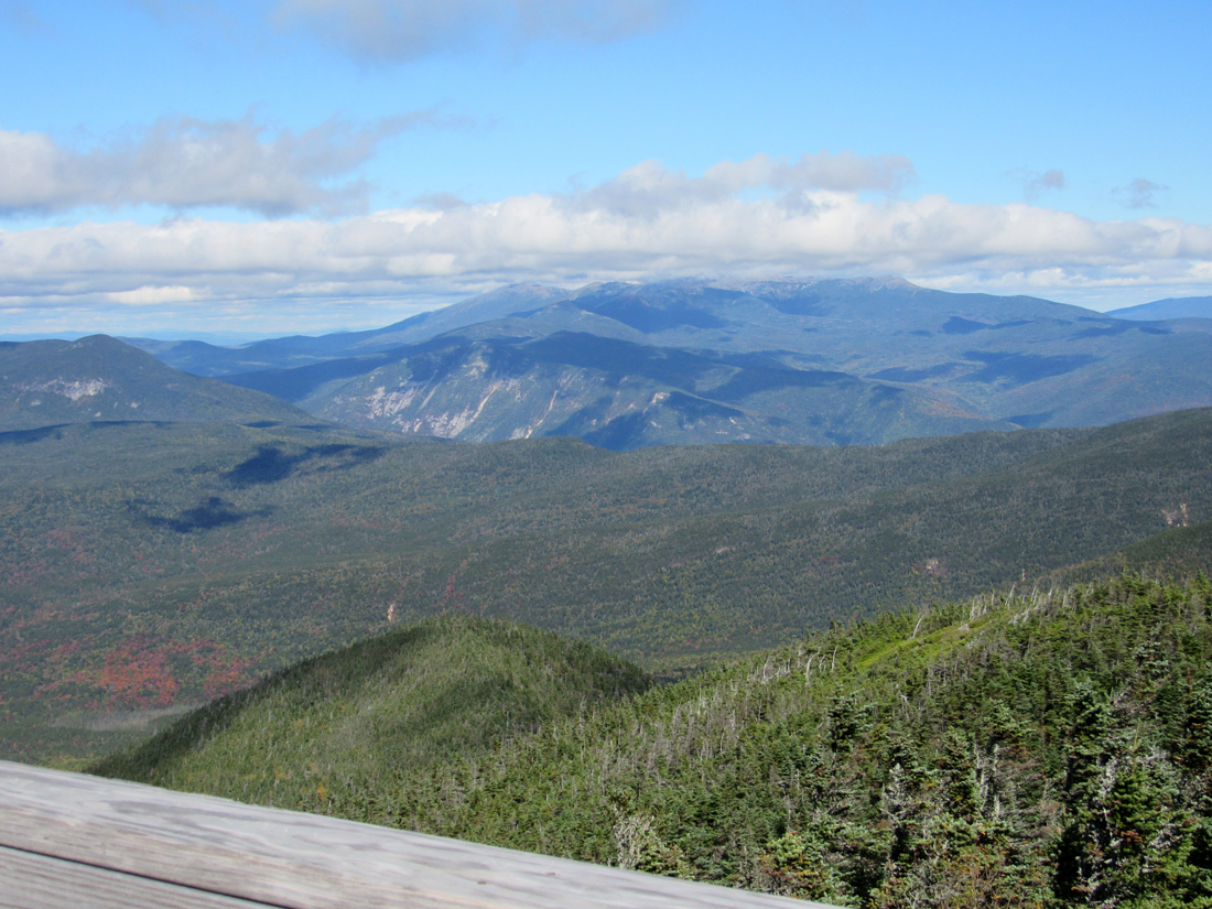
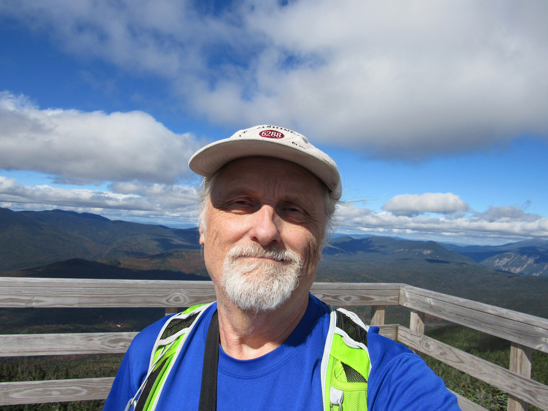
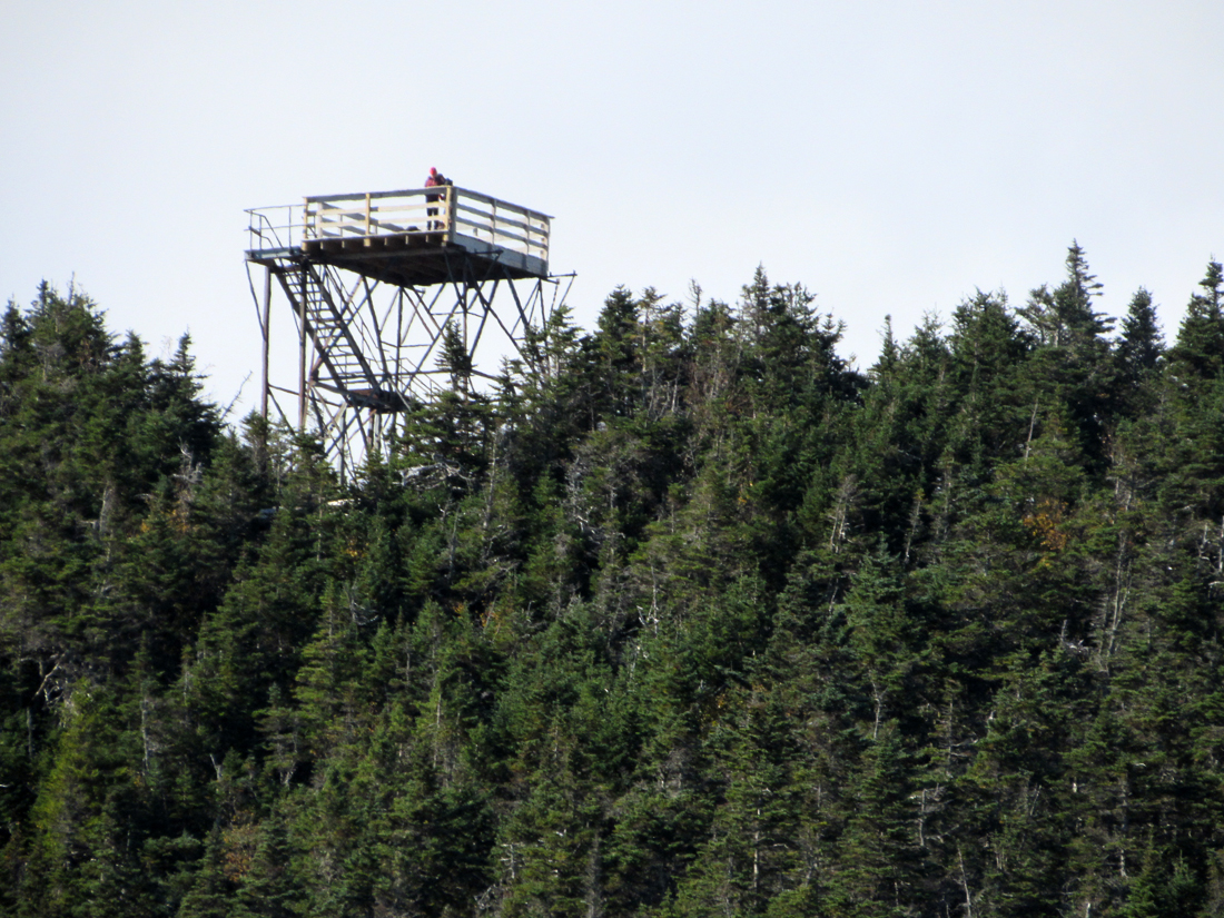
After taking a few pictures, we continued along the ridge and then started the final leg up the summit cone. In the trees again, I felt the weariness coming back, but plodded on, first passing the site of the former firewarden's cabin with its old and its decaying well, and then switchbacking the rest of the way up the mountain. Finally, we were at the observation tower, constructed at the site of the old fire tower to give magnificent 360 degree views of the Pemigewassett Wilderness and surrounding White Mountain ranges.
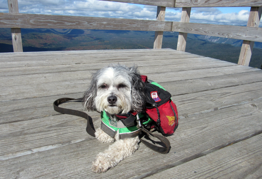
I think that the stairs up the tower had been reconstructed or at least repaired since I climbed Carrigain with Muffin back in 2003. In any case, I didn't remember that the two landing platforms where the stairway makes 90 degree turns were now fairly open metal gratings. Patches did not like these at all. There was (or looked like there was) just too much space for her feet to poke through and get caught. Never-the-less, we made it to the top, but she was never completely comfortable up there, preferring to lie down right in the middle. I did manage to take some good shots of the surrounding mountain ranges. There were a few clouds over Mt Washington but the Webster Cliffs and Willey Range stood out clearly.
On the way down, I carried Patches over the offending landings, and we headed off into a little glade away from the crowds to eat our lunch and rest. Wouldn't you know it, another (different) large unleashed and annoying dog kept barging through the trees to sniff at Patches' food and distract her (and me) while we were trying to enjoy ourselves. I kept telling him/her to go back, sometimes loudly enough that the dog's owner should have been able to hear me, but to no avail. I was glad when both the dog and its owner finally headed down the trail.
Eventually it was time for us to head down too. The short rest and food had been nice but I was still a bit tired and we had a long five plus miles to go. Luckily, most of the trail wasn't too rough, so we made pretty good time hiking quickly downhill. A couple of tenths of a mile before reaching the brook crossing near the Carrigain Notch Trail junction, Patches started growling at something in the woods. I didn't see or hear anything, but she was so persistent that I worried that it could be a bear or moose, so I kept telling her to cut it out and tugging at her leash to keep her moving until we finally crossed the brook and had a more open view of the land around us. The rest of the hike back was uneventful but that last 1.7 miles seemed to go on forever.
This was Patches' 33rd 4000-Footer. She now had only 15 left to go. |
Junction of the Signal Ridge Trail and the Carrigain Notch Trail, 1.7 miles from the trailhead. |

|