Day 1
After climbing Mt Washington in May, Patches had only six peaks (the Bonds, Madison & Adams, and Isolation) left to complete her 4000-Footers, and I wanted to finish all of these in 2022. Because the Bonds are a long day's hike no matter which route you take, I planned for us to go around the time of the summer soltice on June 21st to maximize daylight. Our goal was to camp in the woods nearby to Zealand Falls Hut the first night, thus shortening the time and distance from the trailhead for Saturday's attempt to climb all three Bonds, or if we were running late, to turn around at Mt Bond and save Bondcliff for another trip.
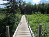
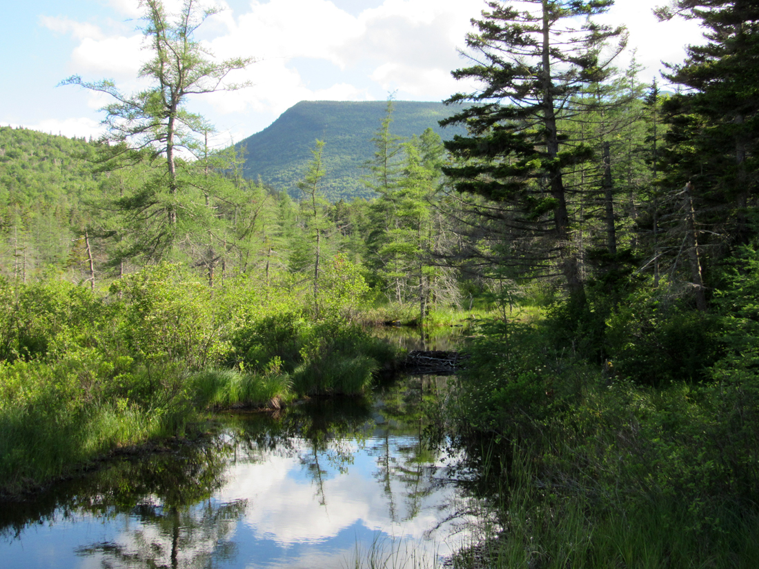
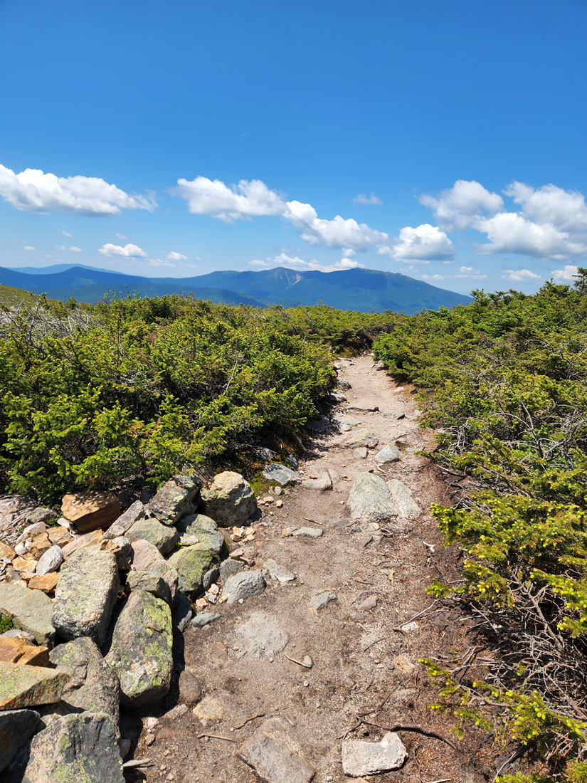
After a 4-1/2 hour traffic-congested drive from Cape Cod, we set off around 2:45 PM from the Zealand Trailhead. My pack was heavier than I have been used to since my heart valve replacement surgery in 2016 but similar to what it was in 2021 when we trekked from the Lincoln Woods Visitor Center to the Franconia Brook Tentsite. The Zealand Trail was as I remembered it, gently and slowly climbing 450 ft to the Twinway except for a rough rocky and rooty stretch on a bypass not far from the trailhead. The bog bridges around the beaver swamp were a welcome relief while they lasted.
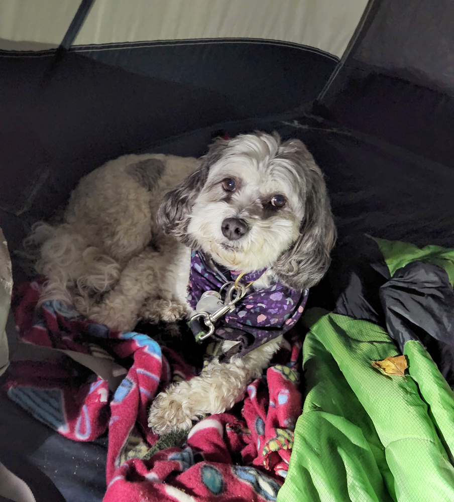
When we reached the Twinway, we hiked ahead a ways down the Ethan Pond Trail to a spot in the woods where I had camped twice in the past, back when our dog Muffin was still alive. After setting up the tent, we rested for a while, and then gathered all our food and cooking items in a bag, and walked down to a large boulder at the junction with the Twinway where I made supper to ensure that no cooking odors lingered near our tent. After eating, we took the bag of food/cooking stuff and climbed up to Zealand Hut where I asked the croo if we could store it there overnight instead of me hanging it up in the tree to keep it away from bears. Luckily, they had no problem with holding on to it for me. I also bought a tee-shirt and used the bathroom, leaving Patches tied up on the porch next to some friendly people who also lived on the Cape. Since I had last been to the hut, the bathrooms had been moved to an adjacent building and were now both gender-neutral (i.e, "anyone can use the bathroom, regardless of gender identity or expression"). There were no urinals and the toilet stalls were roomy with tall walls and doors. Everyone seemed comfortable with this arrangement. Anyway, hut bunkrooms have long been co-ed.
Back in the tent, we settled in for the night. Patches lay cuddled up on her blanket while I read a Kindle book of Victorian ghost stories on my phone for a while and then went to sleep.
Day 2
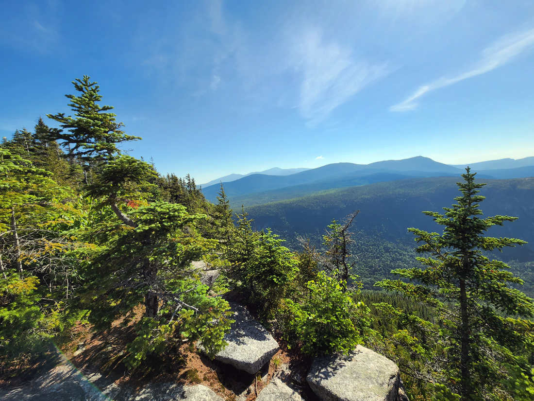
In the morning, we set off around 6:30 AM to climb back up to Zealand Falls Hut where I went through my food bag and took out what we needed for the day. By 7:00, we were on our way up to our first destination, Zeacliff, which has wonderful views toward the east and south. The upper 2/3 of this 1000+ ft climb is fairly steep, but the footing is good.
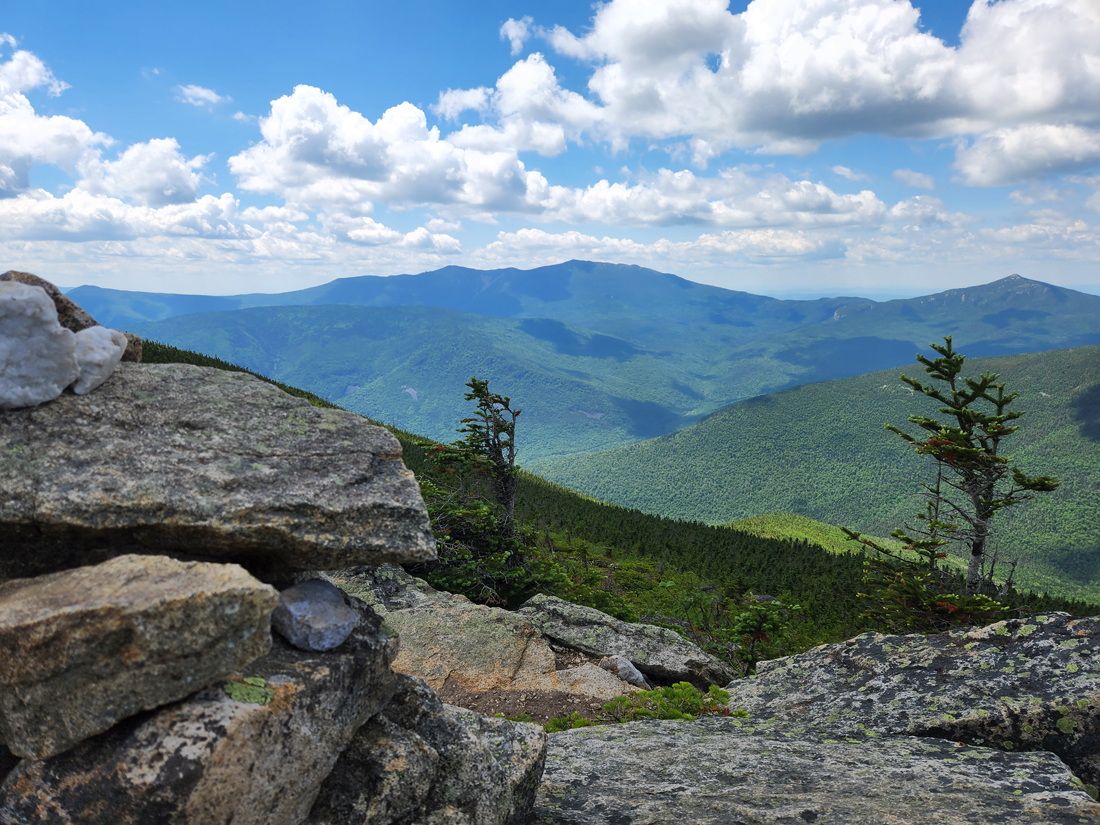
Zeacliff
At the Zeacliff outlook, I took pictures of the views toward Mt Carrigain and the Willey Range. I had hoped to take a photo of Patches too, but a dozen or more hikers showed up soon after us and she was far too distracted to sit still, intimidated by the number of hiking poles and large packs surrounding us. As it turned out, one of the hikers, Lauren, was someone who I had worked with before I was laid off in 2019 and then retired. She recognized me immediately and was glad to see me. I used to maintain service information on our company's website and she lamented that things hadn't gone very smoothly since I left.
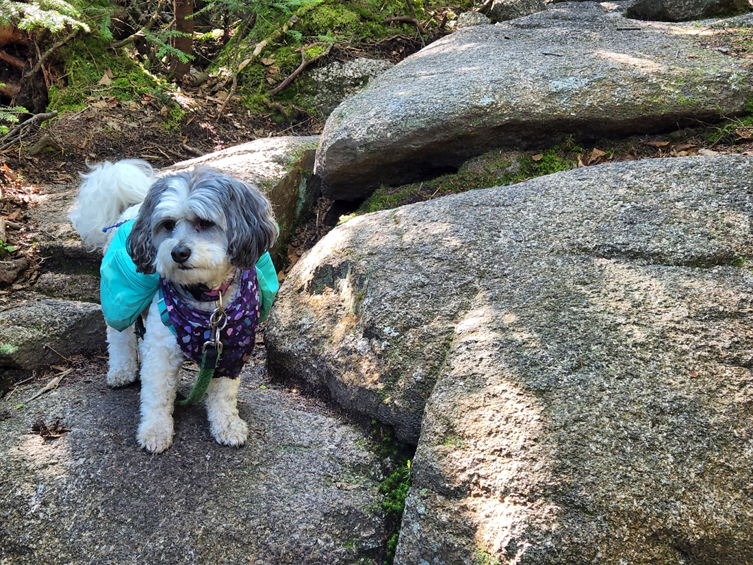
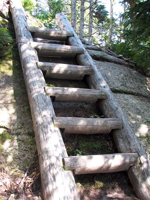
From Zeacliff, we continued through a flat moist area over bog bridges, passed by Zeacliff Pond, and then began the climb to Mt Zealand, including up a steep ladder up a high ledge. Patches climbed the ladder with no difficulty or help, and later, even went down the ladder by herself. There are many ladders along trails in the White Mountains, but most are not as vertical. A few, such as this one, are nearly straight up.
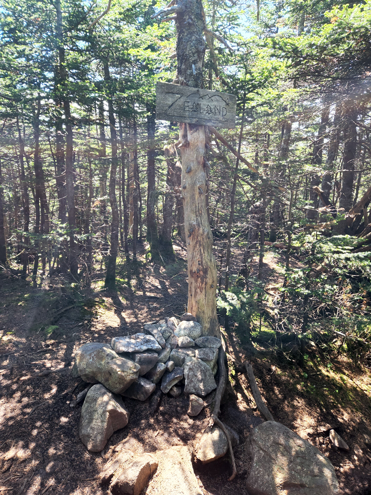
Mt Zealand
Before long (as compared to when we climbed Mt Zealand in 2017 after I had recovered from my heart valve surgery), we reached the Zealand Spur. Even though we'd both been here before, we made the quick five minute trip out and back to its wooded summit. After that. we entered unchartered waters; I'd never been on the Twinway between Mt Zealand and the Bondcliff Trail, and I was surprised that the trail dropped so deeply into a col about a tenth of a mile past Zealand. It seemed to descend forever, but it was probably only 200 or 300 ft.
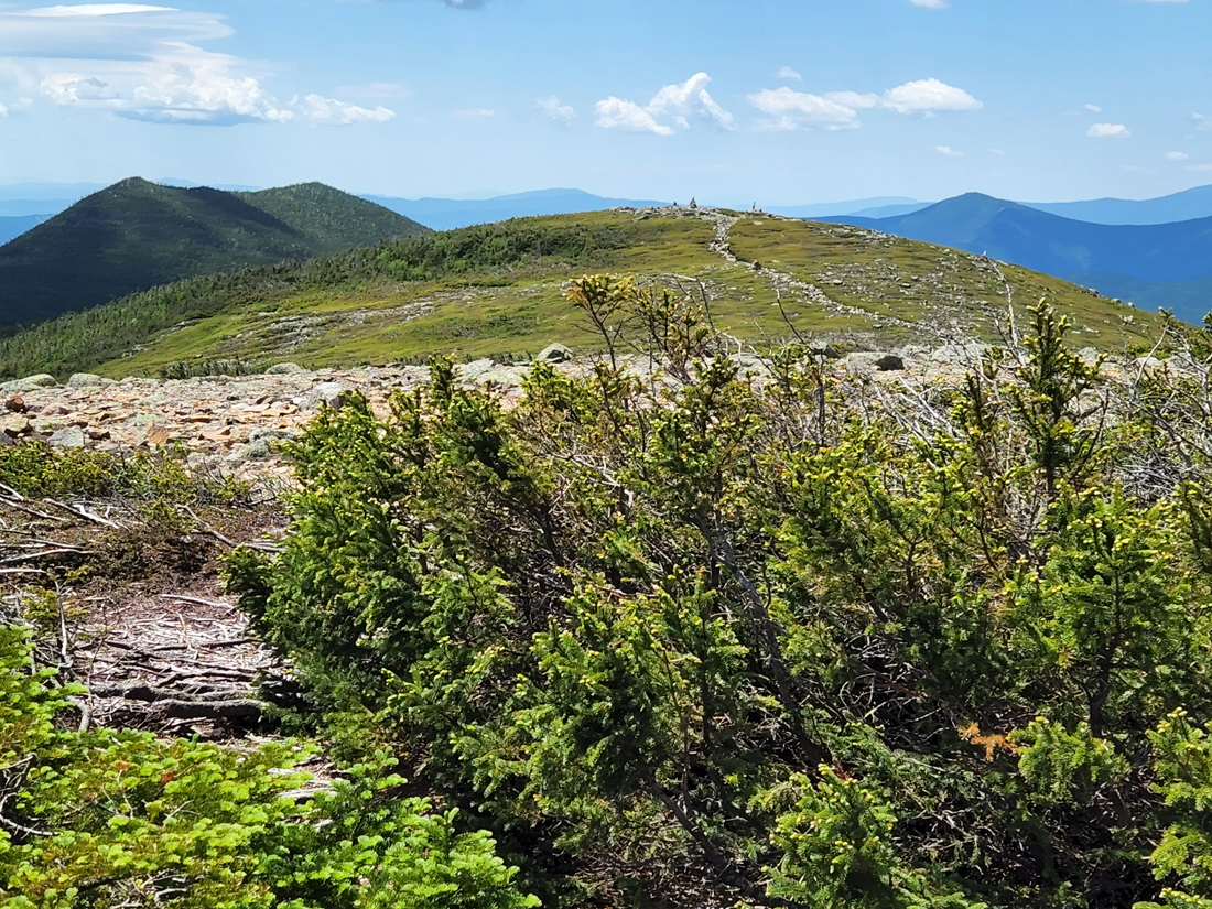
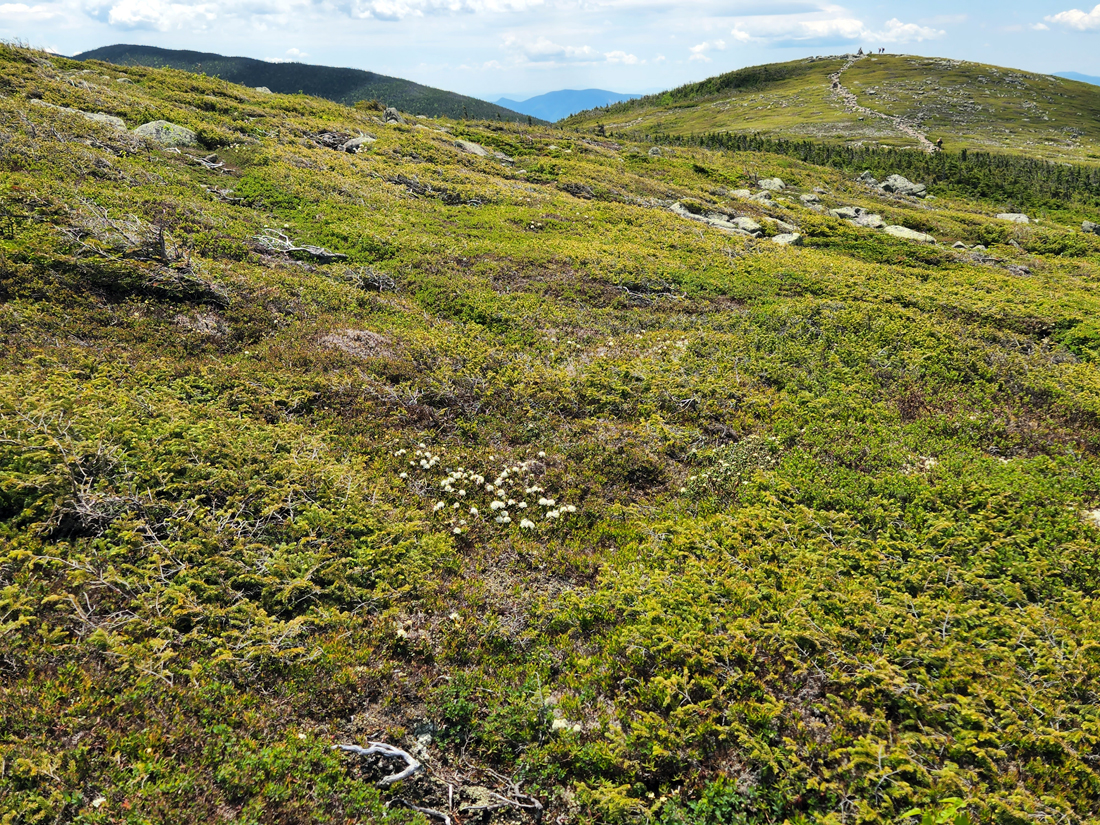
Mt Guyot
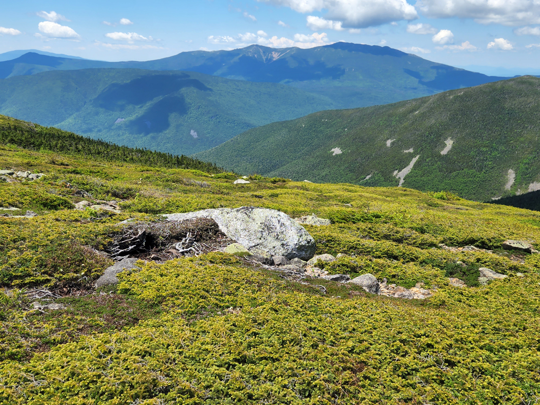
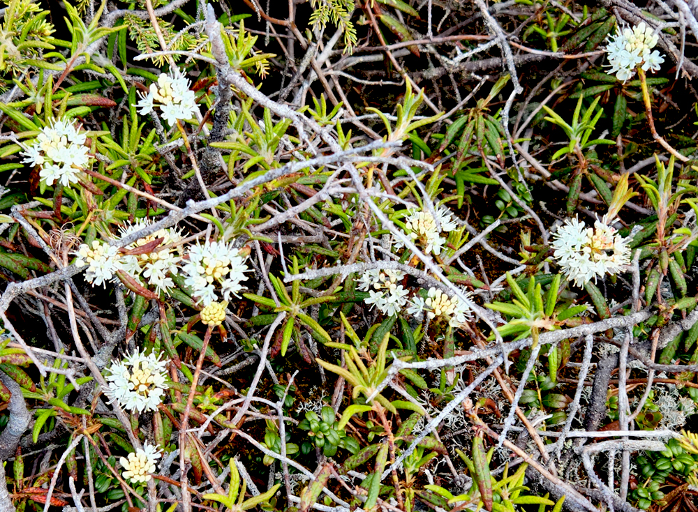
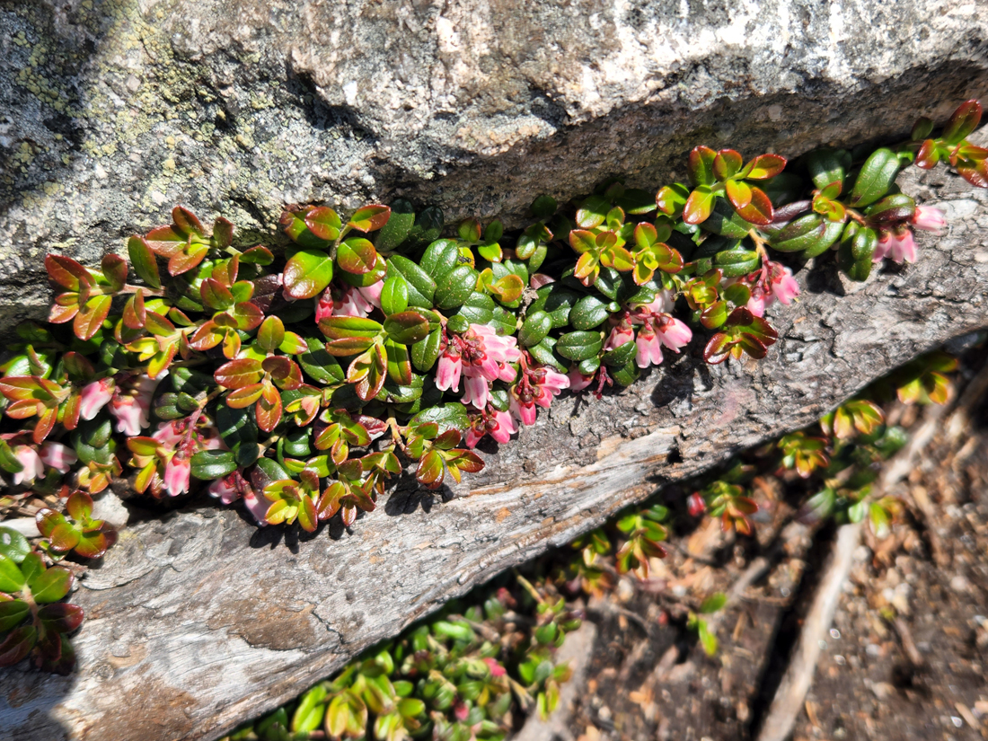
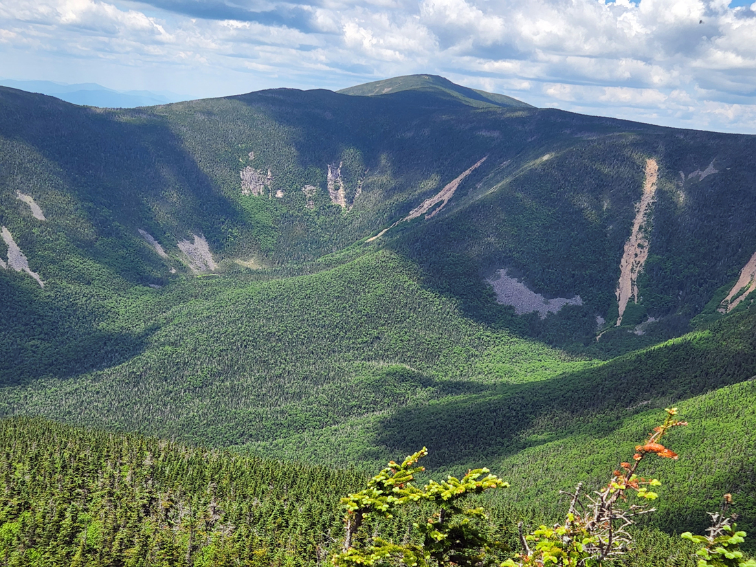
The Twinway climbed less precipitously and in stages out of the col, but I was happy when it was evident that we were on the final approach to Mt Guyot. Although not an official 4000-Footer, Guyot is probably the most unique peak in the Twin Range. It is rounded and green, and nearly devoid of the larger boulders and angular rocks that cover its neighbors. It also has an extensive alpine garden area and twin, nearly-equal in elevation, summits. On this day, both labrador tea and mountain cranberry were in bloom. The junction with the Bondcliff Trail is at the far western end of Guyot, which heads south to gently climb the South summit. and then drops more steeply down to the col where it meets the Guyot Campsite Spur. We were getting low on water, but I decided that it would be better to continue on to West Bond and Mt Bond first, and then stop at the Guyot Campsite on our way back to filter and refill our water bottles.
West Bond
The West Bond Spur was only a couple of tenths of a mile further up the trail; there were quite a few backpacks in a small clearing by the trail junction, as many hikers had left them there to make the round trip to West Bond without the extra weight. One guy had stayed behind to guard them; he'd already climbed West Bond and was content to skip the summit this time. The trail went downhill for quite a distance before it came to a small col. I didn't remember descending this far, but that was sixteen years ago when I was still in my fifties. There were a couple of steep pitches in the final climb to the summit but Patches had no problem hopping from one boulder to the next.
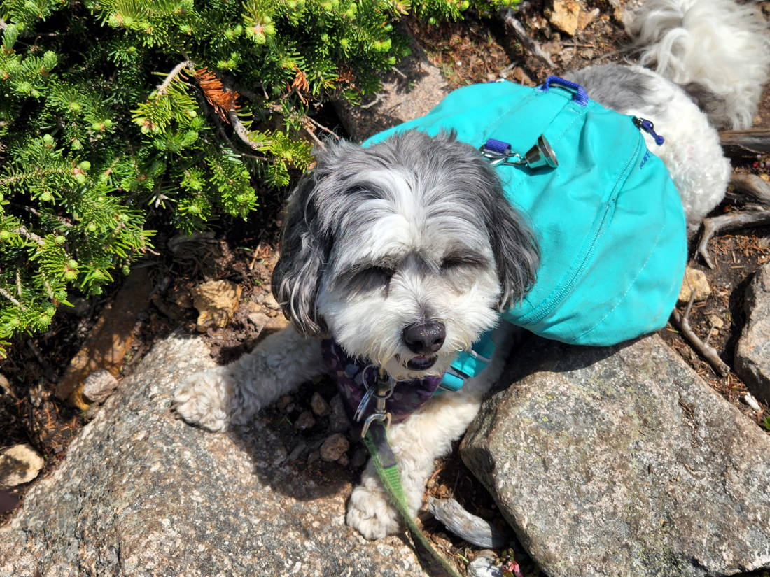
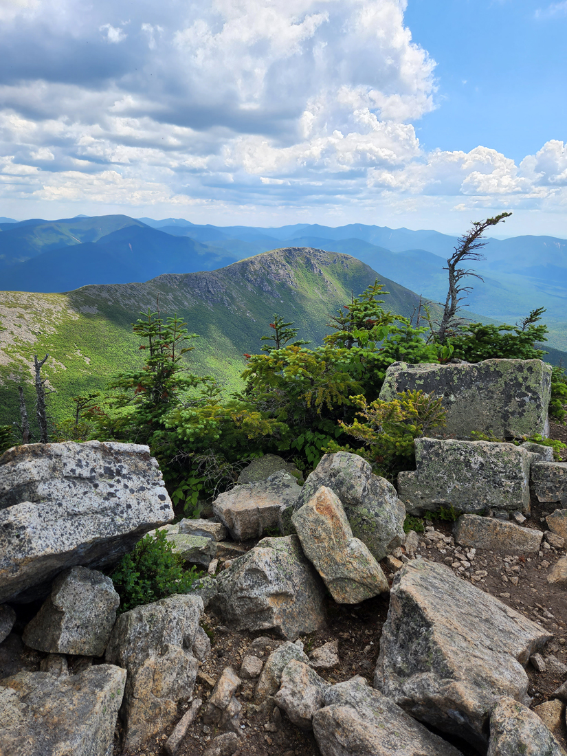
There were a couple of other hikers on top but there was plenty of room to get the feeling of isolation, and they soon left anyway. I shared a few Pringles and some water with Patches as we sat and enjoyed the views. I managed to take a half-decent picture of the two of us; Patches was even smiling and looking at the camera! I also took a photo of the Franconia Range and another of Bondcliff, which I knew we'd never reach today as it was already getting close to 2 PM and we still had Mt Bond to climb and water bottles to fill before we could start heading back.
Mt Bond
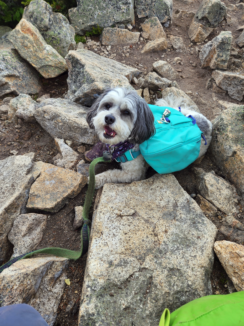
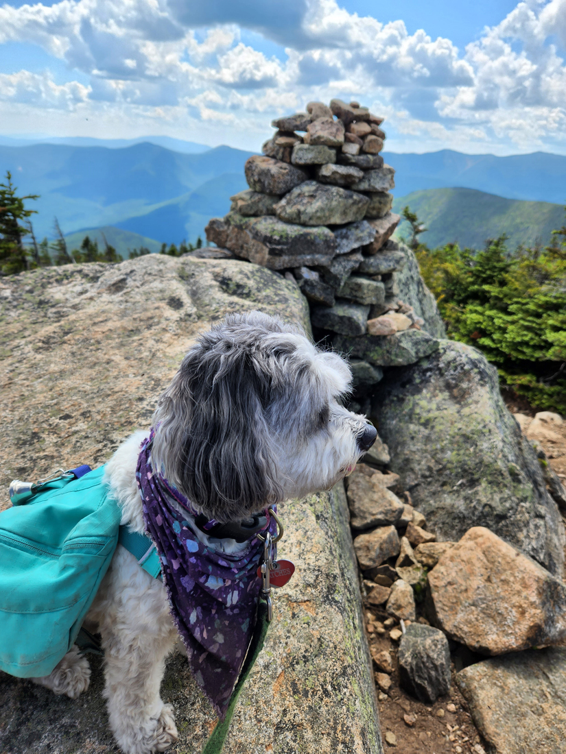
Back at the Bondcliff Trail, we headed south toward Mt Bond, another half mile away. The trail first continued uphill and then leveled out, after which it began to drop down into a col. Here, we met up with another hiker and his young son who were coming back from Mt Bond. We had crossed their paths several times during the day. The boy really liked Patches, and was happy to see her again. He also told us that we didn't have much further to go. The final climb up the summit cone wasn't as steep as West Bond, and we were relieved that after a day of relative crowds in the mountains, we had the summit to ourselves. As it was now after 3 PM, we didn't linger beyond me taking a picture of Patches sitting by the summit cairn, and having a quick drink of water and a few more Pringles. It was time to start retracing our steps.
Guyot Campsite
I didn't relish the side trip down to the Guyot Campsite but we needed water and their spring was the only water source in the area. I had camped here with our dog Muffin back in August 1999 after tackling the Twins, and knew that the steep 2/10 of a mile, 200 foot drop down to the campsite would feel more a half mile, 500 foot climb going back up. I made this trip twice during our stay, the second time while packing a wet tent. There had been some changes since 1999: a brand new enclosed shelter and, I believe, additional tent sites. It looked pretty nice. I managed to fill our two bottles of water while a line formed behind us, all waiting for space since only two at a time could fit. I drank at least a half bottle of water while pumping. It was the first truly cold water I'd had all day, and was much tastier than Zealand Hut's slightly-chlorinated well water.
The Looooong Trip Back
It was a long and weary hike back to Zealand Hut and our tent from the Guyot Campsite Spur Trail junction, but there was nothing to do but plod on if we wanted to get back before dark. I had my headlamp with me, of course, but it's still easier to make the trip while it's light out. Coming down off Mt Guyot felt like the longest stretch. It seemed like we'd never reach the deep col below Mt Zealand. But we eventually got there, climbed up wearily from the col, and passed the Spur Trail to Zealand. After that, the going was easier until we reached the steep area and ladder above Zeacliff Pond, where I had to be more careful with my footing. Patches "sticky rubber" paws never seem to slip or slide.
Before long, we passed Zeacliff Pond and arrived at Zeacliff. I had lost a Mount Washington baseball cap somewhere in this area this morning but couldn't find it again. Then, about a quarter of the way down from Zeacliff, I had the misfortune to either trip or slip in a particularly steep section and fell headlong downhill over a boulder or two. I reached out to stop my fall and almost, but not quite, hit my head on a rock. The first thing I noticed was that I had cut a finger. It wasn't a bad cut, but it was also a little numb, probably from the impact. It was getting close to 8 PM, so I just stopped the bleeding, got up, and we continued on, albeit at a bit slower pace. Then I suddenly noticed that my right leg had also suffered both a bruise and an abrasion, probably from impact against one of the rocks. I take Warfarin so I bleed easily. There wasn't much blood on the surface; it was mostly just scraped and dirty, but a serious hematoma had started to form under the wound, so I knew I was in for a bad and painful bruise. I wiped it off using a bit of water and a handkerchief but figured I'd clean it up better back at the hut.
We finally reached the hut around 8:30 PM while it was still light. I went inside to pick up my bag of food items and one of the croo saw my leg and offered to clean it off and bandage it up. While she was getting the medical supplies, I got a tin of dog food from the food bag and took it out to Patches so she, at least, could eat her supper. Back inside, the croo member cleaned off my leg, wiped it with alcohol (which stung), and then put iodine on it. She was worried about the hematoma which was now even larger, but I told her how the Warfarin had caused it and that it would eventually get better. Then she put on some Bacitrcin ointment and bandaged it up, covering it tightly with an Ace bandage. I thanked her and explained that the Ace bandage would add compression to help reduce the swelling. I thanked her again and then left a few dollars in their tip jar.
By this time, it was fully dark outside, so I put on my headlamp so that Patches and I could see to safely descend the steep, damp trail back to our tent. We had to move very slowly, partly from my leg and partly from having to stop, turn around, and shine my light for Patches to see well enough to make her way down. Finally, back at the tent, Patches immediately went in and collapsed on my sleeping bag, while I stayed out long enough to hang the food bag in a tree.
Day 3
In the morning, after a tiring night that included a lot of itchy blackfly bites, I wasn't in a rush to get up and begin the day. I eventually did, however; Patches was ready to go to the bathroom and have her breakfast, and we still needed to make the three mile trek back to the car. I retrieved the food bag, which was untouched, and then ate a couple of breakfast bars while Patches gobbled down her dog food. The only thing left to do was to pack away all of our stuff and then get going, Luckily, my leg wasn't bothering me, just the bug bites, but I took some Tylenol to ward off any pain.
The hike back was painful, not on my leg, but on my shoulders. The tent and other things were damp and the pack weighed a lot more. Try as I might, I could not keep the straps from digging into my shoulders. The belt would just not stay up on my waist. It was damp and just kept slipping down lower and lower until most, if not all of the weight was on my shoulder straps. The car never looked better when we finally emerged out onto the Zealand Trail parking lot. Despite my accident, the blackflies, and the pain in my shoulders, it was mostly a good hike. Patches had climbed two more peaks and there were now only four more to go: Madison, Adams, Isolation, and Bondcliff.
Epilogue
It took several days for my shoulders to return to normal. The straps must have been pressing on nerves because when we stopped for gas, I momentarily felt lightheaded when I got out of the car and stood up. This feeling had gone away by the time we got home again.
Two weeks later, after three trips to urgent care and one to the emergency department at Cape Cod Hospital, my leg is finally starting to get better. The first antibiotic, Cephalexin, that I got from urgent care wasn't helping enough, and I had a fever for two nights in a row. The hospital did further tests and took an ultrasound of my leg to make sure that I didn't have an abscess, and then prescribed a stronger antibiotic, Doxycycline, which I have now been taking for five days. To help ensure that this doesn't happen again, I bought a new pair of hiking boots after discovering that the soles on my old ones were worn and a bit slick in places. This probably contributed to my fall.
|
Bog bridge along the Zealand Trail where beaver dams have flooded the area. |
|


