Day 1
I'd been thinking about climbing Madison and Adams next, staying at Crag Camp overnight. But then I reasoned that, by staying at Crag Camp and getting an early start the next day, we could summit both peaks, return to Crag Camp, and then hike back down to the car without having to worry about approaching darkness. This meant that we could wait to climb of those two peaks until September or even October. That left either Isolation or Bondcliff, both of them full day hikes best done before daylight hours grew too short. Recent rains and mud hole reports for Isolation contributed to me choosing Bondcliff.
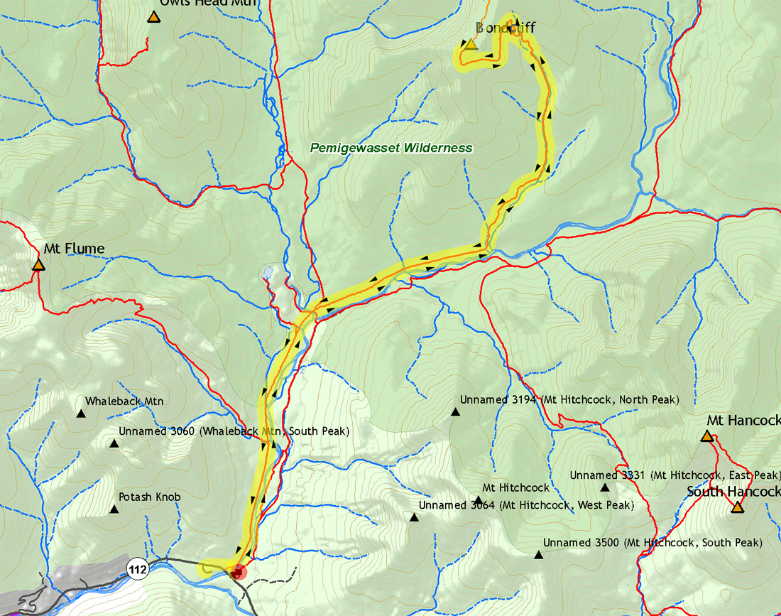
My original plan was to backpack in to Franconia Brook Campsite and then the next morning, cross the East Branch in shorts and Crocs and hike to Bondcliff and back. However, by the time we got to Lincoln, it was pouring with no signs of letting up. I quickly changed plans and we set up our tent at Hancock Campground, just across the Kancamagus Highway from Lincoln Woods. When the rain finally let up, we took a short walk over to the Lincoln Woods Visitor Center and then returned to our campsite to rest for a while. Later, I fed Patches her supper, we drove into town where I got supper from Subway. Back in the tent, I read for a while before falling asleep.
Day 2
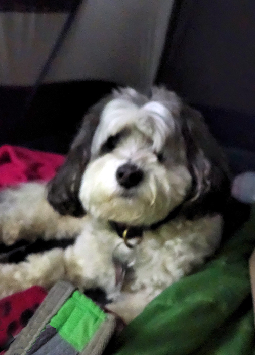
I had set the alarm on my phone for 5 AM, hoping to get started by 5:30. But between lingering in my comfortable sleeping bag and getting my pack ready, we ended up setting off around 6 AM. It took about 10 minutes to hike from the campground to the start of the Lincoln Woods Trail, after which we were on our way, walking as quickly as possible. Book time from the trailhead to Camp 16 (the site of an old logging camp by Black Brook) is 2:39. It was here that the Bondcliff Trail formerly began until fall of 2009, when the Forest Service removed the decaying suspension bridge that once connected the Wilderness Trail to the Pemi East Side Trail. It took us 2:20, nearly 20 minutes ahead of book time, which helped with my goal to get back before it got dark. That was good, but not as quite good as the 1:45 it took me in 2009 on my way to see the old suspension bridge before they removed it. Oh, to be 60 again!
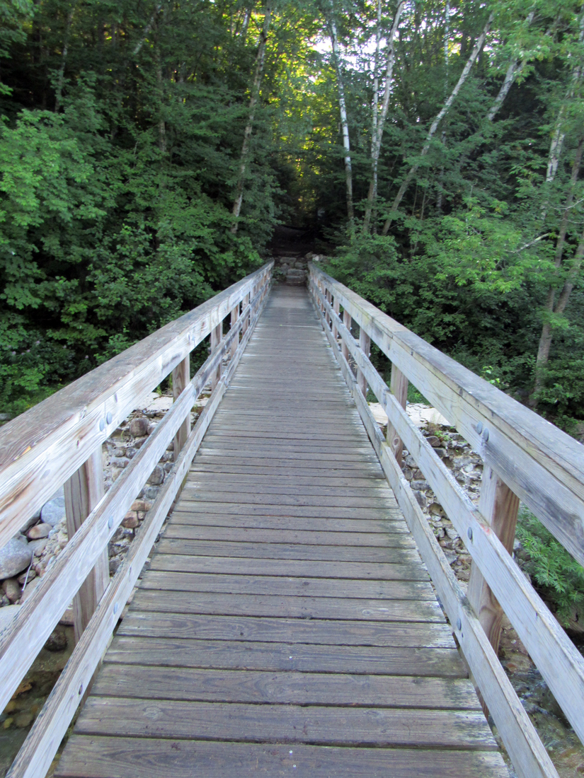
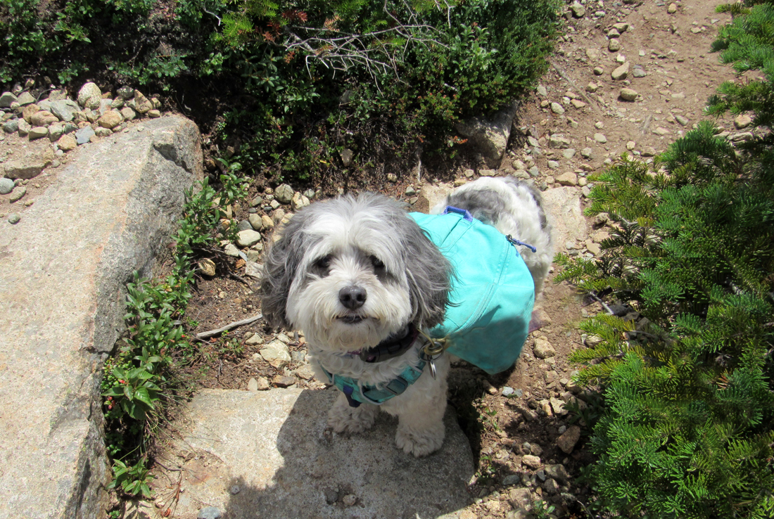
Before continuing, I fed Patches her breakfast (two small plastic packets of dog food) which she quickly gobbled up while I ate a power bar. The next stretch of trail began at a moderate grade but soon entered a long rough, rocky, and rooty bypass with several minor ups and downs. I've never been fond of these bypasses; they're usually constructed because of flooding in the adjacent river or brook, which washes out part of the original trail. But they're almost always rough, with numerous ups and downs, which saps my energy, especially on the way down. Eventually, the bypass did return to the main route, which continued nearly straight until it reached a crossing of Black Brook. I remembered this spot from previous hikes. After crossing, the trail immediately turned hard right before it veered left again and became steeper, climbing a long series of stone steps where we finally began to gain more altitude. Soon after passing the stone steps, we came to an area of frequent switchbacks, traversing up the steep end of the ridge and continuing most of the way to the summit.
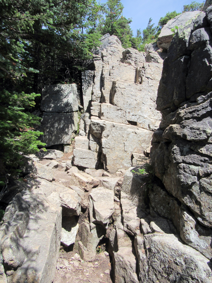
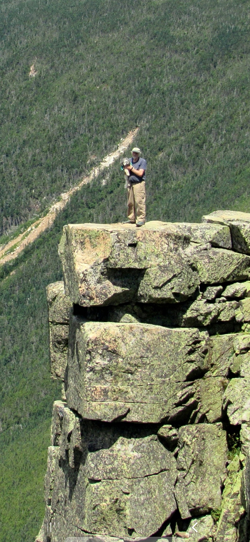
Just below the final approach to the open summit of Bondcliff, there's an approximately 12-foot high cliff that requires scrambling up a series of naturally-occuring step-like blocks of rock while using convenient corners or cracks as handholds. This is the one spot where I helped Patches get up and down, although she might have found an alternate route through the trees by herself. While standing on a rock step while holding onto a handhold with my left hand, I'd use my with my free right hand to pick Patches up by the handle on her backpack and lift her up to the next step above me, and then follow after her and so on until we reached the top. After this, the trail wound up through the scrub until reaching the summit, which was quite popular that day since the weather was near-perfect with minimal wind.
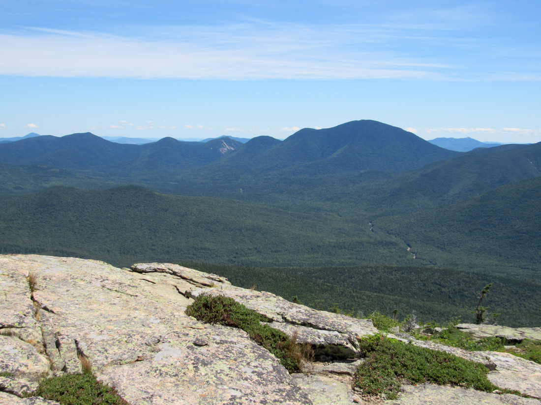
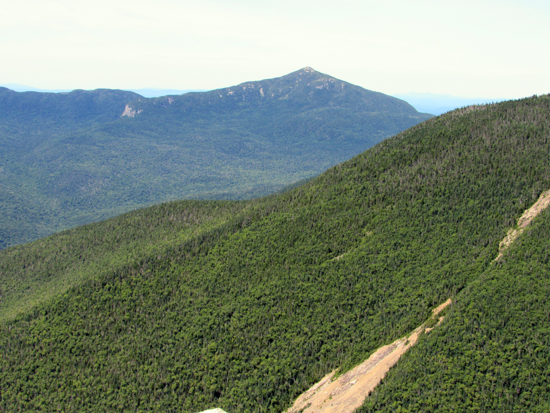
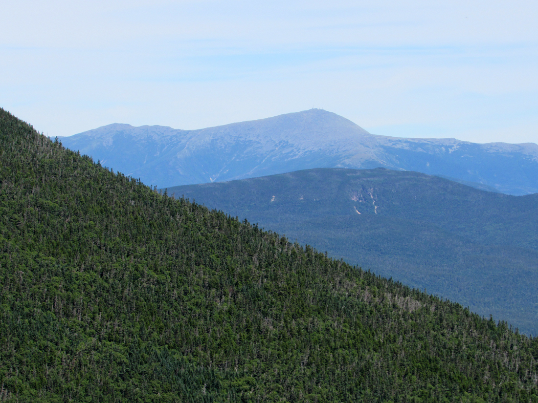
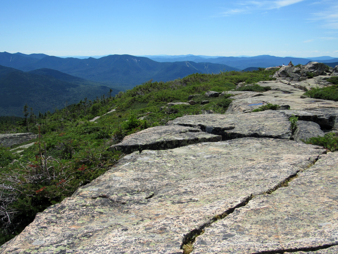
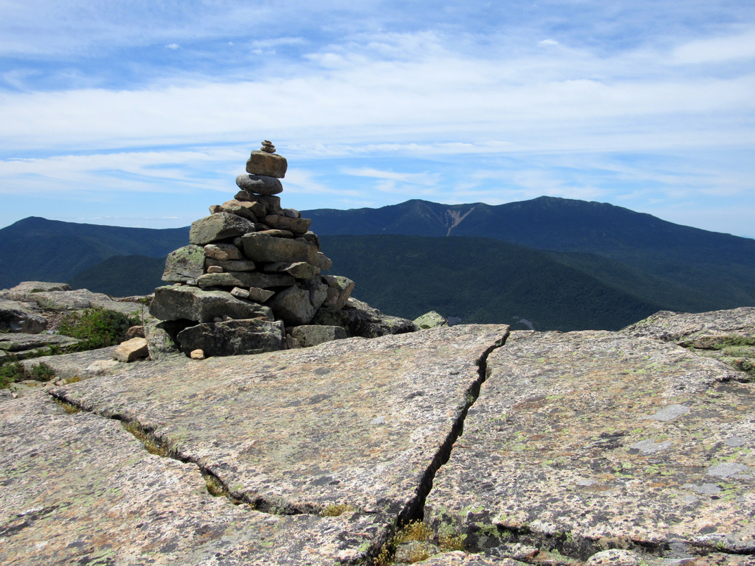
We found a good spot to sit down near the summit cairn. It was a relief to take off my pack and rest for a little while. I ate a power bar and shared some Pringles with Patches, and then gave her a drink of water. As usual, she didn't drink most of it. Other hikers were also resting, eating lunch, admiring the excellent views in all directions, and taking pictures. On a short break from eating, I stood up to take pictures of Mt Carrigain (with Vose Spur on its eastern shoulder) to the southeast, Franconia Ridge and Owl's Head to the west, Mt Garfield to the northwest, and Mts Washington and Jefferson to the northeast.
The next thing to do was have someone take a picture of Patches and me on the iconic Bondcliff prominence overlooking the Franconia Brook valley in the Pemigewasset Wilderness some 3000 feet below. Naturally, someone else needed to take the picture. Sitting nearby was a woman and her college-age daughter. Grabbing Patches' leash and holding my camera, we walked over and I asked them. The daughter volunteered and her mother agreed that she was the better photographer between them. I handed the camera over to her and then walked Patches over to the prominence. I decided that it would be safer if I picked up and held Patches rather than let her walk next to me onto that small space. She's way too curious and would likely walk right up to the edge and look down. When the we got the word that she was done taking pictures, we headed back to get the camera and thank them profusely, and then went back to where we'd been sitting to rest a little longer. While resting, a number of other hikers got their pictures taken standing or sitting on the prominence; at least two of them using the same girl that took ours.
At 1:30, I decided that we should start on our way down, so I packed up the few items I had taken out and put my backpack on again. We started slowly walking along the ridge, savoring the views before we had to descend back into the trees. While walking along, I took pictures of the Bondcliff summit cairn, Patches sitting in the scrub, the Loon Mountain ski trails in Lincoln to the southwest, Mts Bond and West Bond to the north, and one of Bondcliff's many craggy outcrops with Owl's Head and Franconia Ridge in the distance. I also took a picture looking straight down off the edge of the cliffs but it didn't turn out so well, so I deleted it.
We made good time going down the Bondcliff Trail, stopping only at the Black Brook crossing below the stone steps to filter a bottle of water. After passing through the rough bypass, we soon reached Camp 16, after which we made even better time on the wide, smooth bed of rhe former logging railroad. We arrived back at our campsite at 6:30 PM, 12-1/2 hours after setting out in the morning. Considering that we spent a little over a half hour on the summit, we were only an hour over book time, which was pretty good since I've been a much slower climber after my 2016 heart valve replacements.
I put Patches in the car, got a change of clothes from the tent, and went in the bathroom to change. Then I quickly took down our tent, stashed all of the camping gear in the car, and we drove off, stopping briefly in Lincoln to get some supper from McDonald's before merging onto I-93 for the long drive home. |
Patche resting in the tent on Tuesday evening (taken with my phone). |

|


