|
At
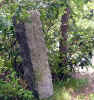
the junction with the Eliot Circle, there's a carved granite
signpost that lists both the trail name and a number that
represents the trail junction. The junctions are also listed on
the Blue Hills Reservation trail map. There's many trail junctions
in these woods, including some where the same two trails cross
more than once. With the trail junction number, you can always
tell where you are if you have the map with you. Right
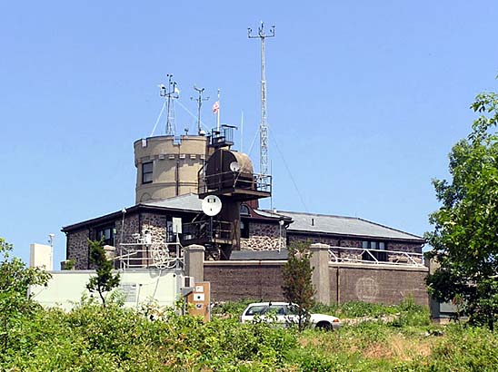
nearby is the Blue Hills Observatory, a privately-owned center
that was founded in 1885 and has been keeping weather records and
studying the science of meteorology even since. I've passed by it
many times but have never been in.
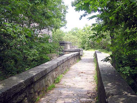
The appropriately-named
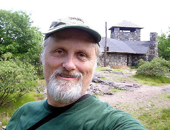
Eliot Circle path circumnavigates the summit plateau, passing both the observatory and the Eliot observation
tower. I generally
follow the Eliot Circle around the east side of the hill to the
Eliot bridge and observation tower. These stone structures were built by the Civilian Conservation Corps in the 1930s.
There's also a shelter with picnic tables and an open fireplace
attached to the tower.
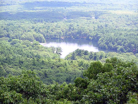
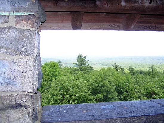
A
spiral staircase ascends the tower to the top level, where several
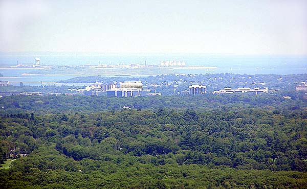
large open windows look out over the views. Boston is visible to
the north, while Boston Harbor and the wooded expanse of Blue
Hills Reservation lie to the east. There's a lot of kettle ponds
scattered throughout the reservation, including Houghton's Pond,
which has a popular swimming beach and picnic area. On nice days,
the views are excellent, but unfortunately, the crowds can be a
problem, particularly in the late spring and early summer when
large school groups often visit the nature center and then climb
the Red Dot Trail to the summit.
Just
below the observation tower, a branch of the Skyline Trail
continues east to many of the other summits in the reservation.
This is the way I usually go. However, on this trip, I just looped
back along the west side of the hill on the Eliot Circle, passing
the now deserted Blue Hills Ski Area before returning to the
Skyline Trail for the trip back down. |
Granite
signpost. Most of the trail junctions in the Blue Hills have these
granite markers with the name of the trail and a junction number
that is also marked on the trail map. |
 |