|
It was also
pretty crowded inside the hut. The
croo
were busy preparing dinner. I saw them making some kind of interesting
bread and what looked like apple crumb pies. Too bad I wasn't
staying overnight! One of the best things about Madison Spring
Hut is the spring. They had a special tap on the counter between
the kitchen and dining area for filling up water bottles. The
water was nice and cold and refreshing. I bought a t-shirt, sat
at one of the tables, and drank a liter of cold water while looking
at my map. It felt good to get out of the sun for a while.
Soon,
it was time to move on. I refilled two bottles, which I figured
would be enough for the rest of the day, and went outside to the
rear of the hut to start my climb up the Osgood Trail. The trail
was a bit steeper than the route up Mt Adams, and I had to pick
my way carefully over the large boulders. I met one group on their
way down, and another hiker also on the way up, passed me by. After
about a half hour, I abruptly arrived at the summit, where two large
cairns pointed the way across a narrow ridge to the top. Once again,
I was lucky to find someone who volunteered to take my picture.
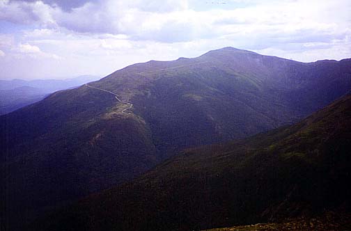
The
views down into the Great Gulf, and back to Madison, Jefferson,
and Washington were great. I could see the twisty line of the auto
road snaking its way up the northeast side of the mountain. But
all good things must end. The afternoon was waning, and I had to
get back down to my car. I had planned to take the Gulfside Trail
back to Lowe's Path and go back down that way, but I was tired and
getting sunburned, and didn't feel much like staying above treeline
for that length of time. After retracing my steps back down the
Osgood Trail, I decided to take the more sheltered and gentle Valley
Way Trail back down to the Appalachia Trailhead and hope to find
a ride the mile-and-a-half back to my car.
Passing
up the hut this time, I started immediately down the Valley Way,
soon entering the scrub and then the woods where I could get some
relief for my sunburned forehead. Anxious to get down and worried
about finding a ride by to my car, I hurried down the trail a bit
too fast, which gave me sore legs and knees for several days afterward.
When
I got back down to the Appalachia Trailhead, I was lucky to run
into two couples who were coming down the Airline Trail at the same
time. I told them about my situation, and they were nice enough
to offer me a ride back to Lowe's Store. I hadn't realized it when
I asked, but one of the women had fallen and had broken her nose
and cut a gash in her cheek, and they were trying to get her to
agree to go to a hospital and have it looked at. One of the men
drove me to my car while the rest of them got the injured woman
into a car. She seemed to be all right, but she must have been in
a lot of pain. I hope she heals quickly. |
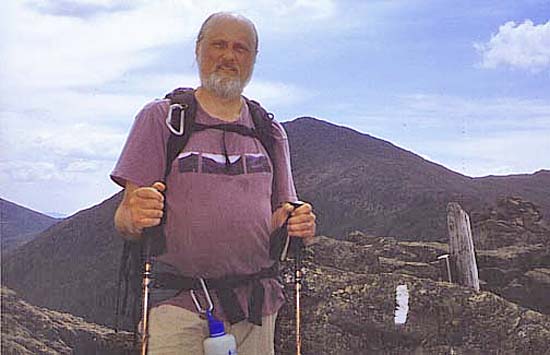
Me
on Mt Madison. The Madison summit area is small and rocky, just
like it looks from the distance. Mt Adams is directly in back of
me. |
|